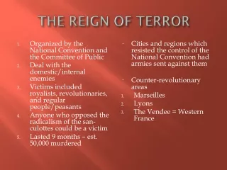
Analyzing 40+ Years of Terrorism Data: Insights from The Shadow of Terror Project
150 likes | 284 Vues
"The Shadow of Terror" project by Bijoy Raveendran at the National Institute of Design compiles a comprehensive dataset of over 200,000 records detailing every terrorist incident from 1970 to 2011. This dataset encompasses critical information about each attack, including the date, location, group name, casualties, weapons used, and motives. By employing data visualization tools like TileMill and MapBox, the project aims to create impactful visual representations of terrorism trends, emphasizing the significance of numbers and threat levels while fostering a deeper understanding of global terrorism.

Analyzing 40+ Years of Terrorism Data: Insights from The Shadow of Terror Project
E N D
Presentation Transcript
THE SHADOW OF TERROR BIJOY RAVEENDRAN INFORMATION & INTERFACE DESIGN JULY 26 2013 | NATIONAL INSTITUTE OF DESIGN
30 years of every terrorist incident from 1970 – 2011 (200K records) • Retrieved from the Global Terrorism DB • Date of attack, place of attack, group name, target, casualities, weapons used, damages, motive, descriprion • Supplementary information from Wikipedia DATASET DATASET
‘Exploratory’ more than ‘explanatory’ • Data is in the form of events – so have a timeline and plot it on a map • No story at the moment – so emphasize on the numbers and threat level • Gather supplementary information from Wikipedia CONSIDERATIONS CONSIDERATIONS
ITERATION INITIAL ITERATIONS
Markers on map can be represented as explosions (or the color of fire) • Use opacity to show overlapping layers or use ‘no-overlap’ (ruled out later) • Make the map borderless , add more negative space around content, so emphasis goes to subject matter • Tree maps a better option over bar charts for • summary data CONSIDERATIONS CONSIDERATIONS (contd.)
Scaled down dataset (30 years to 7 years) • Removed unused data columns • Removed ‘invalids’ • 0 or unknown month/day/year • Unknown city/state/country • 0 casualities/wounded and 0/unknown damages SANITIZING DATA SANITIZING DATA
Used Google’s ‘Geo’ API to geo-tag locations • Pivot tables based on ‘terrorist organizations’, ‘country of attack’, and ‘mode of attack’ columns. • Formula to calculate severity of attack based on following data: • Number of people killed • Number of people wounded • Estimated damage to property ENRICHING DATA ENRICHING DATA
Severity • = ( dead_index * 10 + • wounded_index * 7.5 + • damage_index * 2.5 ) • Wound_Index • 0-75 : 1 • 75-150 : 2 • 150-225 : 3 • 225-300 : 4 • >300: 5 • Dead_Index • 0-40 : 1 • 40-80 : 2 • 80-120 : 3 • 120-160 : 4 • 160 – 200 : 5 • Damage_Index • <1million : 1 • 1m – 1b : 2 • >1b : 3 ENRICHING DATA ENRICHING DATA (contd.)
Excel for data/business logic • TileMill for map creation • MapBox for map hosting • Google Docs for geo-coding • Google Visualization API to generate tree-maps • HTML/Javascript for layout • For proposed future use : • MapBox.js/Wax for custom tooltips/legend • Flash for intro screen TOOLS TOOLS
SEE VISUALIZATION NOW! Goto visualization
‘Invalids’ may be incidents of high severity • TileMill rejects non geo-coded locations – skews the numbers • Geo-coding API is not entirely accurate – combination of city/country not yielding better results. May have to manually encode. ERRORS SOURCES OF ERROR
All deaths are considered the same – shouldn’t assassinations be considered to be of higher priority? • Large data shown as “############” • If ‘others’ occurs in any of the top 10 visualizations, it has been ignored ERRORS SOURCES OF ERROR
Incorporate complete data set • Complete other sections • Include opening sequence to set up the story • Adding animation to map markers will help emphasize more on numbers FUTURE PLANS FUTURE PLANS
Link tooltip to related news article (probably for high severity incidents) • Remove top 5 countries from tree-map. Have a choroplethic view on country wise impact instead. • Include – ‘Your country has XX% chance of being attacked’ • Use different color marker to represent zero casuality attacks • Match-ups FUTURE PLANS FUTURE PLANS
THANK YOU JULY 26 2013 | NATIONAL INSTITUTE OF DESIGN