Download
1 / 20
210 likes | 426 Vues
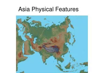
PHYSICAL FEATURES of EAST and SOUTHEAST ASIA. 1- How have tectonic plate movements affected the physical geography of East Asia?. Tectonic plate movements have created mountains and caused powerful earthquakes in parts of the region.

E N D
PHYSICAL FEATURES of EAST and SOUTHEAST ASIA
1-How have tectonic plate movements affected the physical geography of East Asia? • Tectonic plate movements have created mountains and caused powerful earthquakes in parts of the region
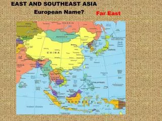
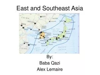
2-a- Which 2 countries extend over most of the landmass of East Asia? Mongolia and China
2-b- Which 2 east Asian countries lie on a peninsula? North and South Korea
2-c- Which 2 East Asian countries are islands? Japan and Taiwan
3-Between which 2 mountain ranges is the Plateau of Tibet? Himalaya and the Kunlun Shan Mountains
4- a-What is the Plateau of Tibet also known as? Roof of the World. b-Why is it called that? About 15,000 feet in height, the Plateau is so high that it is called the Roof of the World.
5- a- What is an archipelago? A chain of islands
5-b- Which East Asian countries form an archipelago? Japan and Taiwan
6-Of the 11 countries of SE Asia: a- Which lie entirely on Southeast Asia’s mainland? Myanmar [Burma] Thailand Laos Cambodia Vietnam
6-Of the 11 countries of SE Asia: b- Which are partly or entirely made up of islands? Indonesia East Timor Malaysia Singapore Brunei Philippines
6-Of the 11 countries of SE Asia: c- Which are archipelagoes? Indonesia Philippines
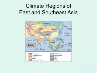
7-Which two oceans surround parts of East and SE Asia? The Indian and the Pacific Oceans
8-What has influenced Japan’s unique culture? • Its surrounding seas kept it isolated from the Asian mainland.
9-Provide information about the following rivers in China: • The Huang He • The Huang He [Yellow River] is northern China’s major river system. • This river is called “yellow” because it carries tons of fine, yellow-brown soil called loess that blows in from deserts in western China. • \ • When deposited, the rich soil---along with the river’s water---makes the North China Plain a major wheat-growing area. • Throughout China’s history, the Huang He has regularly flooded the land, destroying homes and drowning many people. • As a result, the Chinese call the Huang He “China’s sorrow.”
9-Provide information about the following rivers in China: Chang Jiang The Chang Jiang is Asia’s longest river. It flows for about 3,400 miles through spectacular gorges, or canyons and broad plains. It then empties into the ocean at the port city of Shanghai. The Chang provides water for a large farming area where more than half of China’s rice and other grains grow. It is also an important trade route. Ocean-going ships can travel far upriver and barges carry goods even farther.
10- What is the “Three Gorges Dam” and why was it built? • 607 feet high and 1.4 miles wide---it is the world’s largest dam. • The Three Gorges Dam is expected to prevent floods and to supply a large amount of hydroelectric power.
11-Where would you find the following rivers in SE Asia? Irrawaddy Myanmar SalweenMyanmar Chao PhrayaThailand
11-Where would you find the following rivers in SE Asia? Mekong It begins its 2,600 mile journey in China and forms the border between Thailand and Laos It twists and turns through Cambodia and southern Vietnam before emptying into the South China Sea.
12-Why do you think the Mekong region has a large population? Warm temperatures and heavy rains make the Mekong region a fertile rice-growing area.