Assessment of Wind Observations in Mesoscale Weather Forecasts at CIMSS: OSSE Team Experiment
420 likes | 528 Vues
This study evaluates the impact of wind observations on operational weather forecasts using simulated products and derived radiances, focusing on LIDAR winds in conjunction with geostationary measurements. The project aims to assess the value of current and future observation systems in steering forecast accuracy.

Assessment of Wind Observations in Mesoscale Weather Forecasts at CIMSS: OSSE Team Experiment
E N D
Presentation Transcript
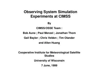
Observing System Simulation Experiments at CIMSS By CIMSS/OSSE Team : Bob Aune ; Paul Menzel ; Jonathan Thom Gail Bayler ; Chris Velden ; Tim Olander and Allen Huang Cooperative Institute for Meteorological Satellite Studies University of Wisconsin 7 June, 1999
Road Map 1) Geostationary Interferometer Initial Focus Soundings (S) = T, Td Winds (W) Soundings plus Winds Soundings, Winds plus Conventional Data (CD) 2) First: Simulated Products; Followed by Derived Products from Simulated Radiances 3) Investigation of LIDAR Winds on top of S, W, and CD
4. Assess The Impact The impact of the observations will be assessed by objectively measuring the ability of each observing system to steer the resulting 12-hour forecasts toward the “true” atmosphere. Observation count T/Td* WIND#Experiment None None No Observations (NO) = NO OBS ~5000 ~6000 Geo. Radiometer (GR) = GEO-R ~5000 ~6000 Geo. Interferometer (GI) = GEO-I ~6200 ~12000 Perfect Observations (PO) = OPTIMAL * : profile # : vector
Wind Objectives 1) To assess the value of wind observations to operational mesoscale numerical weather forecasts in a controlled environment 2) To assess the incremental value of current and future geostationary infrared/visible, and LIDAR wind measurements
Wind Profile OSSE Simulated Error for Clear Water Vapor Winds (m/s) Pressure (mb) GEO-R GEO-I* 200 N/A 4 300 6 4 400 5.5 3.5 500 5 3 700 N/A 2.5 * Projected 30-40 % improvement over Geo-R
Wind Profile OSSE Simulated Error for Cloudy Water Vapor & IR Winds (m/s) Pressure (mb) GEO-R GEO-I* 200 5.5 3.6 300 5 3.3 400 4.5 2.9 500 4.5 2.9 700 4.0 2.6 850 3.5 2.3 * Projected 30-40 % improvement over Geo-R Cloud altitude defines wind level
Winds OSSE Results - Continued Winds OSSE results are preliminary
Current Status 1) OSSE is designed, implemented, and pilot experiment conducted. 2) Winds counterpart, sounding profiles, are successfully assimilated and forecast impact assessed for a case study. 3) Winds assimilation is performed and is under detailed analysis now. 4) CIMSS OSSE home page: http://cimss.ssec.wisc.edu/model/osse/osse05.html
Plans for the On-going Work 1) Simulate winds using radiances 2) 14 day test periods (winter and spring) 3) Conventional observing system evaluation 4) Low Earth Orbit (LEO) OSSE 5) Temperature/water vapor sounding and winds combined OSSE 6) LIDAR wind OSSE
Hurricane Bonnie Wind and Cloud Fields Wind Vectors : Red - 1 km level Green - 14 km level Clouds : Light gray - Ice Cloud Dark Gray - Water Cloud
Hurricane Bonnie Wind and Cloud Fields Wind Vectors : Magenta Stream Lines : Green (@ 4 km) Clouds : Light gray - Ice Cloud Dark Gray - Water Cloud