Comparison of Comma-Type Cloud Structures Using MSG Satellite Imagery
This document presents a conceptual model for analyzing different types of comma clouds through MSG satellite imagery. It compares the channels of MTP with those of MSG, highlighting improvements in spatial resolution and detail. The analysis includes visual and quantitative evaluations of various channel combinations, such as IR and VIS, showing significant differences in cloud features and land recognition capabilities. The findings emphasize the enhanced detail in MSG images, aiding in the understanding of cloud structures and their meteorological implications.

Comparison of Comma-Type Cloud Structures Using MSG Satellite Imagery
E N D
Presentation Transcript
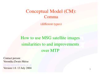
Conceptual Model (CM):Comma(different types) How to use MSG satellite images similarities to and improvements over MTP Contact person: Veronika Zwatz-Meise zwatz-meise@zamg.ac.at Version 1.0. 13 July 2004
Conceptual Model (CM):Comma(different types) • MTP channels in comparison with the corresponding MSG channels • CM: commas: IR image + relevant NWP parameters • MSG additional channels + Channel combinations • (WV and WV difference images)
MTP: ir Co As the image time between MTP and MSG differs, a shift between the cloud systems can be noticed in the two images
Sharper contours through improved space resolution MSG: Ch09 Co
Visual inspection shows only very slight changes between Ch09 and Ch10; quantitative evaluation necessary MSG: Ch10 Co
MTP: vis Co
Looks relatively similar; but: somewhat coarser space resolution MSG: Ch01 Co
Compared to Ch01: no strong differences in the cloud features; but: much better land recognition MSG: Ch02 Co
Sharper contours and more detailed colour combinations through improved space resolution in IR and additional information from 2 different VIS channels MSG: 129 Co
MTP: ir Co
MSG: Ch09 Co Sharper contours through improved space resolution
MSG: Ch10 Co Visual inspection shows only very slight changes between Ch09 and Ch10; quantitative evaluation necessary
MTP: vis Co
Looks relatively similar; but: somewhat coarser space resolution MSG: Ch01 Co Grey cloud represent transparent cloud
Compared to Ch01: no strong differences in the cloud features over the ocean; but: much better land recognition MSG: Ch02 Co transparent cloud less good visible than in Ch01
MTP:VIS(2x)+IR Co Blue: high cloud is very dominant
Sharper contours and more detailed grey-shades through improved space resolution in IR and additional information from 2 different VIS channels MSG:129 Co Dark blue: High cloud light blue: thick cells yellow: less thick cloud cells
Conceptual Model (CM):Comma(different types) • MTP channels in comparison with the corresponding MSG channels • CM: commas: IR image + relevant NWP parameters • MSG additional channels + Channel combinations • (WV and WV difference images)
Comparison of two comma types • Large Comma with thick cloud • Small Comma in high cloud
H500 Comma within huge upper level trough
Comma: PVA max is dramatically shifted to the S (frontal area) model error ? PVA at 500 hPa
H500 Comma within huge upper level trough
PVA at 500 hPa Comma: accompanied by distinct PVA max
Isotachs and PVA 300 Comma: distinct PVA max in left exit region of the jet streak
Conceptual Model (CM):Comma(different types) • MTP channels in comparison with the corresponding MSG channels • CM: commas: IR image + relevant NWP parameters • MSG additional channels + Channel combinations • WV and WV difference images
Comparison of two comma types • Large Comma with thick cloud • Small Comma in high cloud
MSG:129 Co Co: blue/grey/yellow: multilayered; cellular character in structure recognisable
MSG:129 Co Co: blue: mainly cold cloud tops
dark grey: mainly cold cloud tops very few white spots represent cells with water clouds (tops not yet ice) Co
MSG: Ch03 Co dark grey: mainly cold cloud tops some white spots represent cells with water clouds (tops not yet ice)
Co Grey shades: from Vis channels Cyan: represents the ice clouds from Ch03; cyan dominates the Co area; different shades within cyan show different vertical structure of cells
MSG:321 Grey shades: from Vis channels Cyan: represents the ice clouds from Ch03; lots of grey cells visible through the dark cyan of the Co; cells and ice clouds are somewhat decoupled Co
Co Co: cold cloud tops; only very few grey spots (represent warmer cells)
MSG: Ch04 Co Co: cold cloud tops; grey spots represent warmer cells
Co Co: red: low cell tops; water clouds magenta: thick cells with ice cloud blue: cold/ high cloud tops ; ice cloud
MSG:139 Co Co: blue: mainly cold cloud tops some magenta spots visible
MSG:134 Co Co: brown: mainly cold cloud tops some yellow spots visible