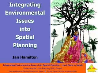
Integrating Environmental Issues into Spatial Planning
Integrating Environmental Issues into Spatial Planning. Ian Hamilton. Why Integrate?. Wider Understanding of Issues More Involvement New Solutions Produce a Better Plan Get Legal Backing. Integrating What?. Environment with a capital “E”. “E” EQUALS EVERYTHING. MY C ommunity

Integrating Environmental Issues into Spatial Planning
E N D
Presentation Transcript
Integrating Environmental Issues into Spatial Planning Ian Hamilton
Why Integrate? • Wider Understanding of Issues • More Involvement • New Solutions • Produce a Better Plan • Get Legal Backing
Integrating What? Environment with a capital “E” “E” EQUALS EVERYTHING MYCommunity MYEnvironment MYWorld
Population Health Economy Town Planning Land Use Energy Spatial Equity Transport Integrating Into What? Spatial Planning Environmental Issues Environment with a small “e”
“Putting Lines on Maps” Spatial Plan = Zones of Yes & No Boundaries = Features or Cadastre Reason = Certainty for Developers/Owners Legal Document = Clarity
Environmental Input Problems Data & Analysis but often No Spatial Output Often wrong level of detail for Planners Need confidence in results before publish “Ms Green, Just draw the range of the endangered Catopuma badia on this map and I will zone it for protection”
Environmental Spatial Inputs • Shoreline Management • Habitat Mapping • Expertise • Interaction with the Public
Shoreline Management: Sandakan • Data Collected: • Bathymetry, Wind, Waves, Water Levels, Surge, Currents • Hydrology & Run-Off • Marine Water Quality, Habitats & Fauna • Mangrove • Shoreline Survey (Aerial & Ground) • Tourism, Fisheries, Aquaculture
Shoreline Management: Sandakan • Management Policies/Considerations: • Physical/Chemical • Morphology, Construction, Water Quality • Biological/Ecological • Terrestrial, Inter-Tidal, Marine • Socio-Cultural • Planning, Tourism, Cultural Heritage • Economic • General, Tourism, Fisheries, Industry
Shoreline Management: Sandakan • Processes: • Subdivide Shoreline into Sediment Cells • Subdivide further into Management Units • Consistent Coastal Processes • Consistent Inter-Tidal & Terrestrial Habitats • Consistent Hydrographic Features • Consistent Shoreline & Hinterland Land Use • Consistent Development Potential • Consistent Land Title Allocation Spatial Planning Input
Sandakan District One Management Unit 4 Cells with Sub-Cells 66 Management Units for 225 km of Shoreline
MU42 Commercial Development Area “This is the main commercial frontage of the town. It is a mixture of commercial units and housing, jetties and other marine facilities. The frontage is presently not well organised. This non-uniform nature of the shoreline development leads to a generally poor foreshore water quality due to the presence of dead water areas that collect rubbish. It is recommended that development in this area be focused towards producing a more streamlined frontage”.
New Port Area Specific Issues “Site 1 can accommodate vessels up to 14m draft with little or no dredging, whilst Site 2 is limited to 8m draft, plus has a complex navigation approach. From a marine point of view Site 1 is therefore preferable. However from a land access point of view access to Site 1 is significantly harder, requiring 11 km of new road of which 2km will cross an intertidal mangrove swamp with its associated construction and environmental concerns. Access to Site 2 on the other hand only requires 5km of new road with no necessity to traverse intertidal mangrove areas. Both sites will require the clearing of mangrove for the jetty facility itself.”
A Picture is worth…. “The sedimentation process will have to be stopped or significantly reduced, for a significant period of time, to allow for any chance of recovery.”
Nothing Kuala Penyu Kuala Penyu District Labuan Colour indicates Speed of Current. Red is Fast and Yellow is Slower. Daat A Causeway clearly has more affect than a Bridge. Bridge “The causeway does affect current patterns locally. This could have an impact upon sediment erosion and accretion patterns in the local area, which could ultimately result in more extensive sand bars and mud flats. While it is difficult to determine from the model results, a higher flow in the straits between P. Daat and Labuan would occur.” Modelling Report November 2003. Causeway
“The causeway creates some protection to the mangrove areas in Sg Klias, which would result in poorer flushing. The bridge piers do not appear to influence flushing significantly. The flushing times provide some quantification to this, where flushing times directly south of the causeway increase from 1 day to 3 – 4 days. The results also show an increase in retention in the vicinity of Sg Klias.” Time in Hours. Red is the Longest Time Causeway Bridge Time required for body of water to mix with external body to a dilution of 1/e (approx. 37%).
Zoning Implications Formation of new river mouth Coastal Erosion Tuaran District Tambalang River
Habitat (Ecosystem) Mapping • Define “Environmentally Critical Areas” (ECA) • Areas of concern from biodiversity & natural resources point of view. • General ECAs: well-defined • Eg coral, sea grass, mangroves, caves • Specific ECAs: evaluation of habitats • Environmental expertise, Criteria
Habitat Map Applications • 1) Identify Environmentally Critical Areas (ECA) • 2) Support eco-tourism development • 3) Ensure sustainable exploitation • 4) Enable strategic conservation planning • 5) Support scientific purposes
General Principles • Maintain 80% of the General ECA’s • Maintain minimum 20 % of dominant terrestrial ecosystems • Maintain few large and contiguous areas rather than many small and scattered • Maintain the distribution of major and minor habitat types characterising the district • Maintain areas upstream rather than downstream river systems • Maintain forest buffers around major rivers (150-300 metres) and minor rivers (30 metres) • Protect Peat Swamp Forest in intact individual peat domes Also identify important wildlife refugees, known distributions of highly endangered species or other wildlife hotspots.
Present Vegetation Cover Historical Assessment Landsat 7 Interpretation Kuala Penyu & Beaufort Districts Hydrogeomorphological Assessment Published Sources
Klias Forest Reserve Bukau River Beaufort District Weston SPOT 2003 “Visible signs of fragmentation of the vegetation cover already exists (yellow circle) between the Klias Forest Reserve and the mangrove forest west of Weston. This fragmentation of the area is already endangering the existing populations of proboscis and leaf monkeys. The proposed red eco-zoning is consistent with the proposed extension of the existing protected forest reserves proposed by the Sabah Biodiversity Conservation Project (1998)”
Yellow Areas: Limited Development Areas In these areas any proposed future development that could have a potentially negative impact on river physics and water quality should be avoided. Red Areas: No Major Development Areas Any proposed future development that could have a potentially negative impact on any ecosystem in these areas should be avoided. Traffic Light Planning
ToR for Habitat Mapper • Requires: • Expertise in Remote Sensing Interpretation • Expertise in Environmental Sciences • Networking with other experts • Site Visits • Rapid Assessment • Prepared to map “Best Guess” lines • Pass on Knowledge
Environmental Expertise • Knowledge of Characteristics & Potential Use of Natural Resources • Peat Swamp: Water Supply & Need for Water Management • Mangroves: Types of Aquaculture & Ideal Locations • Ability to Convey to Non-Scientists • Water Quality: Bio-monitoring/Colour • Watershed Delineation • Initial Environmental Evaluation (IEE)
is the principle of using naturally occurring organisms (flora or fauna) as indicators of the health of the environment. Biomonitoring
Watershed Delineation Mt. Kinabalu Digital Elevation Model (DEM) Tuaran District
Mt. Kinabalu Multiple Watersheds Tuaran District Watershed Delineation
Initial Environmental Evaluation Beaufort Town
Interaction with the Public Waste of Resources Bad Public Relations Unsightly
ELP Project Emphasis SUPPLY BASED Public Meeting Commence dialogue with DLPWG/Community Assess Development Constraints Assess Development Opportunities Continue dialogue with DLPWG/Community Generate Alternatives Evaluate Alternatives Public Meeting/ Comments Preferred Strategy Planning Emphasis Traditional Emphasis Public Involvement DEMAND BASED Calculate Future Population Convert to Land Requirement Generate Alternatives Evaluate Alternatives Public Inspection/ Objections Preferred Strategy
“Environmental Issues” Zones & Policies • new areas (28,006 ha) for Swamp Conservation, Buffer Zones & Hillside Protection (Sandakan) • proposed Water Protection Area (WPA) (27,011 ha) (Tuaran) • new Swamp Conservation (935 ha), People’s Park (704 ha) and Hillside/Panorama views (Tuaran) • extension to Klias Forest Reserve (2,364 ha), mangrove reserves and buffers around environmentally critical areas (31,821 ha) identified by the project’s habitat mapping (Beaufort/Kuala Penyu) • proposed WPAs (21,116 ha of state land) and Water Conservation Areas (10,732 ha outside forest reserves) in Klias peatlands for future water reservoirs, to aid soil stability, reduce fire risk, protect flora/fauna and upstream areas. (Beaufort & Kuala Penyu) • definition of specific areas for aquaculture and associated zonings for value added activities. (Beaufort & Kuala Penyu) • suggested sites/practices for future solid waste disposal
Working Together • Planners Don’t Know Everything!!!!!! • No individual agency can contain full range of skills and knowledge required to prepare such plans; • Technical expertise becoming more specialised and spread more widely (and thinly) even within individual agencies; • Each agency needs to understand the role and relevance of others involved in the plan process; • Increase in public involvement so decisions need to be made in a more transparent way with appropriate accountability; and • The limited data which is available needs to be shared for maximum effectiveness.
Now? • Models: more & better “what if” scenarios • Increased & wider use of GIS at all levels • Environmental data is more Visual • Use SEA at “Strategic” Level • Planners need more Vision • Involve Public & Key Persons • Try to understand environmental issues • eg. Water, Sewage & Solid Waste
Future 1 • Spatial implications of Decisions • New land use = journey = pressure = etc. • More Sprawl or Smaller Self-contained units • Promote compact, more efficient designs • Redevelopment on Brownfield Sites • Agricultural areas Untouchable • Financial instruments to support Plans
Districts Teamwork Support New Planners Future 2
and Finally………………………… Many thanks for all your support during the ELP Project Don’t stop now Paradise will remain under threat Good Luck