Download
1 / 9
90 likes | 360 Vues
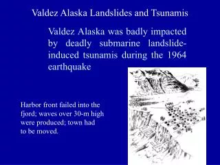
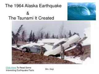
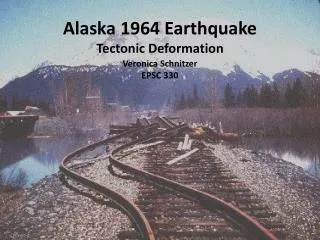
Alaska 1964 Earthquake Tectonic Deformation. Veronica Schnitzer EPSC 330. Background Info. Occurred March 27, 1964 Prince William Sound, Alaska Magnitude 9.2 128 deaths $311 million in property loss Extreme uplift Landslides. u sgs.gov. Coseismic deformation. George Plafker , 1965

E N D
Alaska 1964 EarthquakeTectonic Deformation Veronica SchnitzerEPSC 330
Background Info • Occurred March 27, 1964 • Prince William Sound, Alaska • Magnitude 9.2 • 128 deaths • $311 million in property loss • Extreme uplift • Landslides usgs.gov
Coseismic deformation • George Plafker, 1965 • Saw uplift and subsidence visible on land • Measured change in barnacle line • Drew contour map Plafker, 1965
Postseismic deformation • Savage & Plafker, 1991 • Measured postseismic uplift and subsidence pattern • Looked at change in annual mean sea levels • 5 year postseismic slip • 100 year flow in aesthenosphere Savage & Plafker, 1991
Postseismic deformation • Zweck et al, 2002 • GPS, triangulation, leveling data • Created models to measure distribution of slip • Found more than one time-decaying component • Creep on fault • Viscous/viscoelastic relaxation
Conclusion • The Alaska 1964 earthquake was the second most powerful ever recorded • It resulted in extreme uplift and subsidence on land • Coseismic measurements showed strong evidence for a subduction zone • Postseismic measurements showed two time components of postseismic deformation: short term postseismic slip, and long term viscous/viscoelastic flow.
References • Plafker, G., 1965. Tectonic Deformation Associated with the 1964 Alaska Earthquake. American Association for the Advancement of Science 148, no. 3678, pp. 1675-1687. • Savage, J.C. & Plafker, G., 1991. Tide Gage Measurements of Uplift Alone the South Coast of Alaska. Journal of Geophysical Research 96, no. B3, pp. 4325-4335. • Stover, C.W. & Coffman, J.L., 1993. Seismicity of the United States 1568-1989(Revised). U.S. Geological Survey Professional Paper 1527. Retrieved from http://earthquake.usgs.gov/earthquakes/states/events/1964_03_28.php • Zweck, C., Freymueller, J.T. & Cohen, S.C., 2002. The 1964 great Alaska earthquake: present day and cumulative postseismic deformation in the western Kenia Peninsula. Physics of the Earth and Planetary Interiors 132, pp. 5-20.