Download
1 / 34
340 likes | 359 Vues
GRAV-D: The Gravity for the Re-definition of the American Vertical Datum. Vicki Childers National Geodetic Survey. ACSM 2009 Workshop. Mission : To define, maintain and provide access to the National Spatial Reference System to meet our nation’s economic, social, and environmental needs

E N D
GRAV-D:The Gravity for the Re-definition of the American Vertical Datum Vicki Childers National Geodetic Survey ACSM 2009 Workshop
Mission: To define, maintain and provide access to the National Spatial Reference System to meet our nation’s economic, social, and environmental needs • Primary challenge: to establish and maintain a sufficiently accurate Vertical Reference System to: • Support the surveying community • Predict storm surge and tsunami inundation • Predict riverine and estuary flooding • Monitor sea level rise and the impacts of climate change • Land uplift/subsidence (tectonics, glacial rebound) • Monitor shoreline erosion
Verticaldatum: A reference surface where elevation = zero Heights: How they are calculated above the reference surface "topographic map." Online Art. Britannica Student Encyclopædia. 17 Dec. 2008 <http://student.britannica.com/ebi/art-53199> Vertical Reference System:Two Critical Aspects
Ellipsoidal Reference Surface • Ellipsoid of revolution that best fits the shape of the Earth • Smooth, geometric surface • Reference frame used by GPS http://original.britannica.com/eb/art-1159/Elements-of-a-reference-ellipsoid
Ellipsoid Height (h) • The distance along the ellipsoidal normal from some ellipsoid up to the point of interest Earth’s Surface h Another Ellipsoid (Shape and location are mathematical abstractions) h An Ellipsoid (Shape and location are mathematical abstractions)
But the Earth is not smooth! • Earth and its gravity field are bumpy • Water flows downhill with respect to gravity • Vertical datum must reflect the variable gravity field
Water Follows the Gravity Field • Water will orient itself to the gravity field • Will assume a lowest energy state • The lowest energy state will correspond to an “equipotential surface” of the gravity field CLS-01 Mean Sea Surface (1993-99) 7 years T/P, 5 years ERS, 2 years Geosat http://www.aviso.oceanobs.com/
Gravity-Based Reference Surface W=W3=Constant Surface of equal gravitational potential W=W2=Constant W=W1=Constant W=W0=Constant W=W4=Constant The geoid:one that best fits global mean sea level in the least squares sense
Orthometric Height (H) • The distance along the plumb line from the geoid up to the point of interest Earth’s Surface H The Geoid
Can We Relate Ellipsoidal HeightAnd Orthometric Height? Geoid Undulation (N) • The distance along the ellipsoidal normal from some ellipsoid up to the geoid h = ellipsoidal height H = orthometric height h H ≈ h-N H Geoid N A chosen Ellipsoid
US Vertical Datum – History(Orthometric Heights) • 1807 – 1996 • Defined and Accessed – Leveling/Passive Marks • Currently: North American Vertical Datum 1988 • NAVD 88: 600,000+ Marks • NGS detects hundreds moved/destroyed every year • How many go undetected? • Post-Glacial-Rebound, Subsidence, Tectonics, Frost-Heave – lots of motion out there!
Why isn’t NAVD 88 good enough anymore? • NAVD 88 H=0 level is known not to be the geoid • 50 cm average bias, 1 m tilt across CONUS • 1-2 m bias in AK • Leveling the country again is impractical • Too costly in time and money • Leveling yields cross-country error build-up • Leveling requires leaving behind marks which are impermanent
Q: What is GRAV-D? • Official NGS policy: • Re-define the US Vertical Datum by creating a new gravimetric geoid • 10 year program • Two Major Program Elements • Airborne Gravity “Snapshot” for Baseline • Long Term Monitoring of Temporal Changes • Projected program cost: $38.5M over 10 years
20-100 km gravity gaps along coast Terrestrial gravity New Orleans Ship gravity
Conduct airborne surveys over all of US and its holdings in established priority order High-altitude: 35,000 ft (~10 km) Nominal speed: 280 kts (519 km/hr) Line spacing: 10 km data 40 km cross GRAV-D 1: Airborne Gravity Baseline Puerto Rico/US Virgin Islands 40 km cross line 10 km data line spacing
Airborne Gravity Baseline • New absolute and relative terrestrial measurements for gravity ties • Absolute and relative land surveys to ground truth areas of mismatch with historic data
Gravity Survey Plan Testing Phase Phase 1a Phase 1b • Puerto Rico/US Virgin Islands (Jan ’09) • Test area for proof of concept to define vertical datum from GPS + gravimetric geoid • Alabama Survey (Jan ‘08) • Test of flight altitudes, speeds, line spacing for best accuracy for cost
Phase II: Airborne Survey Plan Order of Priority Coastal Alaska
GRAV-D 2: Monitor Temporal Change • Monitor gravity changes in regions of rapid vertical elevation change • Periodic update of the gravity field and geoid
Track low degree-order gravity changes with GRACE and satellite laser ranging Maintain networks of absolute and relative gravity measured in areas of most rapid change Convert to geoid changes over time Use with tracked GPS stations (CORS) to get orthometric height changes over time How to Monitor Temporal Change
Anchorage Surveys of Opportunity: Alaska • Survey flown out of Anchorage, AK over NOAA’s Hydropalooza Area in July, 2008 • 400km x 500km region covered in ~100 flight hours • Funded out of internal money Free-airanomaly
Surveys of Opportunity: Gulf Coast Free-airanomaly • Extends west from 2006 survey • 400km x 360km region covered in 85 flight hours in Oct/Nov ‘08 • Will continue in Feb to Mexican border • Funded by USACE New Orleans
LA08 GLS06 Gulf Coast Aerogravity • Despite different color bar, contours show that new data match nicely with 2006 survey flown with Naval Research Lab
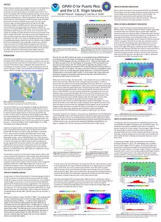
Puerto Rico / US Virgin Islands Survey 2009 • Flown in January in 100 flight hours • Completes our second test survey for the GRAV-D plan -260 -220 -180 -140 -120 -80 -40 0 40 80 120
Texas Survey • Survey resumes next week • Working from Lake Charles, LA and Austin, TX • 100 flight hours • Coverage complete from the AL/GA state line to the Mexican border
Next Steps Seeking funding / partnerships MOU letters to Other Federal Agencies States Industry Partners University Researchers FY 2010 GRAV-D project funding request at OMB level Uncertain funding with new administration 2011 Expected line item funding
Benefits to the Nation • Establish an accurate vertical reference surface for all maps and GIS products • Help to establish and maintain infrastructure in regions of possible flooding • Enable better prediction of inundation from storm surges, tsunamis, and interior flooding • Better able to monitor “effective” sea level change along coastlines • Better monitor shoreline erosion • Help to predict effects of climate change for coastal communities