Download
1 / 34
340 likes | 453 Vues
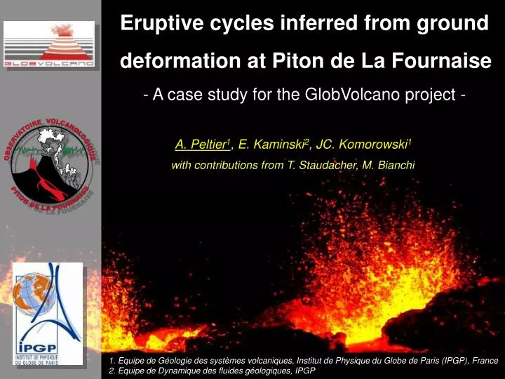
Eruptive cycles inferred from ground deformation at Piton de La Fournaise - A case study for the GlobVolcano project -. A. Peltier 1 , E. Kaminski 2 , JC. Komorowski 1. with contributions from T. Staudacher, M. Bianchi.

E N D
Eruptive cycles inferred from ground deformation at Piton de La Fournaise • - A case study for the GlobVolcano project - A. Peltier1, E. Kaminski2, JC. Komorowski1 with contributions from T. Staudacher, M. Bianchi 1. Equipe de Géologie des systèmes volcaniques, Institut de Physique du Globe de Paris (IPGP), France 2. Equipe de Dynamique des fluides géologiques, IPGP
Introduction - GPS data - PSInSAR - Conclusion N Geological Setting 130 150 170 190 70 Indian Ocean 60 50 40 Piton de La Fournaise 30 20 (Gauss Laborde Réunion Coordinates, km)
Introduction - GPS data - PSInSAR - Conclusion N 5 4 3 2 1 0 Number of eruptions per year Eruptive Activity 130 150 170 190 rest rest 70 1920 1930 1940 1950 1960 1970 1980 1990 2000 60 50 • 2 eruptions per year 40 Piton de La Fournaise • Rest Periods : 1966-1972, 1992-1998 30 • Since 1998 : 26 eruptions 20 (Gauss Laborde Réunion Coordinates, km)
Introduction - GPS data - PSInSAR - Conclusion Summit eruption Elevation (m) Proximal eruption 2000 Distal eruption 1000 Eruptive cycles 01-jan-00 01-jan-02 01-jan-04 01-jan-06 Eruptive fissures : 1998-2007 N Distal eruptions Elevation of eruptive fissures Proximal eruptions Summit eruptions (Peltier et al., in press, JVGR)
Introduction - GPS data - PSInSAR - Conclusion Deformation network Tiltmeter network N Extensometer network Dolomieu Bory Continuous GPS network (since 2004)
Introduction - GPS data - PSInSAR - Conclusion • Piton de La Fournaise: • High eruptive activity • Well monitored with ground deformation network Good case study for the GlobVolcano project Projet GlobVolcano Piton Bien car bcp d’éruption et permet De valider les données avec les field data
Introduction - GPS data - PSInSAR - Conclusion • Piton de La Fournaise: • High eruptive activity • Well monitored with ground deformation network Validation of deformation mapping products Projet GlobVolcano Piton Bien car bcp d’éruption et permet De valider les données avec les field data
Introduction- GPS data - PSInSAR - Conclusion NS component EW component GPS data (2004-2007) (Peltier, 2007)
Introduction- GPS data - PSInSAR - Conclusion NS component EW component GPS data (2004-2007) • Short-term eruptive displacements (up to 20×103 mm d-1) (Peltier, 2007)
Introduction- GPS data - PSInSAR - Conclusion Horizontal displacements Vertical displacements NS component EW component GPS data (2004-2007) • Short-term eruptive displacements (up to 20×103 mm d-1) (1) (2) (1) Horizontal displacements Vertical displacements (2) (Peltier, 2007)
Introduction- GPS data - PSInSAR - Conclusion NS component EW component GPS data (2004-2007) • Short-term eruptive displacements (up to 20×103 mm d-1) (1) ΔP = 2.2 MPa Explained data: 89% (1) (Peltier et al. 2008, EPSL)
Introduction- GPS data - PSInSAR - Conclusion NS component EW component GPS data (2004-2007) • Short-term eruptive displacements (up to 20×103 mm d-1) (1) (Peltier et al. in press, JVGR)
Introduction- GPS data - PSInSAR - Conclusion NS component EW component GPS data (2004-2007) • Pre-eruptive long term inflation (0.4-0.7 mm d-1) (Peltier et al. in press, JVGR)
Introduction- GPS data - PSInSAR - Conclusion Validation of deformation mapping products (PSInSAR) • GPS↔ available data for the PSInSAR product validation. (M. Bianchi)
Introduction- GPS data - PSInSAR - Conclusion Validation of deformation mapping products (PSInSAR) • GPS↔ available data for the PSInSAR product validation. • 1st stage: identify time periods with a continuous GPS record. (M. Bianchi)
Introduction- GPS data - PSInSAR - Conclusion Validation of deformation mapping products (PSInSAR) • GPS↔ available data for the PSInSAR product validation. • 1st stage: identify time periods with a continuous GPS record. • 5 GPS stations with a continuous record between April 2004 and March 2007: - 3 at the summit BORg, DSRg, SNEg - 2 reference stations, outside of the summit cone. SNEg BORg DSRg (M. Bianchi)
Introduction- GPS data - PSInSAR - Conclusion Validation of deformation mapping products (PSInSAR) • GPS↔ available data for the PSInSAR product validation. • 1st stage: identify time periods with a continuous GPS record. • 5 GPS stations with a continuous record between April 2004 and March 2007: - 3 at the summit BORg, DSRg, SNEg - 2 reference stations, outside of the summit cone. (M. Bianchi)
Introduction- GPS data - PSInSAR - Conclusion Validation of deformation mapping products (PSInSAR) • GPS↔ available data for the PSInSAR product validation. • 1st stage: identify time periods with a continuous GPS record. • 5 GPS stations with a continuous record between April 2004 and March 2007: - 3 at the summit BORg, DSRg, SNEg - 2 reference stations, outside of the summit cone. GPS positions over S2 PS results (2004-2007) (M. Bianchi)
Introduction- GPS data - PSInSAR - Conclusion Validation of deformation mapping products (PSInSAR) BORg station January 2004 distal eruption (M. Bianchi)
Introduction- GPS data - PSInSAR - Conclusion PS time series, DSRg station
Introduction- GPS data - PSInSAR - Conclusion Validation of deformation mapping products (PSInSAR) • To avoid the lack of coherency between images used to compute the interferograms, we focused on the pre-eruptive unrest periods. • 2nd stage : find the longest time period with no eruption disturbing both the GPS and the PSInSAR records. • the selected period ranges between March and October 2005. Two distinct deformation phases can be identified : (1) from March to July (2) from July to October
Introduction- GPS data - PSInSAR - Conclusion Validation of deformation mapping products (PSInSAR) • To avoid the lack of coherency between images used to compute the interferograms, we focused on the pre-eruptive unrest periods. • 2nd stage : find the longest time period with no eruption disturbing both the GPS and the PSInSAR records. • the selected period ranges between March and October 2005. Two distinct deformation phases can be identified : (1) from March to July (2) from July to October • Estimates of displacement rates in the line of sight of the satellite as inferred from the PSInSAR time series. • Estimates of GPS displacement rates in the line of sight of the satellite as inferred from the PSInSAR time series.
Introduction- GPS data - PSInSAR - Conclusion Comparison between PSInSAR and GPS data Good agreement between the two methods, within their associated error bars
Introduction- GPS data - PSInSAR - Conclusion Comparison between PSInSAR and GPS data Good agreement between the two methods, within their associated error bars
Introduction- GPS data - PSInSAR - Conclusion Conclusion – Ground deformation mapping product • GPS data : Two time scales of ground deformation (1) Large short-term ground displacements (up to 20×103 mm d-1), a few min to hours prior each eruption (2) Small long-term ground displacements during pre-eruptive unrest (0.4-0.7 mm d-1 of summit inflation) • For the pre-eruptive unrest periods : Good agreement between the PSInSAR and GPS data : PSInSAR data provide global inference of the ground deformation field • PSInSAR data : useful complementary information for accurate ground displacement mapping
Introduction- GPS data - PSInSAR - Conclusion Perspectives • PSInSAR at Piton de La Fournaise • Complementary to GPS data • GPS data: dynamics of the ground deformation in real-time • PSInSAR data: cover a larger area Dolomieu Bory
Introduction- GPS data - PSInSAR - Conclusion Perspectives Distal eruptions • PSInSAR at Piton de La Fournaise • Complementary to GPS data • Notably for the distal eruptions located outside of the summit cone where no field monitored networks are implemented Dolomieu Bory
Introduction- GPS data - PSInSAR - Conclusion Perspectives Distal eruptions • PSInSAR at Piton de La Fournaise • Support to early stage warning of volcanic risk especially during distal eruptions. Dolomieu Bory
Introduction- GPS data - PSInSAR - Conclusion Product Validation at Piton de La Fournaise • Ground deformation mapping • Surface thermal anomalies
Introduction- GPS data - PSInSAR - Conclusion Other product validation : Surface thermal anomalies (ASTER-SPOT-MODIS) Results of the validation September 2006 - January 2007 eruption GlobVolcano mass flux is about 30% larger than the volumetric flux measured by the observatory. This implies an average porosity of about 30% for the lava flow, which agrees with both literature reference and some measurements made by the observatory.
Introduction- GPS data - PSInSAR - Conclusion MODIS MIR- saturation Other product validation : Surface thermal anomalies (ASTER-SPOT-MODIS) Increase of surface activity linked with the summit crater collapse: flux estimated at > 50m3/s on the field (B. Hirn)
Introduction- GPS data - PSInSAR - Conclusion Other product validation : Surface thermal anomalies (ASTER-SPOT-MODIS)
Introduction - GPS data - PSInSAR - Conclusion • Product validation at Piton de La Fournaise: • Ground deformation mapping • Surface thermal anomalies • Remarkable agreement found between ground data and GlobVolcano product. • - Both the location of the eruptive center, the emplacement of active lava flow, the ground displacements and the eruptive mass flux appear as robust and as accurate as the observatory record. Projet GlobVolcano Piton Bien car bcp d’éruption et permet De valider les données avec les field data