Crisis Mapping in an emergency
This brief discusses the critical role of crisis mapping during emergencies, focusing on the coordinated response of various agencies in the wake of the Canterbury earthquake. Key organizations like the NZ Police, Fire Service, and Health Boards played vital roles. Establishing a collaborative platform within 24 hours facilitated data sharing and GIS support for internal teams and external agencies. Key learnings emphasize the importance of having foundational data ready, clear communication channels, and the need for thorough decision-making processes to enhance response efforts in future emergencies.
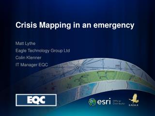

Crisis Mapping in an emergency
E N D
Presentation Transcript
Crisis Mapping in an emergency Matt Lythe Eagle Technology Group Ltd Colin Klenner IT Manager EQC
Agencies Involved in Response • The member organisations of the Coordinating Executive Group are: • The local authority members of the CDEM Group, including Environment Canterbury. • NZ Police • NZ Fire Service • Canterbury District Health Board • South Canterbury District Health Board • St John Ambulance • Department of Conservation • Canterbury Employers Chamber of Commerce • Ministry of Agriculture and Forestry • Canterbury West Coast Rural Fire Committee • Ministry of Civil Defence and Emergency Management • Canterbury CDEM Group Controller
ECan’s Responseto the Quake • Establishment within 24hrs of www.Canterburyearthquake.org.nz • Hosted outside of Ecan infrastructure • Collaborative site - All agencies involved could post entries themselves. (users only needed an internet connection and a web browser)
GIS Response • Activities • preparing data/maps for internal response teams • hand digitising information from situational reports into GIS data for a regional picture • providing GIS and IT support for agencies not normally based in Christchurch e.g. EQC, Red Cross, Fire Service, Ministry of Social Development • setting up GIS portals (public, and secured for response agencies) to make information available
Learnings • Have the best people there at the start • Have all the base data you need in one place • Expect incomplete and ambiguous data • Avoid rushed decisions based on ideas • Check that there is a purpose for actions • Reduce barriers to access to information • Have contact points & communication paths established between agencies
Going up….. Active Landscapes Coming down….
Thank you Eagle are in the Exclusive Briefing Room 11:10am to 12:10pm