Understanding 4-Figure Grid References for Mapping Locations
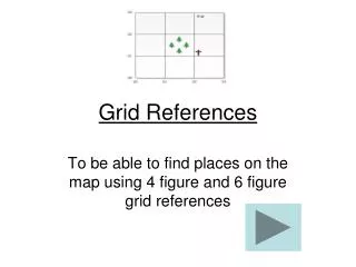
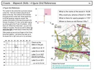
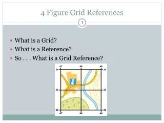
This guide explains how to determine 4-figure grid references on a map for identifying specific locations. Start by examining the numbers along the bottom and side of the map. Moving your finger along these grid lines, record the initial number where your finger ends for both the east-west and north-south coordinates. For example, a cabin located at the reference of 1322 can be accurately found using this method. We also explore other references like the cliffs (1324 or 1521), Loch (1022 or 1123), town (1220 or 1123), and beach (1421 or 1522).

Understanding 4-Figure Grid References for Mapping Locations
E N D
Presentation Transcript
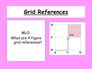
Grid References MLO: What are 4 figure grid references?
First look at the numbers along the bottom of the map. The finger moves towards the east until it is below the cabin. I record the number at the beginning of the square. It is 13.
Now my finger has moved up towards the north until it comes to the cabin. I record the number at the beginning of the square. It is 22.
Are the cliffs 1324 or 1521 • Is the Loch 1022 or 1123 • Is the town 1220 or 1123 • Is the beach 1421 or 1522