Download
1 / 63
640 likes | 829 Vues
Enhancing ISR for Unmanned Aircraft Systems October 2009. Introductions. Matt Malek Director, Strategic Operations Mike Bruchanski Business Development Manager. Why are we here?

E N D
Enhancing ISR for Unmanned Aircraft Systems October 2009
Introductions • Matt Malek Director, Strategic Operations • Mike Bruchanski Business Development Manager
Why are we here? Optimize the air system Improve mission effectiveness Enhance situational awareness How can AGI software support your needs? Mission
AGI basics • COTS software for analysis and visualization • Models object in space over time • Analyze and understand relationships • Constrain relationships
Aircraft and ISR focus Global Navigation Satellite Systems Real-Time Data Feeds Terrain & Cityscape Modeling Antenna Modeling Imagery & Map Data Radar Analysis Sensor Modeling Constraints for Visibility Spacecraft Design & Operation Communications Link Analysis Weather & Atmospheric Effects System Performance Analysis Ground Facility Modeling
Differentiators and benefits • Right answers, Right now • Open architecture • Scalable • Lower cost • Reduces risk • Increase efficiency
Flexible and scalable Components Desktop Engine
AGI software capabilities implemented U.S. Marines U.S. Air Force AMMP U.S. DoD Coalition Warrior U.S. Navy HS - 5 U.S. Army
Fuse data into 3DCOP for decisions Model route and missions through interactive 3D display Conduct trade studies define requirements Engineering and analysis ISR Planning Operations 10
Foundation of capabilities • Accurate visualization • Position and time • 3D visualization • Geometry engine • Model systems • Interaction between multiple objects
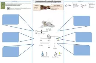
UAS capabilities • Intervisibility (line of sight) • Route modeling • Payload analysis (sensors) • Communication analysis • Urban environments
Case study – U.S. Navy • Benefits: • Expanded analysis capabilities • Reduced analysis time • Significant cost savings • Background: • US Navy Integrated Battlespace Arena Lab needed ISR mission planning tool • Broad Area Maritime Surveillance (BAMS) program • “Above and beyond typical mission planning software” Solution: • Purchase AGI desktop software to validate UAS systems • Modeled various UAS platforms and payloads in a single integrated environment
Intervisibility - line of sight • What can my UAS “see?” • Position and time • Consider constraints • Geometry • Time • Terrain/Body Masking • Lighting • Multiple objects in chain • Report, display and graph data
Intervisibility - line of sight • Application highlights • Access between UAS and ground target • Report and graph data • Create body mask for aircraft • Comparing potential locations for LOS antenna placement
Intervisibility - line of sight • Benefits • Visualize complex analysis • Validated and verified line of sight algorithm • Model real world constraints • Evaluate system design reducing or eliminating the need for test flights
Route modeling • Aircraft performance • Six degree of freedom modeler • Based on aircraft performance • Define basic values • Airspeeds • Accelerations • Climb/decent rates • Fuel flow • Landing/take off distances • Vertical or standard take off • Change performance based on aircraft set up
Route modeling • Aircraft performance • Create aircraft flight plan • Procedures • Waypoint to waypoint • Holding patterns • Takeoff/Landing • Terrain following • Waypoints • Runways • Navaids • Other objects • 3D route editing • Import external models
Route modeling • Application Highlights • Edit route in 3D • Create new waypoints • Add holding pattern • View restricted airspace and threat areas • Calculate and display restricted area intrusions • Import existing route
Route modeling • Benefits • Validated and verified flight model • Adaptable to any aircraft • Flexible route editing • Open architecture import routes
Payload performance • Sensor modeling • Model field of view or field of regard • Placed on any point of UAS • Body masking • Angle constraints • Pointing information • Compare sensor performance • Calculate sensor swath • Customize attributes with plug-ins
Payload performance • Coverage Modeling • Analyze multi-asset interactions • Across region • Along a route • Instantaneous or cumulative • Apply constraints for higher-fidelity modeling • Generate quality figures of merit • Standard AGI calculations • Plug-in capabilities • Calculate satisfaction stats for each figure of merit
Payload performance • Application highlights • Define search region • Import aircraft routes • Model sensor zoom levels • Range and time coverage calculations • NIIRS Plug-in coverage calculations • View satisfaction report
Payload performance • Benefits • Evaluate multiple sensors in a controlled environment • Develop concept of operations for sensor use • Combine with other capabilities for full ISR planning support
Case Study - U.S. Marines • Benefits: • Expanded analysis capabilities • Reduced analysis time • Significant cost savings • Background: • United States Marine Corps (USMC) needed evaluate different UASs’ sensors • Needed a quick assessment Solution: • Purchased AGI software • Assess UAS systems and candidate sensors • Determine communication link capabilities • Compared electro-optical/infrared (EO/IR) sensors
Communication analysis • Communication system modeling • Define transmitter and receiver • Set power, frequency and modulation type • Specify antenna • Dynamic link performance • Add to object • Inherit object properties • Physical environment • Terrain masking and reflection • Atmospheric properties • Weather • Sun effects
Communication analysis • Communication systems modeling • Interference effects • Friendly and enemy • Calculate jamming capabilities • Create reports and graphs • Link budget • View losses • Similar capabilities for radar
Communication analysis • Model urban environments • Multipath diffraction model • Considers actual geometry of surrounding buildings • Higher fidelity and greatly reduced computational times • Multiple applications including: • Tactical mobile communications • Net-centric ISR architectures • Analysis of urban tactics
Communication analysis • Application Highlights • Import urban terrain • Develop building mask • Model line of sight link • Gain pattern visualization • Received power for aircraft route • Analysis of urban area • Multipath calculations
Communication analysis • Benefits • Better prediction of operational performance • Better understanding of mission impact • Model system within a system • Consider complex constraints • Adjust mission based on constraints
Case study – Global defense contractor • Benefits: • Saved millions of US dollars by reducing the number of flight tests • Delivered system on time, earning additional award fees • Background: • Evaluating communication systems for airborne platforms • Specifically concerned with antenna coverage, due to impacts from aircraft keel Solution: • Used AGI software to model “as installed” antenna patterns • Allowed customer to understand the coverage and blockage of various flight paths reducing the number flight tests 36
ISR planning and operations • Rapid development • ISR optimization • 3D visualization and situational awareness • Sensor visualization • Imagery searching and retrieval
COTS development tools Out-of-the-box API Develop and deploy solutions Mission operations Enterprise integration Thin or thick clients Server & desktop applications Web Services Mission specific workflows Create new applications Embed into existing applications COTS applications Out-of-the-box GUI Cross-functional tool System, platform, payload design Systems engineering Mission analysis Real-time analysis Unrestricted workflows Integrated map and globe Integrated graphs and reports Discover Develop Deploy Software to meet your needs
Develop or extend • Create new applications
Develop or extend • Extend existing applications
Rapid development • Move from idea to application at the speed of battle • Leverage AGI technology • Avoid deployment costs and development risk • Faster delivery
Case study – U.S. Government • Benefits: • Mission planning from 2 days to 2 hours • Dynamic replanning from hours to minutes • Plan more missions • Improved data collection • Significant cost savings • Background: • Classified US DoD customer • Need to improve sensor and aircraft mission planning • Customer needed faster delivery Solution: • Used COTS development software and delivered a capability in 90 days
Develop ISR plan • Where should I fly my UAV and when? • Typical planning problem • What do you want to see? • When do you want to see it? • Where is it located? • What are the constraints? • Complicated by real world issues • Large target deck with different constraints • Complicated geometry • Dynamic replanning
Develop an ISR plan • Target scheduling • Ordering of objectives • Airspace navigation • Avoiding no-fly zones • Aircraft routing • Vehicle characteristics
Develop an ISR plan • Application Highlights • Import geometry • Specify targets • Re-task aircraft • Implementation of AGI Components • Dynamic Geometry Library • Terrain Analysis Library • Routing Library
Improve your situational awareness • Effectively present decision aids • 2D and 3D view • Terrain and imagery • Airspaces and regions • Deconfliction • Incorporate many real time feeds • Cursor on target • Blue Force Tracking • Link 16 • Collaborate and annotate • Manage handovers • Mark targets