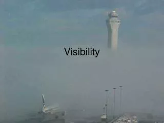
Forecasting Visibility
Discover the causes and observation methods of visibility reductions in weather forecasting. Learn about particle size impact on visibility and different types of fog. Stay informed on advection fog, duststorms, and the importance of monitoring visibility for accurate predictions.


Forecasting Visibility
E N D
Presentation Transcript
Reductions to Visibility Caused by the scattering and absorption of visible light. Major causes: • Hydrometeors: fog, drizzle, snow, rain…particularly heavy rain and snow • Dust and smoke: wildfires, dust raised by strong winds, volcanic eruptions • Other particles such as sand • Air pollution
Observing Visibility • Old days: human observers would use local landmarks of known distances
Today: automated sensors such as the ASOS Visibility Sensor • Uses Xenon flash light source and then measures how much light is scatttered into sensor
Particles size and visibiliy • Large particles (compared to wavelength of light): Mie Scattering. Not wavelength dependent (whitish haze) • E.g., Large hygroscopic salt particles • Small particles (compared to light). Bluish colors. Rayleigh Scattering. Prop to 1/l4 • E.g., Combustion particles
Rayleigh Scattering Mie Scattering
000 FXUS62 KGSP 131857 AFDGSP AREA FORECAST DISCUSSION NATIONAL WEATHER SERVICE GREENVILLE-SPARTANBURG SC 253 PM EDT THU APR 13 2006 .SHORT TERM /TONIGHT THROUGH SATURDAY/... NORTHWESTERLY FLOW ALOFT WILL REMAIN OVER THE AREA THRU FRIDAY. …. THERE IS THE POSSIBILITY THAT KAND/KCLT COULD HAVE A BRIEF PERIOD OF MVFR FOG AROUND SUNRISE FRI GIVEN THE FORECAST HYDROLAPSE. HOWEVER CROSSOVER TEMPS ARE WELL BELOW FORECAST LOW TEMPS...THEREFORE WILL LEAVE OUT FOR NOW. CANNOT RULE OUT SOME VFR CEILINGS FROM TIME TO TIME...BUT CHANCE NOT HIGH ENOUGH TO INCLUDE AT THIS TIME. && .GSP WATCHES/WARNINGS/ADVISORIES... GA...NONE. NC...NONE. SC...NONE. && $$ SHORT TERM...RWH/CSH LONG TERM...CSH AVIATION...RWH
The annual variation can be different in other locations • Where advection fog is dominant often max in late spring/summer. Like coastal CA!
Dust/sand storms • Often associated with strong cold fronts or the outflow from strong convection. • Minimum wind speed threshold depends on characteristics of surface (fine dust easier to loft than large sand particles).
Why increasing? • Drier conditions in western U.S • More disturbance of soils—more grazing, more off-road vehicles, more mountain biking, more exploration for oil and another resources. • More dust coming from Asia.