Download
1 / 21
240 likes | 461 Vues
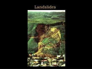
RISK ASSESSMENT METHODOLOGIES FOR LANDSLIDES. Jean-Philippe MALET Olivier MAQUAIRE CNRS & CERG. …. Welcome to Paris!. Final Meeting, Brussels, 26 January 2009. Rotational and translational slides. Diversity of landslide types. Soil spreading. Fall. Toppling. Mudflow. Debris flow.

E N D
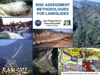
RISK ASSESSMENT METHODOLOGIES FOR LANDSLIDES Jean-Philippe MALET Olivier MAQUAIRE CNRS & CERG …. Welcome to Paris! Final Meeting, Brussels, 26 January 2009
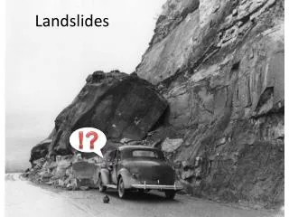
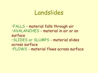
Rotational and translational slides Diversity of landslide types Soil spreading Fall Toppling Mudflow Debris flow Definition of a landslide – Movement of a slope (mass of rock, of soil or of debris) controlled by gravity. Three main mechanisms of movement are distinguished: fall, sliding and flow type processes.
Some statistics on landslides • - A major threat to human life, property, infrastructure and natural environment • - On average, landslides are responsible for ca. 17% of all fatalities from natural hazards worldwide (CRED, 2005) • - The socio-economic impact of landslides is underestimated because landslides are usually not separated from other natural hazard triggers, such as extreme precipitation, earthquakes or floods. • - In the last century, Europe has experienced the second highest number of fatalities and the highest economic losses caused by landslides compared to other continents: • - at least 16,000 people have lost their lives because of landslides • - the material losses amounted to over 1700 mill. in Europe • The European countries the most affected are: • Italy, Spain, Greece, Switzerland, Austria, UK, France, Norway, Sweden.
The landslide risk assessment framework (Fell et al., 2005)
Landslide risk analysis and landslide risk assessment * International terminology available Landslide RAM – A method based on the use of available information to estimate the risk to individuals, property or the environment, from landslide hazards. A landslide RAMs generally contain the following steps: 1/ definition of threat (danger) 2/ estimation of probability of spatial occurrence (susceptibility) 3/ estimation of temporal probability of an event of a given magnitude (hazard) 4/ evaluation of the vulnerability of the element(s) at risk 5/ consequence identification 6/ risk estimation. It includes also the process of making a decision recommendation based on criteria/thresholds (tolerable/acceptable risks). Source: ISSMGE-ISRM-IAEG JTC-1 Joint Technical Committee on Landslides and Engineered Slopes, 2006
Review of current landslide RAMs for EU27 • Questionnaire and litterature review • 71 questionnaires / 30 answers • success rate: 43% 27 questions, 4 themes • General information about • risk assessment • Description of the RAM • Data: Landslide inventory, conditioning factors, triggering factors, damages • Output documents
Review of current landslide RAMs for EU27 • Landslide RAMs available for 18 EU Member States + Switzerland • Official RAM: 5 countries • (France, Italy, Sweden, Switzerland, Austria) • RAM in development: 9 countries • (Belgium, Cyprus, Czech Republic, Hungaria, Ireland, Slovakia, Slovenia, Spain, and United-Kingdom) • RAM used by R&D institutes / private companies: 4 countries • (Germany, Greece, Poland, and Portugal) • No RAM: 6 countries • (Denmark, Germany, Latvia, Lituania, Malta, Netherlands) • Information missing: Luxembourg, Finland
Review of current landslide RAMs for EU27 • RAMSOIL Report: fact sheet describing the status of landslide RAMs per country Countries with an official RAM used in practice Countries with an official RAM in development Countries with ‘local’ RAMs used by research institutes or private companies
Common characteristics of the landslide RAMs All RAMs: susceptibility zoning - Location, volume and classification of existing landslides - Location, volume and classification of potential landslides - Areas with a potential to experience landsliding in the future (travel distance – head retreat) Landslide inventory map Landslide susceptibility map Some RAMs: hazard zoning Estimated temporal frequency (annual probability) Intensity – frequency relationships Landslide hazard map All RAMs: risk zoning Elements at risk Vulnerabillity Spatial and temporal probability Potential damage Landslide risk map
Indicators & spider graphs approach FRANCE SWITZERLAND ITALY SWEDEN • Common principles in landslide RAMs: • Data collection • Use of available data • Scale for risk zoning (1:25,000 – 1:10,000) • Data processing • - Expert ‘heuristic’ method • - Based on principle of causality • - Use of cost efficient methods Common characteristics of each landslide RAMs • Input data: • Topography & derived slope classes • Soil map • Bedrock map (eg. lithology) • Landcover • Occurrence density of landslides • Data processing: qual. approach • Field geomorphologic analysis • Combination of index maps • Output information (documents): • Geomorphological map • S / H / R maps (often, 3 classes of H / R) • Techniques: • Inventory (historical archives, • field observations, aerial photo- • interpretation, remote-sensing) • GIS-based models • Perception: • Criteria / Threshold / Value judgment
R3: Area with specific restrictions R2: Area with low restrictions R1: Area without specific restrictions Hazard & risk maps Landuse planning regulation G3: high hazard / risk G2: moderate hazard / risk G: low hazard / risk Example of a landslide RAM: French ‘PPR methodology’ • PPR: Plan de Prévention des Risques (1995) • Philosophy: • Qualitative approach • Based on expert judgment of the scientist • Use of available data & reports; no specific investigation • Scale of work:1/10.000 (or 1/5000 in urban zones) • Procedure: • Inventory of processes (type, activity, age, magnitude) • Inventory of exposed elements & major stakes • Hazard map = analysis of the type of processes, their activity, magnitude and frequency • Risk map = hazard map x inventory of major stakes • Criteria: reference event of 100 years
Towards harmonization of landslide RAM at International level • Guidelines on Landslide Susceptibility, Hazard and Risk Zoning (2006) • JTC-1 Working Group (Leader: J. Corominas, UPC, Barcelona) Terms and procedures already harmonised: • Definitions and common terminology • Information on what should be included in landslide susceptibility and hazard zoning and risk zoning schemes • Definition of levels of zoning and suggested scales of zoning maps taking into account the needs of the users • General methodology for a landslide QRA • Terms and procedures to harmonize: • Criteria & thresholds for H & R quantification • for each landslide type • Number of classes of H & R
Towards harmonization of landslide RAM at International level • Recommended types and levels of zoning and map scales
Towards harmonization of landslide RAM at International level • Certainly possible to harmonize: - Criteria and thresholds for frequency estimation (return period, annual probability) • Criteria and thresholds for intensity estimation Slovenia (Komac et al., 2006) Switzerland (Lateltin et al., 2005)
Towards harmonization of landslide RAM at International level • Certainly possible to harmonize: - Number of classes in the outputs maps • Legend of the maps (color choice) Switzerland (Lateltin et al., 2005) Austria (Huebl, 2005) 4 classes 3 classes
Frequency of N Number of fatalities Towards harmonization of landslide RAM at International level • Impossible to harmonize - Tolerance criteria and value judgements (by definition different for each country) • Tolerable vs. Acceptable risk ALARP principle • If possibility of loss of life is high, probability of phenomenon should be low • Higher risk than acceptable will be tolerated if control or reduction of risk is not possible • Higher risk is tolerated for existing slope than for planned projects • Higher risk is tolerated for natural slope than for engineered slopes • Tolerable risk may vary from country to country
Towards harmonization of landslide RAM at International level • The way forward: creation of a Pan-European map of areas at risk of landslides • (Conclusions of the ‘Expert Meeting on Guidelines for Mapping Areas at Risk of Landslides in Europe’ animated by JRC, October 2007, Ispra)
Proposition of a ‘Tiered’ approach • Tier 1 approach: • Generic landslide susceptibility map using a heuristic weighting-rating model • - Slope angle (SRTM data, 90x90 m) • - Land Cover (from Corine) • - Soil Parent (rock?) material (from 1:1M EuSoil database) • - Climate date (rainfall totals): 12 x 12 km daily values from PRUDENCE • - European earthquake catalogue Mapping unit: grid approach of 90m Mapping scale: 1:1M • Tier 2 approach: • Landslide susceptibility map (by types) using a multivariate statistical model • * Predicted variable: landslide occurrence – landslide inventory needed! • * Predicting conditionning variables: • - Tier 1 data • - Second order topographical attributes (from SRTM data, 90x90 m or better if available) • - Bedrock / Engineering soil database (including hydraulic & geotechnical properties) • - European major discontinuities (faults) • - Soil moisture maps • - Daily climate date (rainfall totals): 12 x 12 km values from PRUDENCE • - PGA data (from ESPON GSHAP project) Mapping unit: municipality or catchment Mapping scale: 1:250,000 • Possible Tier 3 approach: • Landslide susceptibility/hazard map using a process-based model • Focus only on the high-susceptible areas identified by Tier 2 Mapping unit: catchment Mapping scale: 1:10,000
Proposition of a ‘Tiered’ approach • Method for the Tier 1 assessment is being tested (ex. of France) Output maps – Landslide susceptibility for some departments Input data – Conditionning factors (Malet et al., 2008)
Input data Data processing Output (maps) Criteria Threshold Risk perception & zoning Conclusions - Landslide RAMs are available in 18 European Member States (because of the impacts of landslides on lives, infrastructures and the environment) - A framework for landslide risk analysis, assessment and management is available at International level - Most of the items in the landslide RAMs are harmonized (eg. International guidelines are available) Harmonized Not harmonized
THANKS FOR YOUR ATTENTION …. Welcome to Paris!