Download
1 / 16
160 likes | 303 Vues
GIS Data of Inner Mongolia: Preparation Report. Xining Yang. GIS Data: Inner Mongolia. Two Set of Layers: Inner Mongolia_Natural Maps Inner Mongolia_Base Maps Projection: geographic coordinate system name: GCS_WGS_1984 Geographic Coordinate System Latitude Resolution: 0.000000

E N D
GIS Data of Inner Mongolia: Preparation Report Xining Yang
GIS Data: Inner Mongolia • Two Set of Layers: • Inner Mongolia_Natural Maps • Inner Mongolia_Base Maps • Projection: geographic coordinate system name: GCS_WGS_1984 • Geographic Coordinate System Latitude Resolution: 0.000000 Longitude Resolution: 0.000000 Geographic Coordinate Units: Decimal degrees • Geodetic Model Horizontal Datum Name: D_WGS_1984 Ellipsoid Name: WGS_1984 Semi-major Axis: 6378137.000000 Denominator of Flattening Ratio: 298.257224
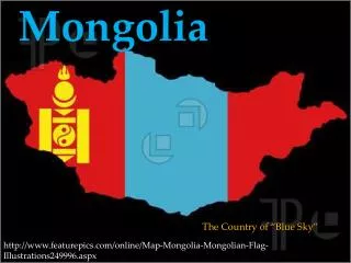
Study Area • Xilin Gol (Chinese: 锡林郭勒盟) is one of 12 prefecture level divisions of Inner Mongolia. The capital is Xilinhot. The area is 202,580 km².
GIS Data Issue • Re-Projecting GIS Layer to Uniform format with UM team. • Metadata needs to be completed • Spatial Analysis of the Layer
Any Questions? 谢谢! Merci! Danker! ありがとうございます! c ba c ba! 감사합니다! Gracias ! Grazie! Xining Yang : xyang5@emich.edu