Download
1 / 20
200 likes | 319 Vues
This document outlines the operations of the READI system, developed by Central Washington University, for real-time GPS monitoring of the Cascadia subduction zone. The system delivers Level-0 to Level-2 data products that facilitate seismic and tsunami analysis following major earthquakes like the Tohoku event. The READI data comprises phase and range data, position time series, and seismic source estimates integrated into monitoring systems. This initiative supports rapid response and analysis of seismic events, leveraging advanced algorithms and telemetry sources to improve earthquake preparedness.

E N D
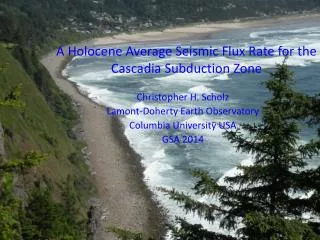
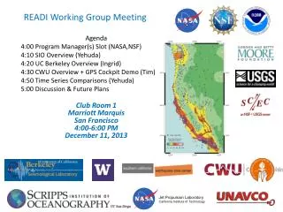
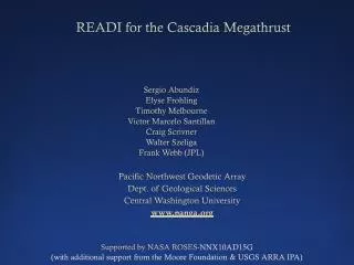
READI for the CascadiaMegathrust Sergio Abundiz Elyse Frohling Timothy Melbourne Victor Marcelo Santillan Craig Scrivner Walter Szeliga Frank Webb (JPL) Pacific Northwest Geodetic Array Dept. of Geological Sciences Central Washington University www.panga.org Supported by NASA ROSES-NNX10AD15G (with additional support from the Moore Foundation & USGS ARRA IPA)
1000 Japanese rtGPS 470 CascadiartGPS
GPS can rapidly constrain moment +60s: Mw 8.47 +120s: Mw 9.04 +90s: Mw 8.80
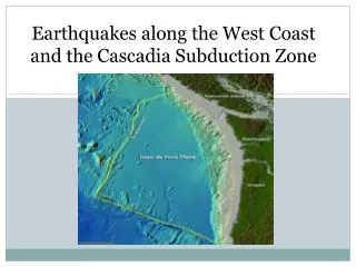
Tohoku in Cascadia No stable reference station in a 2-state radius! USGS, M9, 30m max slip
READI Data Products • Level-0: Phase and range data delivered in real-time • Level-1: Point-position + cov time series delivered in real-time (also tropospheric PWV and ionospheric TEC) • Level-2: Seismic source estimates delivered in real-time • Level-3: rtGPS-derived products and positions integrated into seismic and other monitoring systems
CWU’s READI System Telemetry hub + archive for all 470 PANGA + PBO sites (Level-0 data product) Real-time PPP system (Level-1) Seismic + tsunami analysis code (Level-2) Database to receive and distribute position time series and derived Level 2 data products GUI to interface with the Level 1 & 2 data (GPS Cockpit)
PPP with RTSE & GIPSY 6.2 • Real-time Stream Editor precleans phase & range data • Uses geometry-free linear combination to flag and fix slips & biases • Takes into account different weighting for different observations • Stable, lightweight 5-state Kalman filter processing per satellite • Facilitates parallel processing • Fast convergence and re-convergences < 1 min at 1 Hz • Provides ionospheric delay as a byproduct • Physical models (tides, ocean loading, phase windup, relativistic effects ) are predicted and applied as corrections to Level-0 data to improve accuracy and help to reduce convergence time. • Concurrent GIPSY runs on 20-epoch arcs, last five epochs shunted into rt streams • Run-time is under 0.5 second (w/ smapper.small.e) • GIPSY’s models are excellent (truth)
RTSE post-processing results using GOA 6.1.2 P494 Sierra El Mayor Earthquake 7.1 Mw 04/04/2010
CWU’s READI System • Telemetry hub + archive for all 470 PANGA + PBO sites (Level-0 data product) • Real-time PPP system (Level-1) • Database to receive and distribute position time series and derived Level 2 data products • Seismic + tsunami analysis code (Level-2) • NIF run on positions + covs (McGuire & Segall, 2003) • ComCot used to compute tsunami hydrodynamic GFs • GUI to interface with the Level 1 & 2 data (GPS Cockpit)
Level-1 & Level-2 database & client request system • Accept rtGPS solutions from various sources, in various formats • SQL-Server based • Up to 24 hrs of data held in multiple buffers & sample rates • Level-1 & 2 products streamed on a client request basis • Uses HTTP, JSON and BSON formats to serve data to clients • Well-documented API
CWU’s READI System • Telemetry hub + archive for all 470 PANGA + PBO sites (Level-0 data product) • Real-time PPP system (Level-1) • Database to receive and distribute position time series and derived Level 2 data products • Seismic + tsunami analysis code (Level-2) • NIF run on positions + covs (McGuire & Segall, 2003) • ComCot used to compute tsunami hydrodynamic GFs • GUI to interface with the Level 1 & 2 data (GPS Cockpit)
CWU’s READI System • Telemetry hub + archive for all 470 PANGA + PBO sites (Level-0 data product) • Real-time PPP system (Level-1) • Database to receive and distribute position time series and derived Level 2 data products • Seismic + tsunami analysis code (Level-2) • NIF run on positions + covs (McGuire & Segall, 2003) • ComCot used to compute tsunami hydrodynamic GFs • GUI to interface with Level 1 & 2 data (GPS Cockpit)