Download

1 / 20
200 likes | 343 Vues
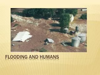
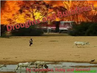
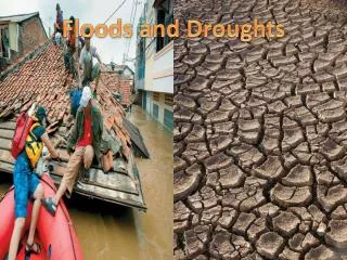
A Land of Droughts and Flooding Rains. Update from Australia . Water for a Healthy Country Flagship. David Lemon | Research Stream Leader: Water Informatics . 20 March 2012. I love a sunburnt country, A land of sweeping plains, Of ragged mountain ranges, Of droughts and flooding rains .

E N D
A Land of Droughts and Flooding Rains Update from Australia Water for a Healthy Country Flagship David Lemon| Research Stream Leader: Water Informatics 20 March 2012
I love a sunburnt country,A land of sweeping plains,Of ragged mountain ranges,Of droughts and flooding rains. • Dorothea MacKellar Update from Australia | David Lemon
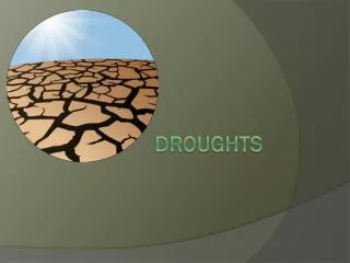
Australia’s water situation 3 Years ago Update from Australia | David Lemon
Australia’s water situation Now Update from Australia | David Lemon
Introduction to geography of Australia Desert Update from Australia | David Lemon
Introduction to geography of Australia Tropics Desert Update from Australia | David Lemon
Introduction to geography of Australia Tropics Desert Major water supply systems People Update from Australia | David Lemon
Water Information Research and Development Alliance (WIRADA) • 5 year alliance between CSIRO and Bureau of Meteorology • Has focussed on: • Water information systems • Tools for exchanging water information • Tools for achieving interoperability between systems • New spatial products for Australia • Water Resources Assessment • AWRA • Water Forecasting • Short (7 day) and Medium (3 months). Update from Australia | David Lemon
WIRADA: Water Information Systems successes • Water Data Transfer Standards • Water Data Transfer Format • Used to deliver data to Bureau • Some looking to use beyond Bureau requirements • V2 will be based on WaterML 2.0 and mandated • WaterML2.0 • Near completion • Ad-hoc tools • Use of semantic technologies to convert ad-hoc spreadsheets to WDTF • Provenance Update from Australia | David Lemon
WIRADA: Water Information Systems successes • Sustainable Water Information Models • SolidGround • Methods and Tools for creation and management of modular information models • Aimed at supporting interoperability • Australian Hydrological Geospatial Fabric (Geofabric) • Consistent underpinning spatial data products to support analysis and reporting • Built on a common conceptual model • HY_Features model Update from Australia | David Lemon
WIRADA: Water Information Systems successes • 30 DEM • SRTM data cleaning • DSM, DEM, DEM-S, DEM-H products • Products now released publically • Conflation Tools • Conflating networks from multiple sources Update from Australia | David Lemon
AWRA • Continental scale historical water balance system • Scientific workflow • Fusion of models and observation data • Makes strong use of remotely sensed observations • Designed to support two new nationally significant water information products from the Bureau of Meteorology • Comprised of model components, data streams, -pre -post processors, provenance system and orchestrated by a workflow engine (currently Delft-FEWS). Update from Australia | David Lemon
AWRA system Components • AWRA-L for landscape processes • A gridded hydrology model representing various landscape processes such as ET, groundwater and flow to river Update from Australia | David Lemon
AWRA system Components • AWRA-R for river modelling • A river reach model representing inflows, storage, groundwater, exchanges, extractions and routing. • Each reach is represented by a template model Update from Australia | David Lemon
AWRA system Components • AWRA-G for groundwater interactions • Methods for better modelling groundwater in both AWRA-L and AWRA-R Update from Australia | David Lemon
AWRA Outputs • Water storage over time in major hydrologic components • Long and shorter term trends • Large scale global water accounts • THREDDS Data Catalogue Update from Australia | David Lemon
Future, beyond WIRADA • Global water monitoring AWRA-L as a starting point • Hydrologic services using WPS • Major challenges; • Access to in situ water data • Scale versus computational load • Extensions to WPS? Update from Australia | David Lemon
WIRADA: What’s next? • One year left • Focus on transition to operations of research • No new work. Complete what we’ve done WIRADA 2? • Yes but limited (if any) informatics Update from Australia | David Lemon
National Plan for Environmental Information National Environmental Information Infrastructure • Barely funded program to ‘do for all environmental information what has been done for water’ • Will be built on using a Linked Data\SDI approach Bioregional Assessments Driven by expanding Coal Seam Gas industry Tracking provenance vital Update from Australia | David Lemon
Thank you • Land and Water/Environmental Information Systems David LemonResearch Stream Leader: Water Informatics t +61 2 2646 5724 e David.Lemon@csiro.au w www.csiro.au/clw • Water for a Healthy Country Flagship