Policy Viewer
250 likes | 282 Vues
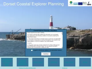
Dorset Coastal Explorer Planning. Coastal Explorer Planning - Disclaimer. Please read this information carefully. If you wish to proceed after reading this information you must signify your agreement to the following conditions of access by selecting the Agree button below.

Policy Viewer
E N D
Presentation Transcript
Dorset Coastal Explorer Planning Coastal Explorer Planning - Disclaimer Please read this information carefully. If you wish to proceed after reading this information you must signify your agreement to the following conditions of access by selecting the Agree button below. 1. The Dorset Coast Forum or Dorset County Council are not responsible for, and gives no guarantee concerning this website, the contents of any linked website or any link contained in any linked website. 2. bla bla ..... 3. Geographic data was primarily collected for the Marine Management Area (Portland Bill to Durlston Head). You are advised that data is therefore less comprehensive outside this area. I agree to the terms stated in the disclaimer above. Dorset Marine and Coastal Explorer (GIS) Consents Guidance (Flowcharts) Policy Viewer Checkout Help Centre About Feedback (including reporting errors) Contact us
Dorset Coastal Explorer Planning Dorset Marine and Coastal Explorer (GIS) Consents Guidance (Flowcharts) Policy Viewer Checkout Help Centre About Feedback (including reporting errors) Contact us
i Policy Report Legislation Level Sectors
i l Portland Harbour Marine Spatial Plan Policy 1 – Strategic Policy The aim of Portland Harbour Authority’s marine spatial plan policies is “to manage and regulate Portland Harbour effectively and efficiently in accordance with Portland Harbour Authority’s obligations under the Portland Harbour Revision Order 1997 and to continue to develop the physical assets of the harbour while protecting the natural resources for the benefit of all Portland Harbour Authority will support all marine plans, operations and policies consistent with Portland Harbour Authority’s Marine Spatial Plan Policies. http://www.portland-port.co.uk/commercial_shipping/port_estate_and_tenants/documents/CompleteMarineSpatialPlan.pdf Adopted December 2008. Weymouth and Portland Local Development Framework Areas of Archaeological Potential Where development involves land within Areas of Archaeological Potential defined on the Proposals Map, the Borough Council will require that the impacts of the proposals on the site's archaeological importance are examined and evaluated and the results presented prior to, or as part of, the planning application http://www.addresscafe.com/weymouth.aspx Effective 15th December 2008. l
Decision Process Y N The Crown Estate The Crown Estate (CE) owns all of the seabed out to the 12 nms around the UK. Rental is due for areas of seabed used for commercial purposes, including aquaculture; therefore a lease must be obtained from the Crown Estate for fish farming operations. For salmon farming the rental is calculated using a formula based on production. Seabed rentals for shellfish are formula-based, linked to the amount of equipment on site and specified in the lease (source: CE website). Application forms for leases and additional information: http://www.thecrownestate.co.uk/aquaculture_leases Aquaculture in England & Wales does not currently fall under any statutory planning regime. Apply for consent under the Coast Protection Act 1949, from the Marine Management Organisation. In addition to a lease from The Crown Estate, all fish farming operations in marine waters around England and Wales, will also require consent under Section 34 of the Coastal Protection Act 1949 from the Marine and Fisheries Agency (now the Marine Management Organisation) (source: The Crown Estate Website). http://marinemanagement.org.uk/works/licensing/cpa.htm Pre-application Those who may wish to apply for a lease from the Crown Estate are encouraged to contact the CE prior to applying to check on the availability of the location concerned. In considering an application for an aquaculture lease in England or Wales, the Crown Estate will consult with statutory authorities and representatives of other interested parties, through a public consultation (source: The Crown Estate website). Wish to apply for a lease from the Crown Estate? Complete a Lease Application Form with plans and any other information required. Submit to The Crown Estate in Edinburgh. Apply for authorization from the Fish Health Inspectorate (FHI) under the The Aquatic Animal Health (England and Wales) Regulations 2009. The Regulations require authorization of all aquaculture production businesses (APBs). All new fish and shellfish farms are required to apply for authorization before development takes place. The main purpose of the authorization is to prevent the introduction and spread of infectious diseases within the UK (source: efishbusiness.co.uk). Application forms and further information: http://www.efishbusiness.co.uk/authorisation/default.asp Require to dispose of fish waste generated on the farm? Require to import or export fish to/from the fish farm? Waste disposal Through the animal by-products regulations (EC 1774/2002), fish farmers are required to dispose of fish waste through rendering or incineration. Traditional forms of disposal such as burial are no longer considered acceptable (source: DEFRA website). http://www.defra.gov.uk/foodfarm/fisheries/farm-health/waste.htm Incineration If you operate an incinerator that only burns fish mortalities and processing waste you must ensure approval by Animal Health. http://www.defra.gov.uk/animalhealth/ If you incinerate animal waste you may need an environmental permit from your environmental regulator or council (source: NetRegs environmental guidance). http://www.netregs.gov.uk/netregs/businesses/62193.aspx Shell disposal Clean shells are classed as animal by-products, but there is an exemption that may allow them to be used as a marketable product for use in construction, drainage and gardening (source: NetRegs environmental guidance). Fish movement The Environment Agency regulates all fish and crayfish introductions and removals within inland waters in England and Wales. The Fish Health Inspectorate regulates movements between authorised fish farm sites. The Fish Health Inspectorate (FHI) authorize farms, register fisheries and control fish movements where a disease is suspected or confirmed (source: efishbusiness.co.uk). For more information, visit the Fish Health Inspectorate’s website: http://www.efishbusiness.co.uk/ Premises that handle or process fishery products and live bivalve molluscs must be approved under European Union Regulation 883/2004 (source: FSA website). http://www.food.gov.uk/ Consents Guidance (Flowcharts) Show / Hide Key
Decision Process Y N Cable lies within UKCS (200nms of UK coast)? Application should be made through the MMO under section 34 of the Coast Protection Act 1949 (CPA). Where an application is made under the CPA, the Secretary of State's powers extend to the entire length of the cable across the United Kingdom continental shelf (source: MMO website). The Crown Estate need to be informed of cables and pipelines transiting or seeking to transit waters that fall within the 200 nautical mile limit (source: CE website). Does the proposed route pass within 500m of an offshore installation within UKCS? Intend to carry out cable protection works? If the proposed cable route passes within 500m of an offshore installation, section 107 of the Telecommunications Act 1984 applies. Applications should be made through the MMO. Cable protection activities, such as rock dumping or the deposit of concrete mattresses, are likely to require a licence under the Food and Environment Protection Act 1985 unless specifically consented by a works authorisation under the Petroleum Act 1998 (source: MMO website). Cable lies within territorial waters (12nms of UK coast)? The Crown Estate’s consent is required for all telecommunication cables and oil and gas pipelines that cross the seabed within 12 nautical miles of the UK coastline (source: CE website). Application should be made under paragraph 11 of the Electronic Communications Code through the Marine Management Organisation. Cable lies within harbour limits? Seek approval of a local harbour authority (under a local harbours act). Consents Guidance (Flowcharts) Show / Hide Key
Decision Process Y N Is there an ongoing emergency requiring work to be carried out immediately? Is the project likely to affect a conservation site (NATURA 2k or SSSI)? Before carrying out any operation likely to damage a SSSI, the authority must give written notice to Natural England. The necessary assents should be gained before seeking grant for any operation likely to damage a SSSI. Likewise, any plan or project likely to have a significant effect on a European site (SPA or SAC) or a Ramsar site must be subject to an Appropriate Assessment under the Conservation (Natural habitats &c.) Regulations, 1994. Consult Natural England in both cases. Where any delay would put lives or assets at unacceptable risk, urgent works can begin without prior approval. However, the EA and other statutory consultees must be informed of this. Preliminary study should be completed according to EA’s guidance. A preliminary study is used to create a strategy, investigate options for schemes of works, or investigate the environmental impacts of FCERM on an area of statutory environmental designation. Preliminary studies can be approved for grant as separate entities (source: EA FCERM guidance). Project anticipated to require extensive investment to continue for more than 5 years or involve long lengths of coastline? Preliminary study should be prepared with a strategy, complete with a Strategic Environmental Assessment (SEA) report, for approval by the Environment Agency. Consult EA. Carry out EIA An Environmental Assessment (EIA) is required for any flood management, land drainage or coast protection scheme that is likely to have a significant effect on the environment. Is the project eligible for a grant from the Environment Agency? Project whole life costs exceed delegated threshold (currently £100mil)? Approval by HM Treasury (alongside DEFRA approval) at the outline business case and full business case stages required. Local Authorities can seek funding from the Environment Agency under the Coastal Protection Act, 1949 (for coastal defences), or Water Resources Act 1991 (WRA) and the Land Drainage Act 1991 (LDA) (for flood defences). If unsure of eligibility consult relevant Grant Memorandum published by the EA. Can be found here: http://www.environment-agency.gov.uk/research/planning/33700.aspx Submit the results of initial investigations and the drafting of specifications for preliminary studies to the Environment Agency (using form FRM 7). Approval is needed before a (further) study is commenced. Local authorities can look for contributions from private, public or voluntary organisations or communities who will benefit the most from the work under the Environment Agency’s Flood and Coastal Erosion Risk Management External Contributions Policy. Public consultation Formal and informal consultation should be undertaken during the appraisal process. As part of the consultation process, the potential benefits and the beneficiaries should be clearly identified. The basis for flood and coastal erosion risk management decisions should be made available in the public realm, wherever possible (source: Appraisal of FCERM, DEFRA). Authorities should also ensure that all necessary consultations with the relevant area offices of the Environment Agency, Natural England, other environmental bodies, and adjoining operating authorities and planning authorities are undertaken. Submit PAR (Project Appraisal Report) to the Environment Agency. Approvals for consent to projects of the CPA (Coastal Protection Act 1949) will normally be considered in parallel with grant applications for formal approval. HM Treasury provides the funding for FCERM. This means that all projects to be funded from public money have to include a project appraisal in line with the requirements of the Treasury Green Book (HM Treasury, 2003). The appraisal is intended to identify the most cost beneficial solution to the problem and the justification for the most appropriate and preferred option (source: FCERM-AG). Consent to works under the (CPA) Act will continue to be available to authorities who choose to undertake coastal works without the support of grant. In that case authorities must submit a PAR appropriate to the value and scope of the scheme for appraisal of technical and environmental issues. In addition benefits must be shown to remain in excess of costs and best value must be used to justify option selection (source: EA FCERM guidance). Attain a FEPA licence from the MMO. The proposal at this state should be sufficiently advanced to allow the MMO to provide indicative advice to the applicant of the principal conditions which they can expect to apply to the FEPA licence (source: MMO website). Work can commence once the formal approval letter from the Environment Agency with an approved sum has been granted (not required in emergencies). Post project evaluation Defra and the Environment Agency wish to select some grant eligible projects for Post Project Evaluation (PPE). Form FRM 8 will assist both Defra and the Environment Agency in choosing completed schemes for PPE commissions. Authorities must make relevant information (including any obtained from monitoring or maintenance purposes) freely available to Defra, the Environment Agency or their authorised consultants (source: EA guidance). Consents Guidance (Flowcharts) Show / Hide Key
nms - Nautical Miles SFC – Southern Fisheries Committee MHW Anywhere At sea MLW 3 nms ~200 nms 6 nms 12 nms Harbour Limit ‘Controlled waters’ SFC Limit ‘UK water’ (Continental shelf limit) Policies All @ nms - Nautical Miles SFC – Southern Fisheries Committee
nms - Nautical Miles SFC – Southern Fisheries Committee MHW Anywhere At sea MLW 3 nms ~200 nms 6 nms 12 nms Harbour Limit ‘Controlled waters’ SFC Limit ‘UK water’ (Continental shelf limit) Policies All @ Nms Nautical Miles SFC – Southern Fisheries Committee United Nations Convention on the Law of the Sea (UNCLOS) This establishes a framework for the exercise of various sovereign rights by coastal states, enabling exploitation of minerals and living resources within territorial seas, extending up to 12nm from agreed national baselines. UNCLOS provides an overarching framework for the marine environment. It sets national jurisdictions and establishes rights of navigation and the legal regime of the high sea. It provides the legal basis for the protection and sustainable development of the marine environment and addresses environmental control, scientific research economic activities and the settlement of disputes. UNCLOS introduced the concept of Exclusive Economic Zones (EEZ). UNCLOS covers virtually all uses of the sea including navigation and over-flight, resource exploration and exploitation, conservation and pollution fishing and shipping. http://www.un.org/Depts/los/convention_agreements/convention_overview_convention.htm
Help Centre Dorset Marine and Coastal Explorer (GIS) Lorem ipsum dolor sit amet, consectetur adipisicing elit, sed do eiusmod tempor incididunt ut labore et dolore magna aliqua. Ut enim ad minim veniam, quis nostrud exercitation ullamco laboris nisi ut aliquip ex ea commodo consequat. Duis aute irure dolor in reprehenderit in voluptate velit esse cillum dolore eu fugiat nulla pariatur.. Consents Guidance (Flowcharts) Lorem ipsum dolor sit amet, consectetur adipisicing elit, sed do eiusmod tempor incididunt ut labore et dolore magna aliqua. Ut enim ad minim veniam, quis nostrud exercitation ullamco laboris nisi ut aliquip ex ea commodo consequat. Duis aute irure dolor in reprehenderit in voluptate velit esse cillum dolore eu fugiat nulla pariatur. Policy Viewer Lorem ipsum dolor sit amet, consectetur adipisicing elit, sed do eiusmod tempor incididunt ut labore et dolore magna aliqua. Ut enim ad minim veniam, quis nostrud exercitation ullamco laboris nisi ut aliquip ex ea commodo consequat. Duis aute irure dolor in reprehenderit in voluptate velit esse cillum dolore eu fugiat nulla pariatur. Checkout Lorem ipsum dolor sit amet, consectetur adipisicing elit, sed do eiusmod tempor incididunt ut labore et dolore magna aliqua. Ut enim ad minim veniam, quis nostrud exercitation ullamco laboris nisi ut aliquip ex ea commodo consequat. Duis aute irure dolor in reprehenderit in voluptate velit esse cillum dolore eu fugiat nulla pariatur.
About Dorset Coastal Explorer Planning Q Who will use it? A Planning professionals, developers, consultants, statutory/non-statutory consultees, academics etc. Q What will they use it for? A To support decision-making and planning in the marine and coastal zones. Q Who is providing the system? A The Dorset Coast Forum, a strategic coastal partnership. Q Why is the system being provided? A It is one deliverable of the C-SCoPE project (Combining Sea and Coastal Planning in Europe), a three year project, part funded by the European Union Interreg IV A ‘2 seas programme’.
nms - Nautical Miles SFC – Southern Fisheries Committee Checkout Report title: Report compiled by: Compilation Date: Basket Dorset Coast Forum Policies International Remove from basket European National Regional and Local Remove from basket Portland Harbour Marine Spatial Plan - Policy 1 – Strategic Policy Flowcharts Remove from basket
nms - Nautical Miles SFC – Southern Fisheries Committee Checkout Report title: Report compiled by: Compilation Date: Basket Dorset Coast Forum Policies International Remove from basket European National Regional and Local Remove from basket Portland Harbour Marine Spatial Plan - Policy 1 – Strategic Policy Flowcharts Remove from basket
nms - Nautical Miles SFC – Southern Fisheries Committee Checkout Report title: Report compiled by: Compilation Date: Basket Dorset Coast Forum Policies International Remove from basket European National Regional and Local Remove from basket Portland Harbour Marine Spatial Plan - Policy 1 – Strategic Policy Flowcharts Remove from basket