Download
1 / 15
150 likes | 272 Vues
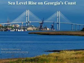
Sea Level Rise on Georgia’s Coast. Georgia Conservancy www.georgiaconservancy.org. Georgia’s Coast. Thr ough a combination of history, economics and legislation, Georgia has the longest unbroken stretch of wild Atlantic beachfront and marsh on the

E N D
Sea Level Rise on Georgia’s Coast Georgia Conservancy www.georgiaconservancy.org
Georgia’s Coast Through a combination of history, economics and legislation, Georgia has the longest unbroken stretch of wild Atlantic beachfront and marsh on the Eastern Seaboard. These exceptional natural features provide for an overwhelming amount of biodiversity and attract birders, anglers and boaters from all over.
The elevation of our coastline is low. For example, Brunswick is 10 to 14 feet above sea level. Our coastline is also characterized by a gradual slope.This means that whereas steeper coastlines may see more erosion from a rise in sea level… Our coastline would see more saltwater intruding into tidal areas and dry land.
Planning for Sea Level Rise in Coastal Georgia NOAA has measured an approx. 3mm annual rise in sea level at Ft. Pulaski since 1935, and this rate is expected to increase exponentially this century. The UGA River Basin Center embarked on a 3-year study to model the effects that sea level rise would have on coastal Georgia and provide guidance in how best to mitigate its impacts.
Findings Year 1 of the study focuses on the Georgia coast as a whole, defined by the six counties of Chatham, Bryan, Liberty, McIntosh, Glynn and Camden. Using the Sea Level Affecting Marshes Model (SLAMM), the River Basin Center modeled the effects that a 1m rise in sea level over the next 100 years would have on the coast.
Coastal land cover is expected to change significantly. The model predicts a loss of 290 square miles of undeveloped dryland — an 8% decrease. In contrast, the amount of open water is predicted to increase by 11%, or approximately 381 square miles. Land Cover 2006 Land Cover 2100 *Orange = Undeveloped Dryland *Blue = Open Water
The River Basin Center also studies how specific coastal areas could be affected by sea level rise. This map shows Tybee Island following a 1-meter rise in sea level.Areas in light blue represent currently dry land that is predicted to be covered with water by 2100.
Year 2 of the study took a closer look at Glynn County, home of the city of Brunswick and St. Simon’s Island. The map below shows Brunswick in 2006. Areas in light blue represent tidal wetlands, and areas in dark blue represent open water.
St. Simon’s Island and Sea Island in 2100 following a 1-meter sea level rise.
Potential Impacts As the amount of dry land on the coast decreases, developments directly on the coastline will be affected. The model cannot demonstrate with certainty if specific houses and business will be affected. The model does demonstrate that critical facilities such as hospitals, schools, roads and causeways could be impacted.
The River Basin Center is currently developing a guidance document that will assist government officials in planning for future developments along the Georgia coastline.
If you want to learn more about the study, please visit www.rivercenter.uga.edu/research/climate/slr_1.htm
Partners The sea level rise study is a 3-year project (2008-2011) conducted by the University of Georgia’s River Basin Center and funded through Coastal Incentive Grants provided by Georgia’s Coastal Management Program’s CZM Awards from the National Oceanic and Atmospheric Administration. The NOAA grant is administered by the state Department of Natural Resources Coastal Resources Division. This report was prepared by UGA River Basin Center under grant awards # NA10NOS4190211, #NA09NOS4190171 and #NA08NOS4190461 to the Department of Natural Resources from the Office of Ocean and Coastal Resource Management, National Oceanic and Atmospheric Administration.