Download
1 / 50
500 likes | 658 Vues
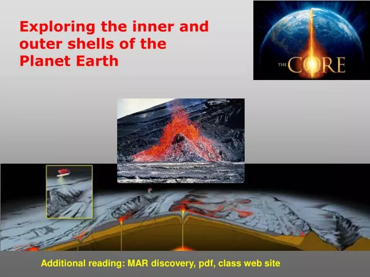
Exploring the inner and outer shells of the Planet Earth. Additional reading: MAR discovery, pdf, class web site. Learning Objectives: Earth structure, Plate tectonics and Ocean floor. Difference between oceanic and continental crust.

E N D
Exploring the inner and outer shells of the Planet Earth Additional reading: MAR discovery, pdf, class web site
Learning Objectives: Earth structure, Plate tectonics and Ocean floor Difference between oceanic and continental crust. Understand the processes that are continuously changing Earth’s surface as lithospheric plates move relative to one another. Identify the role of oceanic ridges, transform faults and deep-sea trenches in defining the edges of lithospheric plates. Understand the importance of asthenospheric thermal convection in plate tectonics and the resulting compression or tensional forces at the plate boundaries. Explain the distribution of magnetic anomaly stripes, seismicity, and volcanism in terms of the concept of global plate tectonics. Spreading rates of ocean basins.
Age of Ocean Crust http://www.ngdc.noaa.gov/mgg/geology/geology.html
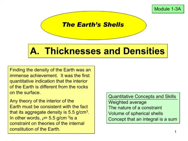
Earth’s Structure • Layered system (like an onion, concentric regions) • differentiation of mineral material
Earth’s Structure (cont’d.) Classification according to chemical composition • 4 concentric regions of • mineral material: • crust • mantle • outer core - molten • inner core - solid
Earth’s Structure (cont’d.) Classification according to chemical composition • Crust • Two types: • continentalggranite – composed of • silicates rich in Na, K & Al • oceangbasalt – composed of • silicates rich in Ca, Mg & Fe • represents 0.4% of Earth’s mass • extends down to 75 km
Earth’s Structure (cont’d.) Classification according to chemical composition • Mantle • Three parts: • uppermost/middle/innermost • Composed of Mg-Fe silicates • represents 68% of Earth’s mass • extends down from base of crust to ~2,900 km • Between the Crust and Mantle is the MOHO layer
Earth’s Structure (cont’d.) Classification according to chemical composition • Core • Two parts: • Outer • Inner • Composed of Fe & Ni • Represents 28% of Earth’s mass • Extends down from base of • mantle ~ 6400km
Earth’s Structure (cont’d.) Classification according to physical properties (factor in temperature and pressure) 4 concentric regions: • lithosphere - rigid outer shell (crust & uppermost mantle) • 100 - 150km thick • does not change shape
Earth’s Structure (cont’d.) • Asthenosphere - soft, flows over geologic time under the weight of the lithosphere (small fraction of middle mantle) • lithosphere ‘floats on top’ • zone where magma formed • 200 – 350km thick • easily deformed, can be pushed down by overlying lithosphere – “plastic” – tar or asphalt
Earth’s Structure (cont’d.) Classification according to physical properties • Mesosphere - rigid but not as hard as lithosphere • higher temp than asthenosphere, but not molten because of compression pressure • 4950km thick
Earth’s Structure (cont’d.) Classification according to physical properties • Core - outer is molten, inner is solid
Earth consists of a series of concentric layers or spheres which differ in chemistry and physical properties. Chemical Layers Physical Layers
Physical state is determined by the combined effects of pressure and temperature. • Increasing pressure raises the melting point of a material. • Increasing temperature provides additional energy to the atoms and molecules of matter allowing them to move farther apart, eventually causing the material to melt. • Both pressure and temperature increase toward the center of the Earth, but at variable rates.
How do we learn about the inner structure of the planet? Seismic waves
Seismology is the study of elastic waves that travel through the earth Two main wave types: Compression waves (P-waves): travel by squeezing and expanding medium they travel through. They can travel through both solids and liquids (e.g., sound waves); • Shear waves (S-waves): travel by shearing medium they pass through. S-waves can travel only through solids since particles need to be bonded to each other to propagate wave;
Earthquake are an incredible source of seismic waves Seismic waves travel along the quickest route, generally through the planetary interior to the seismic stations, changing speed every time material properties change.
Combining information from many seismic waves we can get a detailed internal structure of the earth. Seismic Velocity and Density Reconstructing the internal structure of the planet solid • Crust & upper mantle: large increases in seismic velocities and density solid, more dense • Mantle: Gradual velocity and density increase Liquid Iron • Outer core: dramatic density increase and no S-waves • Inner core: Jump in density and P-wave velocity, S-waves return solid Iron Other planets?
Earthquakes produce waves in the ocean Sea level: RISE FALL Courtesy: K. Satake, unpublished
World Seismicity (1898-2003) Mw ≥6.0 Mw ≥ 7.7 Many large earthquakes occur along subduction zones Most “Great” earthquakes are subduction mega-thrust events
The Physiography of the North Atlantic Ocean Floor continental margins deep ocean basins midoceanic ridges
the Pacific Ring of Fire IS 40,000 km long chain of volcanoes caused by "convergent tectonic plates" coming together;
Mid Atlantic Ridge – new findings: • http://www.noc.soton.ac.uk/gg/classroom@sea/JC007/about.html • http://www.sciencedaily.com/releases/2007/03/070301103112.htm http://www.noc.soton.ac.uk/gg/classroom@sea/JC007/background.html
MAR discovery - http://alpha.es.umb.edu/faculty/af/intro_ocean.htm#Unit1
Continental margins are the submerged edges of the continents and consist of massive wedges of sediment eroded from the land and deposited along the continental edge. The Continental Margin can be divided into three parts: the Continental shelf, the Continental slope, and the Continental rise. Passive Continental Margin
Midoceanic Ridge Province consists of a continuous submarine mountain range that covers about one third of the ocean floor and extends for about 60,000 km around the Earth. Midocean Ridge
Deep Ocean Basin is between the continental margins and the midoceanic ridge and includes a variety of features from mountainous to flat plains: Abyssal plains, Abyssal hills, Seamounts, and Deep sea trenches. Deep Ocean Basin
This three-dimensional rendition of a bathymetric map shows Patton Seamount, a Gulf of Alaska seamount we visited in 1999, with two smaller seamounts in the foreground. Deep areas are blue, and shallow areas are red.
Continents and ocean basins differ in composition, elevation and physiographic features. Geologic Differences between Continents and Ocean Basins 2-3 • Elevation of Earth’s surface displays a bimodal distribution with about 29% above sea level and much of the remainder at a depth of 4 to 5 kilometers below sea level. • Continental crust is mainly composed of granite, a light colored, lower density, igneous rock rich in aluminum, silicon and oxygen. • Oceanic crust is composed of basalt, a dark colored, higher density, volcanic rock rich in silicon, oxygen and magnesium.
WHY DO LAND AND OCEAN EXIST? OCEANIC CRUST = THIN AND DENSER CONTINENTAL CRUST = THICK AND LEIGTHER
Continents are thick (30 to 40 km), have low density and rise high above the supporting mantle rocks. • Sea floor is thin (4 to 10 km), has greater density and does not rise as high above the mantle. Oceanic Crust Versus Continental Crust
MOHO The Mohorovicic Discontinuity marks the lower limit of Earth's crust. As stated above it occurs at an average depth of about 8 kilometers beneath the ocean basins and 32 kilometers beneath continental surfaces. Mohorovičić was able to use his discovery to study thickness variations of the crust. The deepest well that has been drilled to date was located on the Kola Peninsula of the Soviet Union. It was drilled to a depth of about 12 kilometers. Drilling to the Moho through oceanic crust has still been unsuccessful. http://geology.com/articles/mohorovicic-discontinuity.shtml http://www.livescience.com/environment/041119_earth_layers.html
Isostacy Principle that dictates how different parts of the lithosphere stand in relation to each other in the vertical direction • Continental crust less dense (granitic) therefore rises higher relative to ocean crust (basaltic) • Continents move up and down depending on weight on top (i.e. from glaciers - ‘isostatic rebound’) • Continents pop up after glaciers melt • Canada and Scandinavia rising at a rate of 1m/100yrs because the glaciers are receding
Isostasy refers to the balance of an object “floating” upon a fluid medium. Height of the mass above and below the surface of the medium is controlled by the thickness of the mass and its density (similar to ice floating in water). http://atlas.geo.cornell.edu/education/student/isostasy.html http://woodshole.er.usgs.gov/operations/modeling/movies/fli/stellrise.flc
altimetry Satellites in orbit around the planet use radar altimetry to measure the height of the sea level (accuracy of 2 cm). http://www.ecco-group.org/animations_iter21/TP_ps21.mpeg
Model of the shape of the Earth geoid: The equipotential surface of the Earth's gravity field which best fits, in a least squares sense, global mean sea level (MSL) http://www.esri.com/news/arcuser/0703/geoid1of3.html
Ocean Circulation and Climate Deep ocean mixing and pathways
Social impacts: Tsunami
Social impacts: Gas and oil extraction