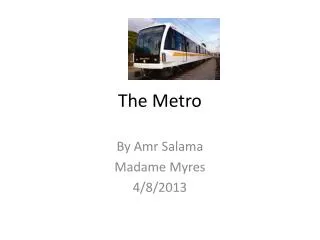
METRO PADYAKAN
140 likes | 164 Vues
Addressing traffic congestion in Metro Manila by creating pedestrian and bike-friendly walkways to improve mobility, reduce environmental impact, and foster economic opportunities.

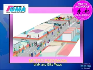
METRO PADYAKAN
E N D
Presentation Transcript
METRO PADYAKAN Walk and Bike Ways Go to Home Page
Project Description Go to Home Page The Problem • Traffic congestion and environmental degradation in Metro Manila due to wide use of motorized transport • Increase in number of illegal settlers - many of whom are among urban workers from out of town – caused by high transportation costs
Project Description • The Concept • Allocation of dedicated secondary roads that interconnect the 17 cities and towns of Metro Manila for the exclusive use of pedestrians and bicycle riders Go to Home Page
Go to Home Page Proposed Network
Project Objectives • To provide a safe thoroughfare where low-cost and environment-friendly means of non-motorized transportation for commuters and pedestrians • To open up economic opportunities along the route of the Walk and Bike ways. Go to Home Page
Project Components Go to Home Page • Identification of the road network for the walk and bike way • Coordination and consultation with stakeholders • Public information campaign • Project implementation • Monitoring and evaluation • Road surface improvements • Road markings • Signage
1.75 1.75 PEDALWAY WALKWAY Go to Home Page Typical Section Of Walk And Bike Way, Exclusive
Typical Section Of Walk And Bike Way Go to Home Page One-Side, Two-Directional Bike Way
Typical Section Of Walk And Bike Way Go to Home Page Road shared w/ motorists, 1-direction per side
Provision of traffic signals and lane markings at major intersections Typical Walk and Bike Way Plan at Intersecting Main Roads Go to Home Page
Immediate Impact • Improved mobility • Cheaper travel • Safe mobility for pedestrians and bikers • Economic benefits • Encourage people to walk and bike • Reduced motorized vehicle use Go to Home Page
Typical 2-lane road, 8 meters wide • Intersecting main road (60 meters) PhP 0.149 M • Main walk and bike way PhP 1.440 M/km • Approx. 500 intersections x 0 .149 M = PhP 74.50 M • Approx. 200-km network x 1.44 M = 288.00 M • TOTAL PROJECT COST PhP 362.50 M • ≈ • PhP 365.00 M PhP 365.00 M Project Cost Go to Home Page
Timeframe Go to Home Page
Katipunan Ave Xavierville Ave K-6th Aurora Boulevard EDSA From Katipunan to EDSA via Xavierville Avenue – Chico St – Langka St. – K-6th - Salgado St. - Kamias Go to Home Page