Download
1 / 34
340 likes | 504 Vues
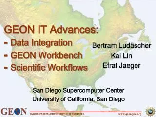
GEON IT Advances: ⁃ Data Integration ⁃ GEON Workbench ⁃ Scientific Workflows. Bertram Lud ä scher Kai Lin Efrat Jaeger. San Diego Supercomputer Center University of California, San Diego. The Problem: Scientific Data Integration or: … from Questions to Queries ….

E N D
GEON IT Advances:⁃ Data Integration⁃ GEON Workbench⁃ Scientific Workflows Bertram Ludäscher Kai Lin Efrat Jaeger San Diego Supercomputer Center University of California, San Diego www.geongrid.org
The Problem: Scientific Data Integrationor: … from Questions to Queries … www.geongrid.org
Information Integration Challenges: S4 Heterogeneities • Systems Integration • platforms, devices, data & service distribution, APIs, protocols, … Grid middleware technologies + e.g. single sign-on, platform independence, transparent use of remote resources, … • Syntax & Structure • heterogeneous data formats (one for each tool ...) • heterogeneous data models (RDBs, ORDBs, OODBs, XMLDBs, flat files, …) • heterogeneous schemas(one for each DB ...) Database mediation technologies + XML-based data exchange, integrated views, transparent query rewriting, … • Semantics • fuzzy metadata, terminology, “hidden” semantics, implicit assumptions, … Knowledge representation & semantic mediation technologies + “smart” data discovery & integration + e.g. ask about X (‘mafic’); find data about Y (‘diorite’); be happy anyways! www.geongrid.org
Information Integration Challenges: S5 Heterogeneities • Synthesis of analysis pipelines, integrated apps & data products, … • How to make use of these wonderful things & put them together to solve a scientist’s problem? • Scientific Problem Solving Environments • GEON Portal and Workbench (“scientist’s view”) + ontology-enhanced data registration, discovery, manipulation + creation and registration of new data products from existing ones, … • GEON Scientific Workflow System (“engineer’s view”) + for designing, re-engineering, deploying analysis pipelines and scientific workflows + e.g., creation of new datasets from existing ones, dataset registration,… www.geongrid.org
domain knowledge Knowledge representation AGE ONTOLOGY Show formations where AGE = ‘Paleozic’ (without age ontology) Show formations where AGE = ‘Paleozic’ (with age ontology) Nevada +/- a few hundred million years Ontology-Enabled Application Example:Geologic Map Integration www.geongrid.org
Querying by Geologic Age … www.geongrid.org
Querying by Geologic Age: Result www.geongrid.org
Querying by Chemical Composition … (GSC) www.geongrid.org
Querying by Chemical Composition: Results www.geongrid.org
Querying w/ British Rock Classification (BRC) Uses a GSC BRC inter-ontology articulation mapping www.geongrid.org
British Rock Classification Query: Results Uses a GSC BRC inter-ontology articulation mapping www.geongrid.org
DataTables GeoChemDB GeolAgeDB Need for Knowledge-enabled Integration • A geologist analyzing chemical data from a pluton finds no recognizable correlation between variables. • What possible scenarios can he examine to understand this heterogeneity? • Measured ages also show a scatter • What is the significance of the observed spread in measure time? • Knowledge Representation Research: • concept maps & ontologies • process maps & ontologies • semantic types • … to facilitate (even) “smarter” tools www.geongrid.org
A Prerequisite: Resource Registration (1a) Register ontologies • geologic age; rock classifications (GSC, BGS), seismology; … (1b) optionally: register inter-ontology articulations • e.g. GSC ontology BGS ontology (2a) Item-level dataset registration • ADN metadata; other controlled vocabularies & ontologies (e.g. geologic age timescale (USGS), SWEET (NASA), …) (2b) Item-detail registration • e.g. associate values in a column with a concept (3) Use ontology-based query UI / application • e.g. query by geologic age and chemical composition www.geongrid.org
Demonstration Preview NOTE: A technology demonstration, not a content demonstration (vocabulary, ontology, maps, …) • Ontology Registration (geologicAge.owl) • Dataset Registration (myShapeFiles.zip) • Item-Level Association (12) • GEONsearch • metadata, spatial, temporal, concept-based • GEONworkbench • use of workspace e.g. composing new maps from existing ones … resume with GEON workflow overview www.geongrid.org
Other distributed apps Kepler, DLESE, … Client Access (via web services) myOntology.owl myDataset.foo Search condition(s) spatialtemporalconcept User actions add delete manipulate metadata metadata ResourceRegistration GEONsearch GEONworkbench GEON Workspace (user) GEON Catalog SRB Log GEONmiddleware external services Gazetteer, DLESE, … Geologic Age, Chronos, … Demonstration Preview User Access (via Portal) www.geongrid.org
Domain Knowledge Ontologies Arizona www.geongrid.org CYBERINFRASTRUCTURE FOR THE GEOSCIENCES 16 Dataset to Ontology Registration (Item-level) www.geongrid.org
GEON Search: Concept-based Querying Portal Demonstration www.geongrid.org
Scientific Problem Solving Environments • GEON Portal and Workbench (“scientist’s view”) previousdemonstration • Kepler Workflow System (“engineer’s view”) • for (semi-)automating “scientific workflows” and “analysis pipelines” • some features: • … low-level plumbing to high-level conceptual flows … • connect reusable components (“actors”, “boxes”) to form apps • abstraction via nesting of subworkflows into composite actors • deploy automated workflows on the Grid and/or with custom Uis • demonstrations available (“Kepler2Go-1.” CD for Summer Institute) www.geongrid.org
www.geongrid.org CYBERINFRASTRUCTURE FOR THE GEOSCIENCES 19 A Kepler Scientific Workflow inline comments canvas for design and execution monitoring component (actor) libraries www.geongrid.org
Translating query xml response to web service xml input format. worldImage XML SOAP response Look Inside Sample GEON Dataset Extraction & Processing www.geongrid.org
Annotation form www.geongrid.org CYBERINFRASTRUCTURE FOR THE GEOSCIENCES 21 GEON Dataset Registration www.geongrid.org
ADN metadata Metadata display validation www.geongrid.org CYBERINFRASTRUCTURE FOR THE GEOSCIENCES 22 GEON Dataset Registration Registering www.geongrid.org
www.geongrid.org CYBERINFRASTRUCTURE FOR THE GEOSCIENCES 23 Putting it all together … www.geongrid.org
HPC workflow www.geongrid.org CYBERINFRASTRUCTURE FOR THE GEOSCIENCES 24 GEON Workflows & KEPLER http://kepler-project.org (next week) http://kepler.ecoinformatics.org (now) www.geongrid.org
E N D GEON IT Advances:⁃ Data Integration⁃ GEON Workbench⁃ Scientific Workflows Bertram Ludäscher Kai Lin Efrat Jaeger San Diego Supercomputer Center UC San Diego www.geongrid.org
Related Publications • Semantic Data Registration and Integration • On Integrating Scientific Resources through Semantic Registration, S. Bowers, K. Lin, and B. Ludäscher, 16th International Conference on Scientific and Statistical Database Management (SSDBM'04), 21-23 June 2004, Santorini Island, Greece. • A System for Semantic Integration of Geologic Maps via Ontologies, K. Lin and B. Ludäscher. In Semantic Web Technologies for Searching and Retrieving Scientific Data (SCISW), Sanibel Island, Florida, 2003. • Towards a Generic Framework for Semantic Registration of Scientific Data, S. Bowers and B. Ludäscher. In Semantic Web Technologies for Searching and Retrieving Scientific Data (SCISW), Sanibel Island, Florida, 2003. • The Role of XML in Mediated Data Integration Systems with Examples from Geological (Map) Data Interoperability, B. Brodaric, B. Ludäscher, and K. Lin. In Geological Society of America (GSA) Annual Meeting, volume 35(6), November 2003. • Semantic Mediation Services in Geologic Data Integration: A Case Study from the GEON Grid, K. Lin, B. Ludäscher, B. Brodaric, D. Seber, C. Baru, and K. A. Sinha. In Geological Society of America (GSA) Annual Meeting, volume 35(6), November 2003. • Query Planning and Rewriting • Processing First-Order Queries under Limited Access Patterns, Alan Nash and B. Ludäscher, Proc. 23rd ACM Symposium on Principles of Database Systems (PODS'04) Paris, France, June 2004. • Processing Unions of Conjunctive Queries with Negation under Limited Access Patterns, Alan Nash and B. Ludäscher., 9th Intl. Conference on Extending Database Technology (EDBT'04) Heraklion, Crete, Greece, March 2004, LNCS 2992. • Web Service Composition Through Declarative Queries: The Case of Conjunctive Queries with Union and Negation, B. Ludäscher and Alan Nash. Research abstract (poster), 20th Intl. Conference on Data Engineering (ICDE'04) Boston, IEEE Computer Society, April 2004. www.geongrid.org
Related Publications • Scientific Workflows • Kepler: An Extensible System for Design and Execution of Scientific Workflows, I. Altintas, C. Berkley, E. Jaeger, M. Jones, B. Ludäscher, S. Mock, 16th International Conference on Scientific and Statistical Database Management (SSDBM'04), 21-23 June 2004, Santorini Island, Greece. • Kepler: Towards a Grid-Enabled System for Scientific Workflows, Ilkay Altintas, Chad Berkley, Efrat Jaeger, Matthew Jones, Bertram Ludäscher, Steve Mock, Workflow in Grid Systems (GGF10), Berlin, March 9th, 2004. • An Ontology-Driven Framework for Data Transformation in Scientific Workflows, S. Bowers and B. Ludäscher, Intl. Workshop on Data Integration in the Life Sciences (DILS'04), March 25-26, 2004 Leipzig, Germany, LNCS 2994. • A Web Service Composition and Deployment Framework for Scientific Workflows, I. Altintas, E. Jaeger, K. Lin, B. Ludaescher, A. Memon, In the 2nd Intl. Conference on Web Services (ICWS), San Diego, California, July 2004. www.geongrid.org
Additional Material (for questions etc) www.geongrid.org
Multi-Hierarchical Rock Classification System (GSC)… a target ontology (after conversion to OWL) for geologic map registration … Genesis Fabric Composition Texture www.geongrid.org
Inside Ontology-Enabled Map Integration User: “Show formations from Cenozoic!” Age Ontology Cenozoic Query Rewriting Quaternary Tertiary select FORMATION where AGE=“Tertiary” or AGE=“Quaternary” PERIOD FORMATION PERIOD LITHOLOGY ABBREV Arizona Montana West Map Rendering Color Definition www.geongrid.org
Data Source Wrapping and Integration ABBREV Arizona PERIOD FORMATION AGE Idaho NAME Colorado PERIOD LITHOLOGY Utah TYPE PERIOD Nevada FMATN TIME_UNIT Wyoming NAME Livingston formation FORMATION PERIOD Tertiary-Cretaceous Montana West AGE New Mexico NAME PERIOD LITHOLOGY andesitic sandstone Montana East FORMATION PERIOD www.geongrid.org
Gravity Modeling Design Workflow • Idea: Comparing observed & synthetic gravity models • Steps: • Extracting and merging gravity depths from heterogeneous data sources for a Lat/Lon bounding box (databases, web services). • Projecting and interpolating data sources into the same coordinate systems. • Differencing observed and synthetic models. • Displaying Differential raster image. www.geongrid.org
Grid Interpolation • Interpolating queried gravity data on the grid and displaying it using a color schema. • Currently IDW interpolation algorithm supported. Future plans: Minimum Curvature, TIN, Kriging and Spline. • Output: either ascii x,y,z,p or ESRI ascii grid format. • Display: using global mapper service. www.geongrid.org
Gravity Modeling Design Workflow www.geongrid.org