Download

1 / 20
220 likes | 546 Vues
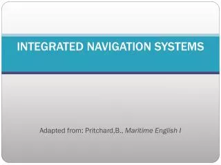
Integrated navigation systems for inland navigation – beyond chart and radar. Dr.- Ing . Martin Sandler in – innovative navigation GmbH Leibnizstr. 11 70806 Kornwestheim, Germany. Integrated navigation systems for inland navigation – beyond chart and radar. Course.

E N D
Integrated navigation systems for inland navigation – beyond chart and radar Dr.-Ing. Martin Sandler in – innovative navigation GmbH Leibnizstr. 11 70806 Kornwestheim, Germany
Integrated navigation systems for inland navigation – beyond chart and radar Course Actual situation (at river Rhine) Usage of AIS Machine control Track control Close range navigation Integration with land based services Conclusion
Actual situation Bridgelayout • Inland-ECDIS chart at central position in wheelhouse
Stateoftheart Units: • Two radars • Inland ECDIS • Inland AIS • Autopilot (rate of turn control) • Rate of turn indicator • Rudder operation • Machine controls • Control of bow thruster • Cameras • ”Office” - Computer with internet access
Actualsituation Interconnections:
Stateoftheart Inland – ECDISNavigation mode • Integration of chart and radar • head up orientation • type approval required • usage of depth information
Stateoftheart Motivation forfurtherdevelopments: • Enhancement of efficiency of transport by inland vessels: • Minimizing fuel consumption • Optimize usage of existing waterways • Enhancement of safety of waterborne transport • Usage of computers at various systems allows enhanced data exchange => “deeper” integration
UsageofAIS • Inland - AIS will be mandatory: • Enhanced awareness of traffic situation • New functions: • automatic prediction of encounters • lock management
Machine Control • Enhanceefficencyoftransportbyinlandvessel • Optimizingspeedoftravel • Depthofwaterway • speedofcurrent • CAN busmotorcontrolcanbeinterfacedto navigation system
MachineControl Optimizationofspeedforupstreampassage, river Rhine: Influences: different waterdepth, different currentvelocity Fuel consumptionreduction 6 % Rel. speedconst Abs. speedconst optimal speed Image by University of Stuttgart, Institute for System Dynamics (ISYS) Absolute speed≈ 5 km/h
Trackcontrol Functionality • Guidance of vessel along a curved line: • Suitable for curved (natural) rivers • mathematical model for dynamics and drift of vessel • Basic track stored in navigation system (guiding line) • Adaption of track according to traffic situation • Adaption of track according to depth requirement and water level => Actual guiding line (transition line) used for navigation
Trackcontrol Functionality • Display of guiding line in Inland-ECDIS chart • => Integration of track control and Inland ECDIS Transitionline Guidingline Image by University of Stuttgart, Institute for System Dynamics (ISYS)
Trackcontrol Benefits • Enhancement of safety due to reductionof human error, situation unawareness • Enhancement of efficiency due to less rudder activity. • Enhancement of efficency by precise guidance along an optimized track
Close range navigation Background • Task: Entering a lock chamber, docking • Only some centimeters free space • Supported by cameras and visual inspection (Wahrschau) • danger of damages • to own vessel • to waterway infrastructure (locks)
Close range navigation Sensors Sensors used in robotics / automotive applications suitable for cm level navigation • laser scanner • ultrasonic distance measurements Image by University of Stuttgart, ISYS, Istitutefor System Dynamics
Integration with land based services Current status Key technologies: • Inland – AIS: Low capacity, specific tasks • ETA / RTA messages for lock operation • traffic lights • Internet access by mobile communication infrastructure • electronic reporting • notices to skipper
Integration with land based services Future applications • download of actual water level model IRIS II, currently in test • download of chart updates
Conclusion Future system setup
Conclusion Future system setup • Different typesofdisplays: • Navigation: radar + AIS + chart + closerangesensors • Chart overviewwith AIS, planning • Conning, trackcontrolstatus • Displayedscreensmaybeassignedtomonitorsaccordingtousersneeds / preferences cf. actualbridgeofseagoingvessels
MOTION! Thankyouforyourattention