INTEGRATED NAVIGATION SYSTEMS
INTEGRATED NAVIGATION SYSTEMS. Adapted from: Pritchard,B., Maritime English I.

INTEGRATED NAVIGATION SYSTEMS
E N D
Presentation Transcript
INTEGRATED NAVIGATION SYSTEMS Adapted from: Pritchard,B., Maritime English I
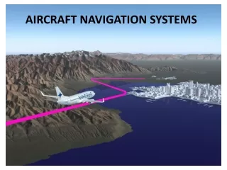
Electronic integrated bridge concepts are driving future navigation system planning.Integrated systems take inputs from various ship sensors, electronically display positioning information, and provide control signals required to maintain a vessel on a preset course.The navigator becomes a system manager, choosing system presets, interpreting system output, and monitoring vessel response.
A modern integrated control system aims to enable one watch-keeping officer to control the ship's navigation, her propulsion system and the cargo spaces. At its heart is a digital processing unit which is interfaced with multiple sensors.
INS brings together data from multiple sources and forms part of the Integrated Bridge System, which revolutionised the way boats navigate.The increasing trend towards electronic displays will be discussed as will how leisure craft that are fitted with AIS Class B are displayed on modern ship bridges.
Recent advances in electronic navigation apparatus and circuits have provided suitable sensor output which can be integrated into one master navigation unit. • The input data required for a safe and economical navigation and for an integrated navigation system are available from:
a heading sensor, i.e. pulses from a gyroscopic compass including the correction of gyro errors • a velocity sensor providing a pulsed input from a duel axis speed log, with corrections for the difference . in speed over ground (SOG) and speed through the water. • sea water temperature and salinity sensors • a pitch and roll sensor, with an electronic inclinometer compensating for changes in the indicated speed.
Heading sensor • A heading sensor that incorporates innovative electromagnetic compass technology for highly accurate and stable readouts of a ship's heading.
Pitch and roll sensor:dynamic roll and pitch accuracy to 0.25°
a depth sensor (e.g. output froman echo sounder displayed on the VDU) • Satellite Navigation Receiver. Output of a single or dual channel receiver is used to up-date the DR position • GPS- global positioning system. • Radar. Processed data from both 3 or 10 an (s and x band) anti-collision radars is of vital importance for the safe passage of a vessel (ARPA). • Auto-Pilot, with a rudder movement indicator. • Satcom
Radar is an object-detection system which uses radio waves to determine the range, altitude, direction, or speed of objects. • The radar dish or antenna transmits pulses of radio waves or microwaves which bounce off any object in their path. The object returns a tiny part of the wave's energy to a dish or antenna which is usually l • Radar was secretly developed by several nations before and during World War II. • The term RADAR was coined in 1941 by the United States Navy as an acronym for radio detection and ranging. The term radar has since entered English and other languages as the common noun radar, losing all capitalization.
In addition to these sensors the integrated navigation system may also include an anemometer, a barometer, VDU with sufficient memory, engine and fuel sensors, cargo sensors, various alarm systems. Likewise, a display of weather forecasts and warnings as well as of reports to navigators are available via satellite. Port information may be included, too.
anemometer • An anemometer is a device for measuring wind speed, and is a common weather station instrument. The term is derived from the Greek word anemos, meaning wind, and is used to describe any airspeed measurement instrument used in meteorology or aerodynamics. The first known description of an anemometer was given by Leon Battista Alberti around 1450.
Ship fluid level (pressure, temperature,draft) monitoring system (cargo, ballast) tank-level sensor