Navigation Systems
Navigation Systems. Objectives. 1. Have a basic knowledge of the definitions for various Aids to Navigation 2. Understand why aids are established 3. Understand the specific purpose of various Aids to Navigation


Navigation Systems
E N D
Presentation Transcript
Objectives 1. Have a basic knowledge of the definitions for various Aids to Navigation 2. Understand why aids are established 3. Understand the specific purpose of various Aids to Navigation 4. Understand the ICW, Western Rivers, Lateral Marking system and the Conventional Direction of Buoyage 5. Become familiar with the flash characteristics used on Aids to Navigation
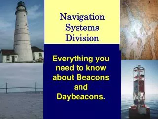
Definitions • Aid to Navigation: • Any device external to a vessel intended to assist a navigator to determine their position, safe course, or to warn of dangers or obstructions to navigation. • Buoy: • An unmanned, floating aid to navigation moored to the seabed. They may be lighted or unlighted.
Definitions • Beacon: • Any fixed aid to navigation located on shore or marine sites. Lighted beacons are called lights, unlighted beacons are called daybeacons. • Range: • Pairs of beacons arranged so that when they are lined up they indicate the center of the channel.
Definitions • Daymark: • The daytime identifierof an aid to navigation presenting one of several colors, shapes, numerals or letters. 1. Square, triangle, rectangle, diamond or octagon 2. Top marks on buoys, and the buoys shape
Definitions • IALA: • International Association of Lighthouse Authorities. • Divides world into 2 regions • Region “A”: Most of the World • Region “B”: North & South America, Japan, Korea, and the Philippines
Definitions • Region “A” • Green Even Triangles • Red Odd Squares • Region “B” • Red Even Triangles • Green Odd Squares
Introduction • Navigation Systems • U.S. Marking system • Intracoastal Waterway system • Western River system
U. S. Marking System • Lateral System: • Employs a simple arrangement of colors, shapes, numbers and light characteristics to show which side an aid should be passed on when proceeding in the Conventional Direction of Buoyage. • 3-R’s • Red Right Returning from sea
U. S. Marking System • Starboard Lateral Marks • Color: Red • Shape: Triangles and Nuns • Character: Even Numbers • Light: Red • Port Lateral Marks • Color:Green • Shape: Squares and Cans • Character: Odd Numbers • Light: Green
9 10 2 1 7 8 5 6 3 2 3 1 2
A U. S. Marking System • Preferred Channel Marks • Purpose: Marks junctions and bifurcation's • Description: • Color: Red & Green horizontally banded(uppermost band is preferred channel) • Shape: Same as preferred channel(uppermost band is preferred channel) • Character: dayboard - topmost color for letter buoy - letter (white) • Light: Same as uppermost band • Characteristic: Gp Fl (2+1) 6s
9 10 2 1 7 8 5 6 3 2 3 1 2
U. S. Marking System • Safe Water Marks • Purpose: Indicates there is navigable water all around the mark • Description: • Color: Redand White vertically striped • Shape: Sphereor Buoy with Topmark • Character: Letters (white)(ex. “GB” Galveston Bay) • Light: White • Characteristic: Mo(A)
U. S. Marking System • Isolated Danger Marks • Purpose: Marks isolated dangers or obstructions that can be passed on all sides • Description: • Color: Black and Red horizontally banded • Shape: Buoy with Top mark • Character: Letters (white) • Light: White • Characteristic: Gp Fl (2) 5s
U. S. Marking System • Special Purpose Aids • Purpose: Not intended to assist safe navigation but to indicate special areas marked on charts (anchorage, traffic separation, data gathering) • Description: • Color: Yellow • Shape: Various • Character: Black letters • Light: Yellow • Characteristic: Fixed, Flashing (except Mo A, 2+1, Qk)
U. S. Marking System • Information and Regulatory Marks • Purpose: Alert the mariner to such things as submerged pipes, no wake zones, etc. • Description: • Color: White; orange band or border • Shape: Square or Diamond • Character: Letters (black, usually words) • Light: White • Characteristic: Anything not otherwise reserved
U. S. Marking System • Wreck Markers • Purpose: To alert the mariner to wrecks • Description: • Color: Appropriate to side of channel • Shape:Appropriate to side of channel • Character: White Letters “WR”, numbered in sequence with channel (WR12) • Light: Same as buoy color • Characteristic: Quick Flashing (unless aid is a preferred channel aid)
9 10 2 1 7 8 5 6 3 DANGER 2 3 N 1 2 A
U. S. Marking System • Conventional Direction • Purpose: To identify how aids should be passed in areas other than channels. • Regions: • Atlantic Coast: Southerly • Gulf Coast: North and Westerly • Pacific Coast: Northerly • Great Lakes:North and Westerly(Lake Michigan: Southerly)
14 13 Intracoastal Waterway System • Runs from Manasquan NJto Brownsville TX Differs only from U.S. marking system in that ICW aids show distinctive identifying symbols • Conventional Direction of Buoyage is the same as the East and Gulf Coasts • Identifying Marks • Starboard Marks:Yellow Triangle • Port Marks: Yellow Square • Non-lateral ICW Mark: 2” Yellow Strip on bottom
92 91 9 10 88 90 2 1 7 8 87 89 6 5 3 DANGER 2 3 N 1 2 A
Western River System • The Mississippi River and it’s tributaries • Western Rivers differ from the U.S. Marking system as follows: 1. The conventional direction of buoyage is from themouthto head of navigation. Local terminology describes aids as Right or Leftdescending bank 2. Aids are notnumberedorlettered 3. Safe water & Iso. danger marksare not used
Western River System • Left Descending Bank Marks: • Color: Red • Shape: Triangle • Light: Red • Characteristic:Group- flashing Characteristics
Western River System • Right Descending Bank Marks: • Color: Green • Shape: Square • Light: Green • Characteristic:Flashing Characteristics
Western River System • Crossing Marks: • Show where traffic is to move from one side of the bank to the other. Upbound takes the points, Downbound takes the bends.
Western River System • Crossing Marks: • Color: Red or Green • Shape: Diamond • Light: White(Changed to Red or Green when damaged or worn) • Characteristic: • Right descending bank - single flash - Green or White • Left descending bank - group flashing two - Red or White
Western River System • Crossing Marks: • By June 1999 solid-colored boards should be changed to Non-lateral Red & Green.
Right descending bank Left descending bank Upbound Traffic
Review • Primary Navigation Marking systems • U.S., Intracoastal Waterway, Western River • US Marking system (Lateral) • Port, Starboard, Preferred Channel, Safe water, Isolated Danger, Special Purpose, Information and Regulatory, and Wreck Markers • Intracoastal Waterway Marks • Starboard Mark- Yellow Triangle • Port Mark- Yellow Square • Non-Lateral - 2”strip
Review • Differences between Western Rivers and U.S. Marking systems • Aids are not numbered or lettered • Safe Water marks and Isolated Danger marks are not used • Difference between Intracoastal and U.S. Marking systems • ICW identifiers are used
9 10 88 90 2 1 7 8 87 92 89 6 5 91 3 DANGER 2 3 N 1 2 A