Download
1 / 20
200 likes | 249 Vues
Explore the evolution of Global Navigation Satellite Systems (GNSS), providing autonomous geo-spatial positioning worldwide. Understand GNSS classifications, satellite-based augmentation systems, and regional navigation systems. Gain insights into the first artificial navigation satellites and the operational principles of modern navigation systems. Discover the Global Positioning System (GPS) and its segments.

E N D
Contents • Global Navigation Satellite Systems. • Fundamental of air navigation develops. • The first artificial navigation satellites. • GPS. • Glonass. • Galileo.
Global Navigation Satellite Systems (GNSS) • GNSS is the standard generic term for satellite navigation systems that provide autonomous geo-spatial positioning with global coverage. GNSS allows small electronic receivers to determine their location (longitude, latitude, and altitude) to within a few metres using time signals transmitted along a line-of-sight by radio from satellites. Receivers on the ground with a fixed position can also be used to calculate the precise time as a reference for scientific experiments.
Evolution of base aeronautical parts 2010 and late Global ATM SYSTEM Regional planning Development of SARPN planning World conference devoted to GNS/ATM systems implementation 1998 Conferences of ALLIPREG Aeronautical Council Approval of GNS/ATM systems development 1998 Introduction Regional planning and implementation of GNS/ATM systems Successive SARP, PANS and instructive documentation Development Adoption of ICAO transition plan for CNS/ATM systems 1998 Assembly Acceptance CNS/ATM systems 1998 Acceptance FANS concept by 10th aeronautical conference 1998 1998 Creation of FANS concept 1998 Foundation of FANS Committee
GNSS classification • GNSS-1 is the first generation system and is the combination of existing satellite navigation systems (GPS and GLONASS), with Satellite Based Augmentation Systems (SBAS) or Ground Based Augmentation Systems (GBAS). In the United States, the satellite based component is the Wide Area Augmentation System (WAAS), in Europe it is the European Geostationary Navigation Overlay Service (EGNOS), and in Japan it is the Multi-Functional Satellite Augmentation System (MSAS). Ground based augmentation is provided by systems like the Local Area Augmentation System (LAAS). • GNSS-2 is the second generation of systems that independently provides a full civilian satellite navigation system, exemplified by the European Galileo positioning system. These systems will provide the accuracy and integrity monitoring necessary for civil navigation. This system consists of L1 and L2 frequencies for civil use and L5 for system integrity. Development is also in progress to provide GPS with civil use L2 and L5 frequencies, making it a GNSS-2 system.
Global Satellite Based Augmentation Systems (SBAS) such as Omnistar and StarFire. • Regional SBAS including WAAS(US), EGNOS (EU), MSAS (Japan) and GAGAN (India). • Regional Satellite Navigation Systems such a QZSS (Japan), IRNSS (India) and Beidou (China). • Continental scale Ground Based Augmentation Systems (GBAS) for example the Australian GRAS and the US Department of Transportation National Differential GPS (DGPS) service. • Regional scale GBAS such as CORS networks. • Local GBAS typified by a single GPS reference station operating Real Time Kinematic (RTK) corrections.
The first artificial navigation satellites • The first satellite navigation system was Transit, a system deployed by the US military in the 1960s. Transit's operation was based on the Doppler effect: the satellites traveled on well-known paths and broadcast their signals on a well known frequency. The received frequency will differ slightly from the broad-cast frequency because of the movement of the satellite with respect to the receiver. By monitoring this frequency shift over a short time interval, the receiver can determine its location to one side, and several such measurements combined with a precise knowledge of the satellite's orbit can fix a particular position.
Modern systems(Principle Operation) • The satellite broadcasts a signal that contains orbital data (from which the position of the satellite can be calculated) and the precise time the signal was transmitted. The satellite uses an atomic clock to maintain synchronization of all the satellites in the constellation. The receiver compares the time of broadcast encoded in the transmission with the time of reception measured by an internal clock, thereby measuring the time-of-flight to the satellite. Each distance measurement, regardless of the system being used, places the receiver on a spherical shell at the measured distance from the broadcaster.
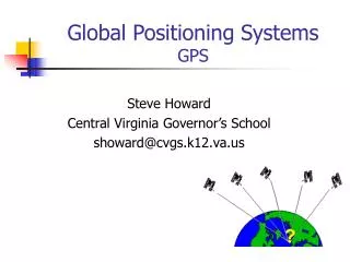
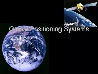
GPS (Global navigation systems ) The Global Positioning System (GPS) is a U.S. space-based global navigation satellite system. It provides reliable positioning, navigation, and timing services to worldwide users on a continuous basis in all weather, anywhere on or near the Earth. GPS satellites broadcast signals from space that GPS receivers use to provide three-dimensional location (latitude, longitude, and altitude) plus precise time.
Contents of a GPS(segments) • Space • Control • User • The Space Segment comprises 24 to 32 satellites in Medium Earth Orbit and also includes the boosters required to launch them into orbit. • The Control Segment comprises a Master Control Station, an Alternate Master Control Station, and a host of dedicated and shared Ground Antennas and Monitor Stations. • The User Segment comprises U.S. and allied military users of the secure GPS Precise Positioning Service, and civil, commercial and scientific users of the Standard Positioning Service.
Space segment (SS)six planes 55° inclination (tilt relative to Earth's equator) and are separated by 60° with four satellites each
Basic concept of GPS • A GPS receiver calculates its position by precisely timing the signals sent by the GPS satellites high above the Earth. Each satellite continually transmits messages which include - the time the message was sent - precise orbital information (the ephemeris) - the general system health and rough orbits of all GPS satellites (the almanac). The receiver utilizes the messages it receives to determine the transit time of each message and computes the distances to each satellite. These distances along with the satellites' locations are used with the possible aid of trilateration to compute the position of the receiver. This position is then displayed, perhaps with a moving map display or latitude and longitude; elevation information may be included. Many GPS units also show derived information such as direction and speed, calculated from position changes.
Position calculation • GPS receiver is able to determine the times sent and then the satellite positions corresponding to these times sent. • Knowing the indicated time the message was received , the GPS receiver can compute the transit time of the message as (tr-ti). • Assuming the message traveled at the speed of light, C, the distance traveled, can be computed as D=(tr-ti)c. • A satellite's position and distance from the receiver define a spherical surface, centered on the satellite.
Two sphere surfaces intersecting in a circle(Position calculation)
GLONASS • GLONASS (Russian: ГЛОНАСС, abbreviation of ГЛОбальная НАвигационная Спутниковая Система; tr.: GLObal'naya NAvigatsionnaya Sputnikovaya Sistema; "GLObal NAvigation Satellite System" in English) is a radio-based satellite navigation system, developed by the former Soviet Union and now operated for the Russian government by the Russian Space Forces
Purpose • GLONASS was developed to provide real-time position and velocity determination, initially for use by the Soviet military for navigation and ballistic missile targeting. It was the Soviet Union's second generation satellite navigation system, improving on the Tsiklon system. • Accuracy Horizontal positioning 57–70 meters, vertical positioning - 70 meters, velocity vector measuring - 15 cm/s, time transfer - 1 µs.
Orbital characteristics • A fully constellation consists of 24 satellites, with 21 used for transmitting signals and three for on-orbit spares, deployed in three orbital planes. The three orbital planes' ascending nodes are separated by 120° with each plane containing eight equally spaced satellites. The orbits are inclination of about 64.8°, and orbit the Earth at an altitude of 19,100 km (11,868 mi), which yields an orbital period of approximately 11 hours, 15 minutes. The planes themselves have a latitude displacement of 15°, which results in the satellites crossing the equator one at a time, instead of three at once. The overall arrangement is such that, if the constellation is fully populated, a minimum of five satellites are in view from any given point at any given time
Operation • The GLONASS system consists of 19 satellites, of which 16 are operational, and 3 of which are undergoing maintenance (October 2009). The system requires 18 satellites for continuous navigation services covering the entire territory of the Russian Federation, and 24 satellites to provide services worldwide. • GLONASS uses a coordinate datum named "PZ-90" (Parametry Zemli), in which the precise location of the North Pole is given as an average of its position from 1900 to 1905. This is in contrast to the GPS's coordinate datum, WGS 84, which uses the location of the North Pole in 1984. As of September 17, 2007 the PZ-90 datum has been updated to differ from WGS 84 by less than 40 cm (16 in) in any given direction.
Satellites transmit two types of signal: • standard precision (SP) • obfuscatedhigh precision (HP). They transmit the same code as their SP signal, however each transmits on a different frequency using a 15-channel frequency division multiple access (FDMA) technique spanning either side from 1602.0 MHz, known as the L1 band. • The HP signal is broadcast in phase quadrature with the SP signal, effectively sharing the same carrier wave as the SP signal, but with a ten times higher bandwidth than the SP signal. • The L2 signals use the same FDMA as the L1 band signals, but transmit straddling 1246 MHz.