Global Positioning Systems
Global Positioning Systems. Kristen Mastromarino CSC 110. GPS. Global Positioning System is also known as a GPS The satellite -based navigation system has become a necessary tool for everyone around the world to know their location.


Global Positioning Systems
E N D
Presentation Transcript
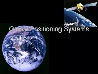
Global Positioning Systems Kristen Mastromarino CSC 110
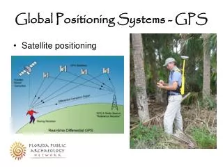
GPS • Global Positioning System is also known as a GPS • The satellite-based navigation system has become a necessary tool for everyone around the world to know their location. • Without the GPS, todays newest generations wouldn’t know how to navigate without getting completely lost.
History • In 1957 the Soviet launched the satellite Sputnik. • U.S. scientists learned that they could track the satellite's orbit by listening to changes in its radio frequency • This is the same principle that explains why the pitch of a car's horn seem to change as the car speeds by. • In the early 1960s the U.S launched ten satellites that would help track the U.S Navy submarines.
History cont. • In 1973 Ivan Getting and Bradford Parkinson began leading a Defense Department project to provide continuous navigation information, this was the first GPS formally known as “NAVSTAR GPS”. • In 1978 the military had launched its first collection of GPS satellites. • This collection consisted of 24 satellites orbiting 12,000 miles high, each circling the globe every 12 hours each weighing around 2,000 pounds
By calculating the difference between radio signals received from these satellites, GPS receivers on the ground can determine their own location, speed and elevation with great accuracy normally within a few meters or even less.
GPS & The Military • GPS’s help with guiding missiles and bombs to their destinations in Iraq, Afghanistan and elsewhere else that's needs. • Military soldiers and government officials even carry around ID cards that have small GPSs in them. • If they are to break their ID cards due to and emergency, the government gets the signal and can find that persons exact location
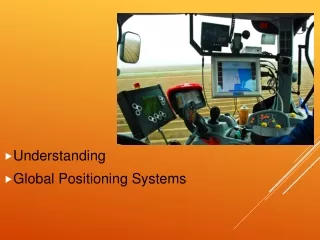
GPS & Society • Helps parents find and keep track of their children and is being installed as a location device in cars and in cell phones to assist people in mapping and directions • GPS can make it easier to call for help in case of emergencies. Emergency teams and rescuers know exactly where you are, even if your position changes between the time you call and the time help arrives. • Even pets use GPSs, pet collars can help you track pets if they are stolen or lost.
Works Cited • Randy Jams (2009). History of GPS. Online. Available at: http://www.time.com/time/magazine/article/0,9171,1901500,00.html. Last Accessed December 4 2014. • Rachel Greenburge (2011). How GPS Affects Business, Society and Education. Onlinehttp://rachelgreenberg.tripod.com/id12.html. Last Accessed December 6 2012.