Global Positioning Systems
This course covers the fundamentals of Global Positioning Systems (GPS), including its definition, basic components, and operational mechanics. Participants will engage in brainstorming exercises to explore practical applications of GPS in their companies. Learn about the constellation of satellites, the principles of triangulation, timing accuracy, and error correction. Real-world examples, such as GPS's role in coastal erosion management, will illustrate its relevance. By the end of the course, attendees will understand how GPS can enhance business operations and decision-making.


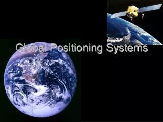
Global Positioning Systems
E N D
Presentation Transcript
Global Positioning Systems Jessie Fowls Boise State University Operations Management – 345
Topics That Will Be Covered • GPS definition • Brainstorming Exercise • GPS basic breakdown • How GPS works • Real World Example • Application Exercise • Summary
GPS Definition • Worldwide space-based radio navigation system consisting of as constellation of 24 satellites and their ground stations.1
Brainstorming Exercise • How could GPS be used in your company? • What areas of your company would benefit most from GPS?
GPS Basic Breakdown • Consists of 24 Earth-orbiting satellites • Solar cells power each satellite • Antennas transmit timing info. • Operated and maintained by U.S. Department of Defense
GPS Basic Breakdown • GPS Satellite Facts2 • Name: Navstar • Altitude: 10,900 Nautical Miles (12,660 Miles) • Weight: 1900 lbs (in orbit) • Size: 17ft. with solar panels extended • Orbital Period: 12 hours
GPS Basic Breakdown • Three components • Space: Satellites • Control: Master Control Station • User Segments: Receivers
How GPS Works • Five Logical Steps3 • Triangulating or Trilaterating • Measuring Distance • Getting Perfect Timing • Satellite Positions • Error Correction
How GPS Works • Triangulation or Trilateration • Using the distance of 3 satellites measured from your position anywhere on the planet
How GPS Works • Trilateration Illustration Suppose you knew you were • 625 miles from Boise • 690 miles from Minneapolis • 615 miles from Tucson
How GPS Works 625 miles 690 miles Boise Minneapolis Denver 615 miles • Determines your location to be somewhere near Denver.4 Tucson
How GPS Works • Measuring Distance - Coordinates of your location • Longitude and Latitude • Altitude
How GPS Works • Getting Perfect Timing • Radio Signal • Atomic Clock
How GPS Works • Satellite Positions • High Orbits • Careful Monitoring
How GPS Works • Error Correction • Types of error (slows signal) • Charged particles in ionosphere • Water vapor in troposphere • Ground obstructions
How GPS Works • Error Correction • Minimizing Error • Predicting delay • Comparing signal speeds • “Dual frequency”
Real World Example • U.K. Coastal Erosion5 • Problem in past and present • GPS is used to prevent destruction of structures
Real World Example • Monitor coastline with GPS • Technology used to predict risky areas • Information used for future shoreline management planning
Exercise • List some possible uses for GPS in general. • More specifically, for what types of things might your company use GPS?
Summary • GPS: Global Positioning Systems • Determines precise location anywhere on Earth • Uses advanced technology and an easily understandable method for calculating location. • Can be used in nearly every aspect of business, environment, recreation, education, etc…
Summary “GPS is to position what the clock was to time”6
Bibliography • “All About GPS” http://www.trimble.com/gps • “Global Positioning System.” Microsoft Encarta Encyclopedia. 2002 ed. • Hartman, Julie. “Combination of technologies improves coastal erosion measurements.” Civil Engineering Oct. 2001: 33-35. • “How GPS Receivers Work” http://www.howstuffworks.com/gps.htm • Kaplan, Elliott D. ed. Understanding GPS: Principles and Applications1st ed. Boston: Artech House, 1996. 487.