Download
1 / 38
380 likes | 399 Vues
Explore how Global Positioning System (GPS) technology revolutionizes farming practices to increase efficiency and crop yields. Learn the fundamentals of GPS components - Space Segment, Control Segment, and User Segment, and its applications in variable rate applications. Discover how GPS satellites determine object positions on Earth and how to utilize this information to optimize fertilizer application in agricultural fields. Enhance your understanding of geospatial technologies and their impact on Agriculture, Food, and Natural Resource (AFNR) systems through hands-on activities and practical applications.

E N D
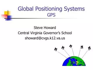
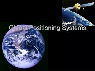
Understanding Global Positioning Systems
CCSS.ELA Literacy. RST.9‐10.1 Cite specific textual evidence to support analysis of science and technical texts, attending to the precise details of explanations or descriptions. • CCSS.ELA Literacy. RST.9‐10.7 Translate quantitative or technical information expressed in words in a text into visual form (e.g., a table or chart) and translate information expressed visually or mathematically (e.g., in an equation) into words. • CCSS.ELA Literacy.RST.11‐12.1 Cite specific textual evidence to support analysis of science and technical texts, attending to important distinctions the author makes and to any gaps or inconsistencies in the account. • CCSS.ELA Literacy. RST.11‐12.3 Follow precisely a complex multistep procedure when carrying out experiments, taking measurements, or performing technical tasks; analyze the specific results based on explanations in the text • HSSIC.A.1 Understand statistics as a process for making inferences about population parameters based on a random sample from that population. (HS‐LS2‐6) Next Generation Science/Common Core Standards Addressed!
PST.05.03. Apply geospatial technologies to solve problems and increase the efficiency of AFNR systems. • PST.05.03.01.a. Research and summarize the impact of utilizing geospatial technologies(i.e., GPS, GIS, remote sensing, telematics, etc.) in AFNR systems Agriculture, Food and Natural Resource Standards Addressed!
Describe how satellites can be used to determine the position of objects on earth. • Describe how GPS satellites are used to navigate variable rate applications of agricultural inputs. Student Learning Objectives/ Bell Work!
Control segment • Global Positioning System (GPS) • NAVSTAR • Parallel swathing • Space segment • Triangulation • User segment • Variable Rate Application Terms
Draw a map of a 40 acre field that needs fertilizer. Show the students that it has been sampled every 4 acres, for a total of 10 smaller sections within the field. • For maximum yields in those 10 sections, 5 of them need 175 lbs. of fertilizer/acre, 2 need 275 lbs./acre, 1 needs 135 lbs./acre, another needs 150 lbs./acre, and the final section needs 250 lbs./acre. Interest Approach
Ask the students how much fertilizer they would order per acre for the farm. • Would they put on 275 lbs./acre so that every acre could reach it’s maximum potential? • How could they use GPS technology to be able to apply the correct amounts to each section within the field? Interest Approach
Describe how satellites can be used to determine the position of objects on earth. Objective One
The Global Positioning System(GPS) was created by the Department of Defense in the early 80’s, and became fully operational on April 27, 1995. How can Satellites Determine the Position of Objects on Earth?
It was originally designed to serve as a world-wide navigational aid for the United States Military. • The system can now be used for commercial, industrial, and civilian uses. How can Satellites Determine the Position of Objects on Earth?
GPS receivers can determine their position 24 hours a day in all weather conditions. The Global Positioning System is divided into three parts: • Space Segment • Control Segment • User Segment. How can Satellites Determine the Position of Objects on Earth?
A. Space Segmentconsists of 24 NAVSTAR (Navigation by Satellite Timing And Ranging) Satellites. • Of the 24, there are 21 in use, and the other three serve as functioning spares. • The satellites orbit at 10,900 nautical miles above the earth’s surface. How can Satellites Determine the Position of Objects on Earth?
1. Each satellite circles the earth twice per day, once every twelve hours. • There are six orbital paths with four satellites in each path. • This organization guarantees that there are always at least four satellites available to a GPS receiver. How can Satellites Determine the Position of Objects on Earth?
The GPS receivers can only receive information from those satellites that are “above the horizon,” meaning that the receiver must be in the line of sight of the orbiting satellite in the sky. How can Satellites Determine the Position of Objects on Earth?
2. Each satellite is equipped with a radio transmitter and receivers for sending and receiving radio waves. • Their signals are similar to those received by a television set, but at a higher frequency. How can Satellites Determine the Position of Objects on Earth?
The satellites also contain atomic clocks, which keep time based on natural periodic vibrations within atoms. • These precise clocks are what make it possible for GPS to be used for mapping and navigation. How can Satellites Determine the Position of Objects on Earth?
B. The Control Segmentis the network of monitoring stations that track and monitor GPS satellites all around the world. • The Master Control Station is located at Falcon Air Force Base in Colorado Springs, Colorado. How can Satellites Determine the Position of Objects on Earth?
The stations measure radio wave signals that are continuously transmitted by the satellites and relay the information to the stations. • The Master Control Monitoring Station uses this information to compute the exact orbits of the satellites and to update their navigation. How can Satellites Determine the Position of Objects on Earth?
C. The User Segmentconsists of military and civilians who use GPS receivers for determining the position of a vehicle or location. • GPS receivers use Triangulation, which means taking information from three or more satellites to determine an exact location on the earth. How can Satellites Determine the Position of Objects on Earth?
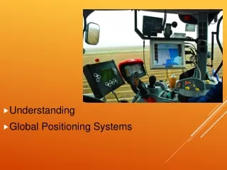
II. GPS can be used to navigate agricultural equipment and to correctly apply varying rates of inputs to maximize yields. How can GPS utilize variable rate technology accurately apply agricultural inputs?
GPS can be used to guide equipment through the field accurately. • This process is known as parallel swathing. • Parallel swathing: driving or flying a vehicle in straight, parallel paths without leaving gaps or overlapping between passes. How can GPS utilize variable rate technology accurately apply agricultural inputs?
When applying fertilizers or pesticides, a producer does not want to leave gaps or fertilization and pest control would not be complete. • Overlaps lead to over-application, which leads to excessive cost, crop damage, or environmental damage. How can GPS utilize variable rate technology accurately apply agricultural inputs?
Parallel swathing navigates machinery so that applications can be made with great accuracy. • The operator of the equipment simply hits a start key when beginning a field. How can GPS utilize variable rate technology accurately apply agricultural inputs?
When they come to the other end of the field, they can hit the stop key, and then the GPS receiver will guide them through the rest of the field based on the first pass. How can GPS utilize variable rate technology accurately apply agricultural inputs?
B. Variable Rate Application: refers to the use of site-specific data of cropping inputs such as seeds, fertilizer, lime, and pesticides. How can GPS utilize variable rate technology accurately apply agricultural inputs?
Other inputs can be achieved using the Global Positioning System. • In this process, producers can vary the rates applied to their land based on information that has been collected from that acreage over the past years. How can GPS utilize variable rate technology accurately apply agricultural inputs?
These decisions could be based on soil type information, drainage, past yields, soil sample data, or any other information that is a part of the data layers collected on that farm. How can GPS utilize variable rate technology accurately apply agricultural inputs?
C. The data is collected and entered into a computer program that analyzes the information. • The producer and their consultant determine what their application rates will be for whatever input they will be applying. How can GPS utilize variable rate technology accurately apply agricultural inputs?
In this instance, let’s say fertilizer. • The application data is put into the computer in the fertilizer spreader, which controls the output of the spreader at different locations throughout the field. How can GPS utilize variable rate technology accurately apply agricultural inputs?
D. The GPS receiver gives the fertilizer spreader’s computer the information as to where it is within the field, and the computer uses that information to adjust how much is applied at differing locations throughout the field. How can GPS utilize variable rate technology accurately apply agricultural inputs?
E. GPS technology can be used on sprayers, planters, combines, soil sampling equipment, or any implement that can collect data about exact points within a field. • This data is stored in a computer, and can then be used to analyze the amount of inputs that will be used in the future. How can GPS utilize variable rate technology accurately apply agricultural inputs?
When applying fertilizers or pesticides, a producer does not want to leave gaps or fertilization and pest control would not be complete. • Overlaps lead to over-application, which leads to excessive cost, crop damage, or environmental damage. How can GPS utilize variable rate technology accurately apply agricultural inputs?
The Global Positioning System(GPS) was created by the Department of Defense in the early 80’s, and became fully operational on April 27, 1995. • GPS receivers can determine their position 24 hours a day in all weather conditions. The Global Positioning System is divided into three parts: • Space Segment • Control Segment • User Segment. Review/Summary
GPS can be used to navigate agricultural equipment and to correctly apply varying rates of inputs to maximize yields. • GPS can be used to guide equipment through the field accurately. Review/Summary