Global Positioning Systems
Discover the Global Positioning System (GPS) and its various applications, from tracking locations to fitness use. Learn how GPS works, types of GPS units, pros and cons, and how to utilize GPS for exercise like geocaching. Explore the possibilities with GPS technology!


Global Positioning Systems
E N D
Presentation Transcript
Global Positioning Systems Alex Wilson & Justin Munoz
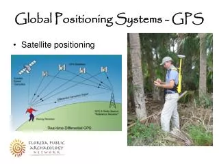
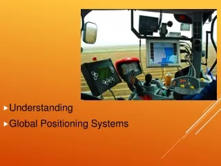
What is GPS? • The Global Positioning System (GPS) is a satellite-based navigation system made up of a network of 24 satellites placed into orbit by the U.S. Department of Defense. GPS was originally intended for military applications, but in the 1980s, the government made the system available for civilian use. GPS works in any weather conditions, anywhere in the world, 24 hours a day. There are no subscription fees or setup charges to use GPS.
How GPS works? • GPS satellites circle the earth twice a day in a very precise orbit and transmit signal information to earth. GPS receivers take this information and use triangulation to calculate the user's exact location.
What can a GPS do? • Mark locations you want to find later. • Map out trails that you have traveled. • GPS’s log how far someone has traveled. • Some can show what pace you are running at. • Hunters use them a lot to mark where their camp is. • Used when fishing to mark fishing spots or to mark objects under the water you cannot see so that you do not run over them.
Different Types of GPS’s • Trail Units- Used to mark locations while in the outdoors such as camps or places to fish and hunt. • Sport/Fitness Units-Trip- log routes, heart rate, and cadence data that can be uploaded to a computerized training log. Specialized golf GPS receivers provide precise yardage and other useful information and can be preloaded with your favorite courses. • Car Units- Store locations and provides directions to places and addresses. • Water/Air-Map page, terrain page (topography), route page, position data page, "direct-to" navigation, airport/water information, and more.
Garmin eTrex HC $130 Pros Inexpensive Highly sensitive signal processor Color Display Cons Non expandable Memory No High-end Features Maps are not detailed
$550 Montana 600 Pros 4 in. Color Touch screen Huge Memory(2000 Waypoints, 200 Routes) Wireless Syncing Many Features Cons Expensive
Forerunner 205 $150 Pros Compact Light Weight Cons No Heart Rate Monitoring Low Memory
Forerunner 405CX $350 Pros Wireless Syncing Workouts Pre-Loaded Hear Rate Monitor Cons Expensive Can not save routes
Videos GPSGeocaching Garmin 610 navigation Garmin 610 first run
How can we use GPS for exercise? • Geocaching • Georgia Geocaching • Geocaching Waypoints • Garmin
References • http://www.garmin.com/garmin/cms/site/us • http://www.geocaching.com/
The End Credits Producer: Alex Wilson Executive Producer: Justin Munoz