Download
1 / 34
340 likes | 371 Vues
Explore principles and satellites of GNSS systems like GPS, GLONASS, and Galileo for precise positioning and time transfer. Learn about satellite orbits, clock synchronizations, and signal measurements. Discover the International GNSS Service (IGS) for scientific use.

E N D
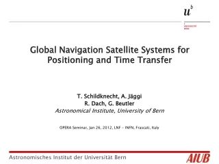
Global Navigation Satellite Systems for Positioning and Time Transfer A. Jäggi, T. Schildknecht R. Dach, G. Beutler Astronomical Institute, University of Bern Istituto Nazionale di Fisica Nucleare Laboratori Nazionali di Frascati January 26, 2012 Astronomical Institute
Who are we? Astronomical Institute
Who are we? • Research: • Fundamental Astronomy: • Space Surveillance • Celestial Mechanics • Satellite Geodesy • Global Geodynamic http://www.aiub.unibe.ch • Zimmerwald Observatory: • Optical Astronomy (CCD) Space Debris, Asteroids, Comets • Satellite Laser Ranging to satellites equipped with retro-reflectors • GNSS Receivers recording signals from GPS, GLONASS, and Galileo Astronomical Institute
Content • Global Navigation Satellite Systems (GNSS) • Principles of satellite positioning and navigation • The International GNSS Service (IGS) • The GNSS Observation Equations • Some remarks concerning relativity • Time transfer using common view and other methods Astronomical Institute
GLONASS: Russia (about 24 satellites) • Galileo: Europa (2 IOV satellites, 2 test satellites) GALILEO GLONASS Global Navigation Satellite Systems • GPS: USA (30-32 satellites) GPS Astronomical Institute
Global Navigation Satellite Systems • Groundtracks of GPS, GLONASS and GALILEO over one day Astronomical Institute
Global Navigation Satellite Systems 2 Astronomical Institute
GPS as seen from Zimmerwald • GPS: • Currently 32 satellites • Six orbital planes, spaced by 60 deg in the equator, inclined by 55 deg. • Semi-major axes: 26500 km • Revolution period: 11h 58m • (half a sidereal day) • Almost circular orbits • GPS as seen from Zimmer-wald Astronomical Institute
GLONASS as seen from Zimmerwald • GLONASS: • Currently 24 satellites • Three orbital planes, spaced by 120 deg in the equator, inclined by 63 deg. • Semi-major axes: 25500km • Rev period: 11h 16m • Repeats after 8 sidereal days • Almost circular orbits • GLONASS as seen from Zimmerwald Astronomical Institute
Galileo as seen from Zimmerwald • Galileo: • Currently 2+2 satellites • Three orbital planes, spaced by 120 deg in the equator, inclined by 56 deg. • Semi-major axes: 30000km • Rev period: 13h 45m • Repeats after 10 sidereal days • Almost circular orbits • Galileo as seen from Zimmer-wald Astronomical Institute
Globale Navigation Satellite Systems • Ground tracks: top, left: GPS, one day; top right: Glonass, 8 days, bottom: Galileo, one day (!!) Astronomical Institute
Principles of Positioning and Timing • GNSS have been designed for use on the Earth’s surface or in the Earth-near space. • Each satellite is equipped with a stable oscillator generating at least two coherent carriers. Code info is modulated on the carrier. • The travelling time of signals (and its changes in time) between the GPS satellite and the receiver are the basic measurements. • With the speed of light c the dis-tancesr(and their time evolution)between satellite and receiver may be reconstructed. Astronomical Institute
Principles of Positioning and Timing • Bits encoded on carrier by phase • Signals driven by an atomic clock • modulation: • Two carrier signals: • C/A-code (Clear Access / Coarse Acquisition) • P-code (Protected / Precise) • Broadcast/Navigation Message • L1: f = 1575.43 MHz, λ = 19 cm • L2: f = 1227.60 MHz, λ = 24 cm Astronomical Institute
Speed of light (in vacuum) • Receiver clock reading at signal reception (in receiver clock time) • GPS satellite clock reading at signal emission (in satellite clock time) Principles of Positioning and Timing • Code Observations • are defined as: • No actual „range“ (distance) because of clock offsets (pseudo-range) • Measurement noise: ~ 0.5 m for good P-code Astronomical Institute
Principles of Positioning and Timing • The pseudo-range is composed of • = +c (ti - tk)+ I(l) + t • = |r(tk)-R(ti)| is used to determine the position R(ti) of a receiver at time ti, but also the orbital positionr(tk) of the satellite k at time tk. • c (ti - tk) is used for clock-synchronisation. • I (l), the delay of the signals due to the ionosphere, may be used for ionosphere modelling. • t, the signal delay in the neutral atmosphere, may be used in meteorology (in particular to determine the rapidly varying water vapor content). • A similar equation holds for the phase observation equation. Astronomical Institute
The IGS • The scientific use of GNSS is coordinated by the IGS. • Created in 1989 with I.I. Mueller, G. Mader, B. Minster, B. Melbourne, and Ruth Neilan as protagonists. • The IGS became an official IAG service in 1994. • The IGS first was a pure GPS Service, it was renamed as the International GNSS Service in 2004. • Today the IGS is an interdisciplinary service in support of Earth Sciences and Society, making optimum use of the data from all GNSS. • Since its creation the IGS Central Bureau is located at JPL, Pasadena, with Ruth Neilan as director. Astronomical Institute
The IGS Monitor station motion in „real time“ IGS Network in January 2012 In 1992 the IGS was based on about 20 geodetic receivers, 400+ receivers are active and their data openly available today Astronomical Institute
The IGS • In 1992 the IGS started off as an orbit determination service (few dm accuracy) for about 20 GPS satellites. • Today, the IGS providesephemerides (accuracy/consistency of 2-4 cm) and clock corrections for all GPS and GLONASS satellites, i.e., for all currently active GNSS satellites. • In addition the IGS provides • archive of all globally relevant GNSS data since 1991 • satellite and receiver clock corrections (sub-ns accuracy) • polar motion (PM) and length of day (lod) (mm-cm [/day] accuracy) • coordinates & velocities for 200+ sites (mm-cm / mm/y accuracy) • atmosphere information (ionosphere and troposphere) • The IGS products are • accurate, reliable and robust, • available in a timely manner. Astronomical Institute
The IGS • Consistency of IGS-derived GPS (left) and GLONASS (right) orbits: • today both on the 1-2 cm level (weekly report of IGS ACC) 5cm Astronomical Institute
The IGS • Consistency of IGS-derived GPS clock corrections; left: history, right: recent weeks. • today both on the 50-100 ps level (weekly report of IGS ACC) Astronomical Institute
The IGS • The Center for Orbit Determination in Europe (CODE) is one of the global analysis centers of the IGS. It is a joint-venture between the • Astronomical Institute of the University of Bern (AIUB), Bern, Switzerland • Swiss Federal Office of Topography (swisstopo), Wabern, Switzerland • German Federal Office for Cartography and Geodesy (BKG), Frankfurt, Germany • Institute of Astronomical and Physical Geodesy (IAPG) of the Technische Universität München (TUM), Munich, Germany Astronomical Institute
The IGS • Left: Ionosphere map (2 hours time resolution) routinely derived by IGS Analysis Centers • Right: Development of mean daily TEC since mid 1996 • (figures from CODE/IGS Analysis Center) Astronomical Institute
The IGS • Left: Polar motion (~motion of rotation axis on Earth‘s surface) since 1993 (diameter of figure about 14m) • Right: Excess Length of day since 1993 (milliseconds) (from CODE Analysis Center) Astronomical Institute
The GNSS Observation Equations Left-hand side of Eqn.: Measurement, namely difference of the readings of two clocks Right-hand side of Eqn.: Mathematical Model Astronomical Institute
The GNSS Observation Equations • The distinction is made between • code observations (RMS of the order of m) absolute measurement of distances • phase observations (RMS of the order of mm) biased (relative) measurement of distances • Each GNSS satellite transmits coherent info on at least two carriers ionospheric refraction may be eliminated by a special linear combination. • For the GPS there were until quite recently two carriers L1 (λ1 = 19.0 cm ) and L2 (λ2 = 24.4 cm). Astronomical Institute
The GNSS Observation Equations • The scientific user of GNSS has to • determine all parameters in the observation equations • use code and phase observations and all linear combinations • Example: CODE Analysis Center of the IGS at AIUB • The normal user of GNSS • assumes the satellite orbits and the satellite clock corrections as known (takes them from the IGS), • may use either code only, phase only, • may use a selection or a linear combination of carriers • may use only a subset of all observations available Astronomical Institute
Known from ACs or IGS: • satellite positions • satellite clock offsets • 4 unknown parameters: • receiver position • receiver clock offset The GNSS Observation Equations • GPS time of reception and emission • , • Satellite clock offset • Receiver clock offset • Distance between receiver and satellite Astronomical Institute
The GNSS Observation Equations • : atmospheric delay missing, exactly 4 satellites, … • Simplified model for • More than 4 satellites: best receiver position and clock offset with least-squares or filter algorithms Astronomical Institute
The GNSS Observation Equations Astronomical Institute
Remark • In astronomy it is clear since centuries that one has to define carfully the „observed functions“ of celestial bodies. • The astrometric position of a minor panet, a comet, or a moon of a planet is, e.g, the geometrical direction (represented by a unit vector) from the observer at observation time to the body at emission time of the photons. • For distance measurements the same principle has to be observed (we did that when setting up the GNSS observation equations). • Illustration from Beutler (2005), Methods of Celestial Mechanics, Vol I, Chapter 8. • C: Central body (e.g., Sun), O: Observer (e.g., on Earth), P: observed object Astronomical Institute
Relativity • The differences between the classical and the special relativistic treatment of the observation equations are of the order • 1 - {1-v2/c2}1/2 ≈ ½ v2/c2, • where v is the velocity of the observed object w.r.t. the observer and c is the speed of light. • In the case of GPS satellites v ≈ 4000m/s and therefore • ½ v2/c2 ≈ 2.2 · 10-11. • Relativistic effects are applied in GNSS analysis • when solving the equations of motion in the parameterized post Newtonian formulation (PPN) very small correction; • because distances are measured by forming the difference of the readings of a GNSS satellite clock and a receiver clock on or near the Earth‘s surface relatively big once per rev correction (constant term removed by adjusting the frequencies of GNSS clocks). Astronomical Institute
Relativity • Relevant timescales: • Terrestrial time TT is used as the independent argument in the PPN equations. • TT is in essence the terrestrial time used on the Earth‘s surface. • The proper time t of a GNSS satellite clock defines the signal generation at the satellite. • t differs fromTT because of the relative motion of the satellite(s) w.r.t. the receiver(s). • The difference ( TT - t ) has to be applied to let satellite clocks refer to TT. • The following formulas are taken from the IERS Conventions 2010 (Luzum and Petit, 2010). Astronomical Institute
Relativity • The IERS Conventions 2010state: ≈ 4.4647·10-10 • As LG = 6.9693 · 10-10(transformation from a geocentric clock to one on the Earth‘s surface) is constant and as the term [ … ] is constant for a circular orbit (UE≈ GM/r), the relativistic effects may be approximately compen-sated by offsetting the GNSS satellite clock frequencies by - 4.4647·10-10 (value for GPS). • A periodic correction (< 50 ns), due to the small orbital eccentricities of GNSS satellites, must be applied: Astronomical Institute
Conclusions - I • GNSS as a science tool delivers absolute positions of a site on or near the surface of the Earth with 0.5-1.5 cm accuracy per geocentric coordinate using, let us say, 30 s GNSS measurements as collected by a geodetic receiver at the site. • Relative positions up to 2000 km on or near the Earth may be determined with a slightly better accuracy. • GNSS as a science tool is capable of performing (sub-)ns time transfer between time terminals (special GNSS receivers) on or near the surface of the Earth (e.g., LEO satellites) and between the GNSS satellites and receivers on or near the Earth‘s surface. • The use of IGS (International GNSS Service) products (or of products of one of its analysis centers) is mandatory to achieve the above quoted state-of-the-art accuracies. Astronomical Institute