Download
1 / 55
550 likes | 581 Vues
Discover the vast world ocean, its geography, composition, and layered structure. Dive deep into oceanography and learn about the four main ocean basins and the importance of salinity. Explore the density variations with depth and the impact of temperature on seawater density.

E N D
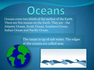
The vast world ocean Geography of the Oceans • Earth is often referred to as the blue planet. • 71 % (360 M km2) of Earth’s surface is represented by oceans and marginal seas; seas around the ocean’s margin like Mediterranean and Caribbean sea. • Continents and islands comprise the remaining 29%; (150 M km2 ) • The Northern Hemisphere is called the land hemisphere (61% water and 39% is land), and the Southern Hemisphere, the water hemisphere(81%water and 19% is land).
Oceanography Is an interdisciplinary science that draws on the methods and knowledge of biology, chemistry, physics, and geology to study all aspects of the world ocean.
The vast world ocean • Four main ocean basins • Pacific Ocean—The largest and has the greatest depth covering over half oceans area, world’s deepest ~3940m, fit continent areas. • Atlantic Ocean—About half the size of the Pacific and not quite as deep and bounded • Indian Ocean—Slightly smaller than the Atlantic, largely a Southern Hemisphere body • Arctic Ocean—About 7 percent the size of the Pacific and quarter as deep as the rest of the oceans.
Composition of seawater3.5 % by weight of sea water is dissolved minerals termed as “Salts” • Salinity • Salinity is the total amount of solid material dissolved in water • Typically expressed as a percent • Dissolved substances in seawater are small numbers and therefore expressed in parts per thousand (35‰) • Most of the salt in seawater is sodium chloride (table salt)
Dissolved components in seawater 9 elements are very important in maintaining necessary chemical Environment for life in the sea
Composition of seawater • Sources of sea salts 1. Chemical weathering of rocks on continents; 2.5 billion tons of dissolved delivered by streams. 2. Earth’s interior through volcanic eruptions, through Process called outgassing ~ Major source of water in ocean and atmosphere Cl, Br, S, B • Composition of seawater has been relatively stable for millions of years: • Material is removed just as rapidly as it is added~ withdraw by plants, animals, sediments hydrothermal activity (oceanic ridges).
Composition of seawater • Processes affecting seawater salinity • Primarily due to changes in the water content of the solution. These include: 1. The addition of fresh water due to precipitation, runoff, icebergs melting, and sea-ice melting. 2. The removal of fresh water by evaporationand the formation of sea ice also affect salinity.
* This graph shows the variations in ocean surface temperature (top curve) and surface salinity (lower curve). * Interpreting Diagrams. At which latitudes is sea surface temperature highest? Why?
25-35 N and S Evaporation is high • 35-60 N and S Precipitation is high • Near equator lower salinities prevail. • Open ocean, salinity varies between 33‰ - 38‰ • Some marginal seas (Red sea and Persian gulf), salinity may exceeds 42‰ • Baltic sea in northern Europe’s , salinity is often below 10‰
Temperature and salinity change with depth in the oceans founded by oceanographers: A three-layered structure exists in the open ocean • 1. surface mixed zone: 2%, the warmest –solar energy-wave turbulence varied according to latitude and season of the year • 2. Transition zone:18%, falls abruptly with depth. A layer of rapid temperature change below the zone of mixing is known as the thermocline (200-1000 m). • 3. Deep zone:80%: below 1000m ocean-water temperatures are consistently below 4° C.
The ocean’s layered structure • Salinity variations with depth, correspond to the general three-layered structure described for temperature • A zone of rapidly changing salinity, called the halocline, corresponds to the thermocline
Density Variation with Depth By sampling ocean waters, oceanographers have learned that temperature and salinity—and the water’s resulting density—vary with depth. Figure below shows two graphs of density versus depth. One graph shows the density for low-latitude regions and the other for high-latitude regions. Compare the density curves to the temperature curves. The temperature is the most important factor affecting seawater density. It also shows that temperature is inversely proportional to density.
* When two quantities are inversely proportional, they can be multiplied together to equal a constant. Therefore, if the value of one quantity increases, the value of the other quantity decreases proportionately. * When water temperature increases, its density decreases.
The pycnocline (pycno = density, cline = slope) is the layer of ocean water between about 300 meters and 1000 meters where there is a rapid change of density with depth. A pycnocline presents a significant barrier to mixing between low-density water above and high-density water below. A pycnocline is not present in high latitudes; instead, the water column is about the same density throughout.
Mapping the ocean floor If all water were removed from the ocean basin, a great variety of features would be seen: Chains of volcano, deep canyons, rift valleys and large submarine plateaus Until the 1920s, ocean depths were determined laboriously, by lowering rope until it touched bottom.
Bathymetry—measurement of ocean depths and the charting of the shape or topography of the ocean floor. • Echo sounder (also called sonar, sound navigation and ranging, first device) • Invented in the 1920s • Primary instrument for measuring depth • Depends on reflects sound from ocean floor
Mapping the ocean floor • Sidescan sonar :following WWII by U.S navy for mines. • Multibeam sonar • Employs and array of sound sources and listening devices • Obtains a profile of a narrow strip of seafloor.
Multibeam sonar Fan of sound received by narrowly receivers at different angles “Mowing the lawn”: regularly back-and-forth pattern: 10 km wide with <1m resolution Torpedo-shaped instrument no bathymetric data Both Sidescan and Multibeam sonars obtain an image of narrow swath (رقعة)of sea floor every few seconds,
Measuring the shape of the ocean surface from space • Employs satellites of microwave pulses and equipped with radar altimeters. After compensating for waves, tides, currents, and atmospheric effects: the ocean surface is not perfectly flat, this because gravity attracts water toward regions were massive sea floor feature occur.
Mapping the ocean floor • Three major topographic units of the ocean floor: A. Continental margins (Passive and active) B. Deep-Ocean basin C. Oceanic (mid-ocean) ridge
A.Continental margins • Passive continental margins • Not associated with plate boundaries • Experience little volcanism • Few earthquakes • Found along most coastal area that surround the Atlantic Ocean
Continental margins • Passive continental margins • Features comprising a passive continental margin I. Continental shelf • Flooded extension of the continent and represent 7.5% of ocean area. • Varies greatly in width~ 1500km, 130m depth, gently sloping about 0.1º. • Contains oil and important mineral deposits, source of fishing. 4. Some areas are mantled by extensive glacial deposits during Ice age: Pleistocene. 5. Most consist of thick accumulations of shallow-water sediments (several km thick), particularly during earlier period of coral reef building.
A.Continental margins II. Continental slope 1. Narrow feature and extends to about 20km. 2. Marks the seaward edge of the continental shelf 3. Relatively steep structure: ~5º but may exceed 25º 4. Consists of a thick accumulations of sediments that moved downslope from the continental shelf 5. At the base of the continental slope turbidity currents that follow submarine canyons deposit sediments that forms deep-sea fans 6. Boundary between continental crust and oceanic crust
Continental margins • Submarine canyons and turbidity currents • Submarine canyons • Deep, steep-sided valleys cut into the continental slope • Some are seaward extensions of river valleys • Most appear to have been eroded by turbidity currents
Continental margins III. Continental rise • Found in regions where trenches are absent: 20 km width and may extend to hundred km into the deep-ocean basin. • Continental slope merges into a more gradual incline—The continental rise: slope drops to about 0.3º
Continental margins • Turbidity currents: originate along the continental slope and continue across the continental rise • Downslope movements of dense, sediment-laden water • Created when sand and mud are dislodged and thrown into suspension • Because mud-chocked water is denser than normal seawater , it flows downslope as a mass, eroding and accumulating more sediments as it goes • Deposits are called turbidites: coarse sand sediment dropped at the base first, then followed by successively finer silt and clay
Continental margins • Active continental margins • Continental slope descends abruptly into a deep-ocean trench, here the continental margin is very narrow , the trench may lie 50km offshore. • Located primarily around the Pacific Ocean • Accumulations of deformed sediment and scraps of ocean crust form accretionary wedges. • Some subduction zones have little or no accumulation of sediments : ocean sediments are being carried into the mantle with subducting plate.
Deep-ocean trenches • Long, relatively narrow features • Deepest parts of ocean:11022m the deepest at Mariana trench • Most are located in the Pacific Ocean • Sites where moving lithospheric plates plunge into the mantle • Associated with volcanic activity • Volcanic islands arcs • Continental volcanic arcs
B. Deep-ocean basin • Abyssal plains • Likely the most level places on Earth • Sites of thick accumulations of sediment: transported sediments coming from turbidity current • Found in all oceans: Atlantic ocean has fewer trenches, so it has more extensive abyssal plains than does the pacific • Seamounts and guyots • Isolated volcanic peaks (conical steep sided and hundred of meters high) • Many form near oceanic ridges and the greatest number found in the Pacific. • May emerge as an island • May sink and form flat-topped seamounts called guyotsor tablemounts: Some of the volcanoes are eroded to near sea level by water wave action and over millions of years it sink as moving plate carry them away where they originated
C. Mid-ocean ridge: developed at divergent plate boundaries forming a broad linear swell called oceanic ridge, or mid-ocean ridge Characterized by: • An elevated position • Extensive faulting • Numerous volcanic structures that have developed on newly formed crust • Interconnected ridge system is the longest topographic feature on Earth’s surface: Over 70,000 kilometers in length • Representing 23 % of Earth’s surface • Winds through all major oceans similar to the seam on baseball and have a widths from 1000 to 4000 km ~half area of ocean floor. • Along the axis of some segments are deep downfaulted forming structures called rift valleys, this ridge is segmented by large transform faults.
Features associated with rift valleys: • active volcanoes, recent underwater lava flows, and hydrothermal vent (black smokers). • Consist of layer upon layer of basaltic rocks that have been faulted and uplifted ~ 2-3 km high • Mid-Atlantic Ridge has been studied more thoroughly than any other ridge system ~ the submerged structures standing 2500-3000 m
Seafloor sediments • Ocean floor is mantled with sediment • Sources • Turbidity currents • Sediment that slowly settles to the bottom from above • Thickness varies • Thickest in trenches—Accumulations may approach 10 kilometers
Seafloor sediments • Thickness varies • Pacific Ocean—About 600 meters or less • Atlantic Ocean—From 500 – 1000 meters thick • Mud is the most common sediment on the deep-ocean floor , Sand-sized sediments are found also.
Seafloor sediments • Types of seafloor sediments They are of 3 types and categorized according to their origin, but all are found as mixtures. 1. Terrigenous sediment • Material weathered from continental rocks and transported to the ocean • Virtually every part of the ocean receives some terrigenous sediments, the coarse sand and gravel settle near shore, whereas fine sediments take years to settle to ocean floor (1cm of abyssal clay layer requires 50,000yrs). • Fine particles remain suspended for a long time and chemical reaction occurs such as Oxidation often produces red and brown colored sediments (rust)