Download
1 / 29
290 likes | 380 Vues
Dive into the life cycle of a satellite mission in vivid images, showcasing the complexities of calibration & validation. Learn why investing in satellites is vital to studying global oceans, illustrated through the journey of NASA-funded scientists. Follow the development, testing, launch, and data processing phases of a satellite project, highlighting the challenges and rewards of such endeavors. Discover the critical role of fieldwork in refining instrument requirements and improving data quality for comprehensive oceanic studies. With perseverance and collaboration, achieving satellite mission success is within reach!

E N D
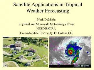
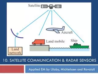
The life cycle of a satellite mission in pictures – Or, why you need a strong calibration & validation program Ocean Optics Class University of Maine July 2011
Because it’s hard to sample the global oceans on boats, buoys, & drifters … bio-optical data collected by NASA-funded scientists during the MODIS-Aqua era
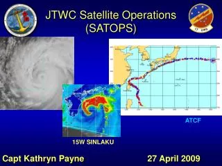
Most ocean color satellites sample the full globe every two days! MODIS-Aqua observations for one day (1 February 2008)
Chesapeake Bay Program Even if you only care about a small patch of ocean …
Chesapeake Bay Program Satellites offer routine synoptic views.
Chesapeake Bay Program And provide wonderfully complementary data streams! complementary data streams
So, how does one build a satellite flight project & complementary calibration / validation team?
You develop this idea, nurture it in collaboration with scientists & engineers, then pitch it to the powers-that-be.
Let’s say the powers-that-be like your idea & can help finance its development. You start hosting meetings to review your instrument concept … Lots & lots of meetings.
depth latitude longitude But life is only partially run in powerpoint. Field work also provides critical insight into instrument requirements.
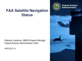
If you’re lucky, the powers-that-be might even let it fly on a real spacecraft mission …
If the instrument passes all of its tests, it’s time to find a ride into space. Chances are, this isn’t near where you live.
You start holding your breath as the instrument reaches the launch pad …
How about now? Did I mention that 10-yrs have passed, 1000’s of man-hours expended, & $100M’s been spent since you first came up with your idea? http://www.youtube.com/watch?v=WY00J_PgeYc http://www.youtube.com/watch?v=sYHh8C8Kcrk
Sorry, you’re not even close to done. First, you discover that your absolute laboratory calibrations are a little off …
depth latitude longitude Field work support many of these post-launch activities.
Ultimately, with the proper investment of time, energy, money, collaborative efforts & other resources, you can achieve this … which is pretty cool.