Water Cycle and Watersheds
290 likes | 478 Vues
Water Cycle and Watersheds. Mr. Brian Oram, PG Professional Geologist, PASEO, Licensed Well Driller Lab Director, Center for Environmental Quality Wilkes University GeoEnvironmental Sciences and Environmental Engineering Department Wilkes Barre, PA 18766

Water Cycle and Watersheds
E N D
Presentation Transcript
Water Cycle and Watersheds Mr. Brian Oram, PG Professional Geologist, PASEO, Licensed Well Driller Lab Director, Center for Environmental Quality Wilkes University GeoEnvironmental Sciences and Environmental Engineering Department Wilkes Barre, PA 18766 http://www.wilkes.eduhttp://www.water-research.net
Center for Environmental Quality Non-profit/ equal opportunity employer, is operated and managed, within the GeoEnvironmental Sciences and Engineering Department Outreach Programs • Environmental and Professional Education and Training • Applied Research • Community and Business Outreach Programs Website: http://www.water-research.net
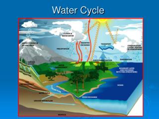
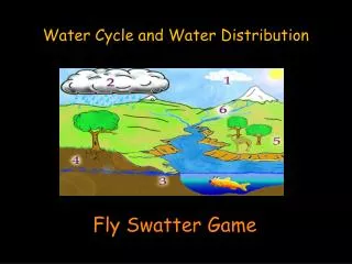
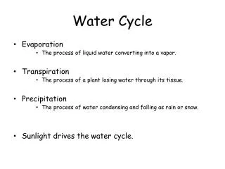
water cycle Components of the Water Cycle First The InsSolar Energy InputPrecipitationCondensationWell InjectionIrrigation The OutsEvaporationTranspirationInfiltrationPercolationRunoffGroundwater FlowSurfacewater FlowWell Pumping
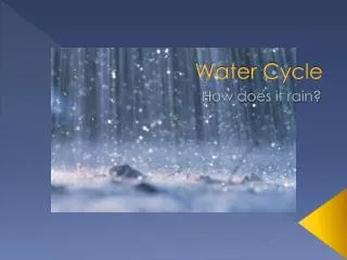
Precipitation Types of PrecipitationNatural RainSnow Ice Hail Condensation/ Dew Man-MadeIrrigationWastewater Applications
InterceptionInfiltration / Percolation Infiltration Percolation Infiltration- Movement Water Into SoilPercolation - Water Movement Throughthe Soil Canopy Interception
Evaporation / TranspirationEvapotranspiration Evaporation- Driven by Thermal Gradient and Moisture Difference Stomata
Runoff / Overland Flow Low Infiltration Causes - Overland Flow- Loss Organic Material Uncontrolled RunoffCauses Erosion When Rainfall Rate Exceeds Infiltration Runoff is Generated
Groundwater Flow and Aquifers UnconfinedAquifer ConfinedAquifer
Surface Water & GroundwaterThey Are Related and Connected ! Local Water Divide
Induced Recharge or Artificial Discharge Artificial Recharge- Septic Systems Pumping Well - Artificial Discharge
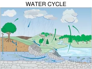
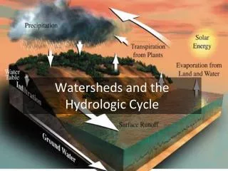
What is a Watershed? The simple definitionIt's the area of land that catches rain and snow and drains or seeps into a marsh, stream, river, lake or groundwater. Right Now Your Sitting In a Watershed ! They cross county, state, and national boundaries(This is the challenge !)
Non Point Source Pollution Non-point source (NPS) pollution, unlike pollution from industrial and sewage treatment plants, comes from many diffuse sources. NPS pollution is caused by rainfall or snowmelt moving over and through the ground. As the runoff moves, it picks up and carries away natural and human-made pollutants, finally depositing them into lakes, rivers, wetlands, coastal waters, and even our underground sources of drinking water.
Sources of Non-Point Pollution Excess fertilizers, herbicides, and insecticides from agricultural lands and residential areas; Oil, grease, and toxic chemicals; Sediment from improperly managed construction sites, crop and forest lands, and eroding streambanks; Bacteria and nutrients from livestock, pet wastes, urban runoff and faulty septic systems; and Atmospheric deposition and hydromodification are also sources of non-point source pollution. We are Still the Largest Source of Oil Pollution to the Environment !
Sources of Pollution Causes of Contamination Improper Waste DisposalImproper Well ConstructionPoor Site SelectionWells Not Properly AbandonedImproper Waste StorageLack of Information on Hazardous Sites or Activities (Partial Listing)
Groundwater Moves 1. Which ways can groundwater move?a. Upb. Downc. Sidewaysd. All of the above 1. d. All of the aboveAlthough most movement is lateral (sideways), it can move straight up or down. Groundwater simply follows the path of least resistance by moving from higher pressure zones to lower pressure zones.
Groundwater Moves 2. How is the speed of groundwater movement measured?a. Feet per dayb. Feet per weekc. Feet per monthd. Feet per year 2. d. Feet per yearGroundwater movement is usually measured in feet per year. This is why a pollutant that enters groundwater requires many years before it purifies itself or is carried to a monitored well.
Groundwater Moves 3. How is stream flow usually measured?a. Feet per secondb. Feet per minutec. Feet per hourd. Yards per hour 3. a. Feet per secondWater flow in streams/rivers is measured in feet per second.
Groundwater Moves 4. What determines how fast groundwater moves?a. Temperatureb. Air pressurec. Depth of water tabled. Size of materials 4. d. Size of materialsCoarse materials like sand and gravel allow water to move rapidly. (They also form excellent aquifers because of their holding capacity.) In contrast, fine-grained materials, like clay or shale, are very difficult for water to move through. Thus, water moves very, very slowly in these materials.
Groundwater Moves 5. Can the water table elevation change often?a. Yesb. No 5. a. YesWater table elevations often fluctuate because of recharge and discharge variations. They generally peak in the winter and spring due to recharge from rains and snow melt. Throughout the summer the water table commonly declines due to evaporation, uptake by plants (transpiration), increased public use, industrial use, and crop, golf course and lawn irrigation. Elevations commonly reach their lowest point in early fall.
Groundwater Moves 6. Does aquifer storage capacity vary?a. Yesb. No6. a. YesJust like the water level in rivers and streams, the amount of water in the groundwater supply can vary due to seasonal, weather, use and other factors.
Water Cycle and Watersheds Mr. Brian Oram, PG Professional Geologist, PASEO, Licensed Well Driller Lab Director, Center for Environmental Quality Wilkes University GeoEnvironmental Sciences and Environmental Engineering Department Wilkes Barre, PA 18766 http://www.wilkes.eduhttp://www.water-research.net