
Efficient GIS Data Searching and Importing Methods
Learn about various methods and tools to efficiently find and import GIS data sets, including web search engines, NSDI Geospatial Data Clearinghouse, USGS GeoData site, and more.

Efficient GIS Data Searching and Importing Methods
E N D
Presentation Transcript
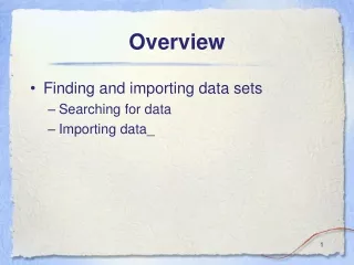
Overview • Finding and importing data sets • Searching for data • Importing data_
Overview • Searching for data • Web search engines • NSDI Geospatial Data Clearinghouse • USGS GeoData site • The Geography Network • University of Washington Map Library Geospatial Data Archive (WAGDA) • GIS Data Depot
Overview • Searching for data • Web search engines • NSDI Geospatial Data Clearinghouse • USGS GeoData site • The Geography Network • University of Washington Map Library Geospatial Data Archive (WAGDA) • GIS Data Depot
Searching for data: Web search engines • Primary method for searching for general data on the net • (+) Keyword searching • (+) Logical parsing of searches • (+) Search is far and wide • (+) Possible to use meta-searchers • (+) Graphical results • (–) Low precision_
Searching for data: Web search engines • Search for “GIS & data” results are fairly good
Searching for data: Web search engines • Search for “GIS & data & Washington” results are NOT good
Searching for data: Web search engines • Why are web search engines not the best tool for searching GIS data? • Search engine indexes are created by “spiders” • Spiders only find and index keywords, not meaning • Searching for keywords is not efficient • Too many erroneous matches • Not a true database query • No spatial coordinates in normal search engines • Too many dead ends and broken links • No standard format for searching various engines_
Overview • Searching for data • Web search engines • NSDI Geospatial Data Clearinghouse • USGS GeoData site • The Geography Network • University of Washington Map Library Geospatial Data Archive (WAGDA) • GIS Data Depot
Searching for data: NSDI • Better/more efficient methods are needed for obtaining GIS data • Federal Geospatial Data Committee (FGDC) • Federal agency with mission to increase access/use of geospatial data • National Spatial Data Infrastructure ( NSDI) • Coordinated effort among many participants_
Searching for data: NSDI GDC • NSDI Geospatial Data Clearinghouse • Built on a distributed database • Database is Z39.50 compliant (international library standard) • Queries are run against specific fields rather than as simple keywords • Fields are specifically for geospatial data description
Searching for data: NSDI GDC • Specific GDC server network built on top of the Network • Use of common search engine • Metadata (“data about data” = data description files) are the keystone_
Searching for data: NSDI GDC: Metadata • Content-standardized metadata is the foundation of a robust searching tool • Records for individual data sets contain data for specific fields, e.g., • Title • Abstract • Spatial extent, projection, coordinate system • Data type • Currency of time scale • Source scale • Developer/Contact information_
Searching for data: NSDI GDC: Indexed databases • Metadata records are indexed into international library standard (“Z39.50 protocol”) databases • Specific sites containing indexes (nodes) are registered with search server sites • Searching functions are embedded in web interfaces • Searches can be limited to individual nodes or to many nodes • Databases are searchable across TCP/IP networks (web, simple terminal) • Results are displayed in web pages_
Searching for data: NSDI GDC: Searching • Search by place name or geographic location
Searching for data: NSDI GDC: Searching • Search by time period or various other fields
Searching for data: NSDI GDC: Searching • Select node to search
Searching for data: NSDI GDC: Results • Number of hits is displayed
Searching for data: NSDI GDC: Results • Individual record titles can be viewed
Searching for data: NSDI GDC: Results • Individual records can be read
Searching for data: NSDI GDC: Results • Distribution information is always included
Searching for data: NSDI GDC: Results • Drawbacks: • Content is not up to date • Metadata records have no requirement to provide actual data sets! • Links may be bad_
Overview • Searching for data • Web search engines • NSDI Geospatial Data Clearinghouse • USGS GeoData site • The Geography Network • University of Washington Map Library Geospatial Data Archive (WAGDA) • GIS Data Depot
Searching for data: USGS GeoData site • A tremendous amount of data area available for “free” • Data sets representing USGS topographic quadrangles • Data from paper maps converted to digital format • DEM (raster elevation) data • Vector data for a variety of themes • Variety of source scales_
Searching for data: USGS GeoData site • 7.5’ (1:24,000) topographic quadrangle vector data series
Searching for data: USGS GeoData site: Downloading • Interactive searching
Searching for data: USGS GeoData site: Downloading • Interactive searching
Searching for data: USGS GeoData site: Downloading • Interactive searching
Searching for data: USGS GeoData site: Downloading • Individual files for a quad can be downloaded
Individual files for a quad • Available files are listed
Overview • Searching for data • Web search engines • NSDI Geospatial Data Clearinghouse • USGS GeoData site • The Geography Network • University of Washington Map Library Geospatial Data Archive (WAGDA) • GIS Data Depot
The Geography Network • The Geography Network • Server network built on ESRI technology • Searchable • Some data available for download • Some free • Some at a cost • Much “live” data
The Geography Network • Searching
The Geography Network • Using “live” data from the Geography Network
Overview • Searching for data • Web search engines • NSDI Geospatial Data Clearinghouse • USGS GeoData site • The Geography Network • University of Washington Map Library Geospatial Data Archive (WAGDA) • GIS Data Depot
Searching for data: University of Washington Map Library Geospatial Data Archive • wagda.lib.washington.edu • Staffed by “GIS Librarians” • Should be your first stop when searching for GIS data • Depository library • Suzzallo Library basement • Data repository for Washington and PNW data • On-line and off-line data sets • City of Seattle GIS database • 10 m USGS DEMs • Large collection of paper maps & aerial photos_
Searching for data: WAGDA Web page • Main WAGDA site
Searching for data: WAGDA Web page • Geospatial data for the Northwest
Files on WAGDA • Example: Seattle data
Files on WAGDA • Example: Seattle data
Overview • Searching for data • Web search engines • NSDI Geospatial Data Clearinghouse • USGS GeoData site • The Geography Network • University of Washington Map Library Geospatial Data Archive • GIS Data Depot
GIS Data Depot • GIS Data Depot: • www.gisdatadepot.com • Lots of free data • US data • Worldwide data • Official source for USGS DEM data sets
GIS Data Depot • GIS Data Depot
GIS Data Depot • GIS Data Depot
Overview • Importing data • ArcInfo interchange file • ArcInfo generate file • Spatial Data Transfer Standard (SDTS) files • USGS DEM (raster) data • USGS DLG (vector) data • DRG_
Overview • Importing data • ArcInfo interchange file • ArcInfo generate file • Spatial Data Transfer Standard (SDTS) files • USGS DEM (raster) data • USGS DLG (vector) data_ • DRG_
Importing data: ArcInfo interchange file • ArcInfo has been a leading software • Very common file format for movement of data • Known as “interchange,” “export,” or “E00” file • Solves ArcInfo file system problem for data sharing • Easy to transfer from machine to machine or across file system; easy to distribute via the Network • Can be imported to ArcMap
some of these files are associated with this data set Importing data: ArcInfo file structure • Distributed file layout of ArcInfo coverage
Importing data: ArcInfo file structure • Problematic file structure for file management • Directories for ArcInfo data sets cannot be altered, copied, or moved arbitrarily • Interchange file “packages” the coverage directory and info files into a single file_ • Interchange file can be copied or moved and then imported • Importing recreates original file structure_


