Understanding Geostrophic Wind-Driven Circulation and Its Oceanic Impacts
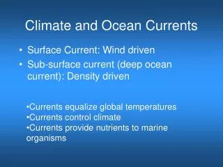
This article explores the intricacies of geostrophic circulation under the influence of surface winds, focusing on the Ekman spiral and its impact on ocean currents. It discusses the formation of gyres, both in the Atlantic and Pacific Oceans, and examines the significance of boundary currents like the Gulf Stream and their role in heat and mass transport. Additionally, the article highlights the phenomenon of upwelling, particularly in coastal regions, and the critical role of ocean currents in influencing climate and marine ecosystems.

Understanding Geostrophic Wind-Driven Circulation and Its Oceanic Impacts
E N D
Presentation Transcript
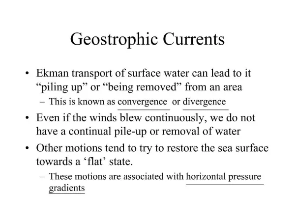
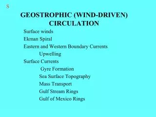
S GEOSTROPHIC (WIND-DRIVEN) CIRCULATION Surface winds Ekman Spiral Eastern and Western Boundary Currents Upwelling Surface Currents Gyre Formation Sea Surface Topography Mass Transport Gulf Stream Rings Gulf of Mexico Rings
P Ocean currents and climate ZONAL ISOTHERMS Fig. 7-8a
S SURFACE WINDS
P Basically zonal
S Measuring surface currents Fig. 7.2
S EKMAN SPIRAL
P Ekman spiral • Surface currents move at angle to wind • Ekman spiral describes speed and direction of seawater flow at different depths • Each successive layer moves increasingly to right (N hemisphere) Fig. 7.5
P Ekman transport • Average movement of seawater under influence of wind • 90o to right of wind in Northern hemisphere • 90o to left of wind in Southern hemisphere Fig. 7.6
S SURFACE CURRENTS
P orange arrows = wind yellow arrows = water
P Ocean gyres • Subtropical gyres • Centered about 30o N or S • Equatorial current • Western Boundary currents • Northern or Southern Boundary currents • Eastern Boundary currents Fig. 7.3
P Other surface currents • Equatorial Countercurrents • Subpolar gyres Fig. 7.4
S Zonal Currents (E-W)Boundary Currents (~N-S)
S BOUNDARY CURRENTS
PP > 2 knots < 2 knots
P Atlantic Ocean circulation • North Atlantic Subtropical Gyre • North Equatorial Current • Gulf Stream • North Atlantic Current • Canary Current • South Equatorial Current • Atlantic Equatorial Counter Current
P Atlantic Ocean circulation • South Atlantic Subtropical Gyre • Brazil Current • Antarctic Circumpolar Current • Benguela Current • South Equatorial Current Fig. 7.14
S UPWELLING
07_12a-c S
P Coastal upwelling • Ekman transport moves surface seawater offshore (upwelling) Fig. 7.11a
P Other surface currents • Equatorial Countercurrents • Subpolar gyres Fig. 7.4
P Low concentrations except in equatorial Pacific and high latitudes at the surface
S 502 10/22 GULF STREAM RINGS
P Rings, or eddies, are important because they transfer heat, salt, plants and animals across strong boundaries.
P Gulf Stream • Best studied • Meanders or loops • Warm-core rings • Cold-core rings • Unique biological populations Fig. 7.16
S Cold-core Rings
S GULF OF MEXICO RINGS
S 504 10/24 GYRE FORMATION
PP North Atlantic Gyre South Atlantic Gyre
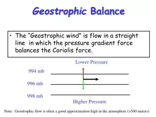
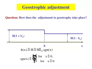
P Geostrophic flow • Ekman transport piles up water within subtropical gyres • Surface water flows downhill (gravity) and • Also to the right (Coriolis effect) • Balance of downhill and to the right causes geostrophic flow around the “hill” Fig. 7.7
P Western intensification • Top of hill of water displaced toward west due to Earth’s rotation • Western boundary currents intensified • Faster • Narrower • Deeper