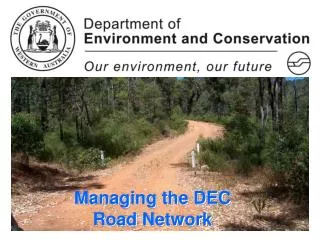
Managing the DEC Road Network
170 likes | 304 Vues
Managing the DEC Road Network. DEC Overview. Core function is Land Management responsible for 27,308,451ha Roads provide access throughout State Forest, National Parks and Reserves, Leases, an estimated 70,000km network.

Managing the DEC Road Network
E N D
Presentation Transcript
DEC Overview • Core function is Land Management responsible for 27,308,451ha • Roads provide access throughout State Forest, National Parks and Reserves, Leases, an estimated 70,000km network. • Access is not always necessary, therefore some roads are no longer maintained and becomes naturally relegated
DEC Southwest Region 4724km of which 1393 paved
Two DEC Road Centerline DB’s • Basic Map producing data, similar to Landgates but with little attributes • New raw road centerline data captured during inventory of Strategic Roads, fully attributed and linked to ROMAN data Neither have been compared or amalgamated at this stage due to verification of position, names and extents
DEC Road Data • Information Management Branch (IMB) maintain spatial datasets for DEC including roads, landform, land use, vegetation, • Responsible for spatial products such as ESD, COG etc using ESRI and Microstation programs • Currently in negotiations with Landgate for access to maintain single database CALM OPERATIONS GRAPHIC (COG) Image
IMB Road Dataset History • Dataset originally from DOLA and value added through DAP in late 1980’s • Now forms the basis to all map products • No extents or road names assigned • Simple classification applied - Sealed,<> 6m, etc • Dataset is maintained on request or during projects such as the ESD as its just too big • Data is updated a as desktop exercise using ortho’s etc, not inspectedin the field
Strategic Roads Initiative • 2001, DEC responded to High Court decision to abolish the non-feasance rule • Adopted a modified version of the ROMAN asset management system • Introduced a Road Classification System using additional fields to categorize the network.
Phase 1 - Inventory • Managers nominated roads to be collected • Roads were classified either: • Strategic, Non-Strategic • Four wheel drive, Two wheel drive • Public, Industry or DEC • Commenced the inventory of 40 000km of roads in 2004 and was completed last Tuesday
Strategic Roads Initiative Data (SRD) • All data is now available in ROMAN for the entire road network • Other information such as Speed environment and safety hazards and remedial recommendations have been recorded • Raw road centerline data for roads collected (DGPS <1m)
Phase 2 – Data verification and maintenance • 2 Datasets, - ROMAN information for asset mgnt, Microsoft Access DB - Raw road centerline data Both datasets require access by regional staff for validation and maintenance, one affecting the other. • DEC requires a system which has multi-user access and is more spatially orientated
ROMAN 2 ?? • Functionality appears suitable for DEC requirements • Regional staff and other users (FPC) have access to spatially represented road information for verification and maintenance of data • DEC have a system to prioritise and fund regional works programs • Data can be accessed by MRWA for shared asset management, eg bridges etc
Spatial Data Maintenance ChallengeScenario 1 • Regional staff using ROMAN 2 alter road alignment during asphalt upgrade and extend original road extent • Spatial alignment and new ROMAN road attributes are submitted in ROMAN 2 • This data flows through to MRWA, this information needs to flow on to Landgate • Should the spatial data be delivered to Landgate from MRWA or fed from DEC??
Outcomes for a RRN • Classified and attributed road centerline for DEC network • ‘posted’ speed zones or speed environments avaiable • Developing a RAV network for the southwest • ROMAN 2 system proposed to broadcast road closure, detour, etc
Current Projects • Reviewing the current classification with associated operational guidelines and CoP’s • Finding a suitable database that meets corporate and user outputs • Clean up of the raw centerline data • Compiling a comprehensive bridge database with MRWA • Determining a Class 1/2/3 RAV network with MRWA • Using Network Analyst to undertake time mapping with downgrade of roads/bridges for funding case
Surveyed roads need to be verified • Many surveyed roads have deviated from the original alignments nominated by the regions and districts • Some additional roads have been added on the day of the road survey • These roads need to be verified by regional staff • Some roads may be taken off the final cut of data Surveyed Road Nominated Road
Some roads captured in multiple sections(due to other roads intersecting the surveyed road) Bevan Road