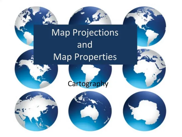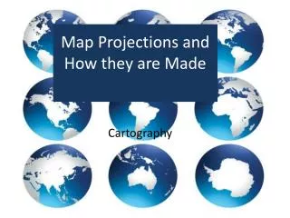
Map Projections and How they are Made
740 likes | 1.01k Vues
Map Projections and How they are Made. Cartography. Additional Study. Map Projections: http://geology.isu.edu/geostac/Field_Exercise/topomaps/map_proj.htm Round Earth, Flat Maps: http://www.nationalgeographic.com/features/2000/exploration/projections/. Map Projection: From Globe to Map.

Map Projections and How they are Made
E N D
Presentation Transcript
Map Projections and How they are Made Cartography
Additional Study Map Projections: http://geology.isu.edu/geostac/Field_Exercise/topomaps/map_proj.htm Round Earth, Flat Maps: http://www.nationalgeographic.com/features/2000/exploration/projections/
Map Projection: From Globe to Map A map projection is used to portray all or part of the round Earth on a flat surface. This cannot be done without some distortion.
Map Projection: From Globe to Map Every flat map misrepresents the surface of the Earth in some way. No map can rival a globe in truly representing the surface of the entire Earth. However, a map or parts of a map can show one or more—but never all—of the following: True directions True distances True areas True shapes
Types of Map Projections Map Properties . • Useful map properties: • preserving distances (equidistance) • preserving directions • preserving shape (conformality) • preserving area(equal area)
Types of Map Projections Map Properties What is the largest continent? Most people would say Antarctica. But is it? See Continents by Land Area.
Countries Arguing Over Maps Mercator Shapes Conformal vs Peters Size Equal-Area vs vs
Conformal MapsPreserving shapeMeridians and Parallels intersect at right angle • Conformal Maps • When the scale of a map at any point on the map is the same in any direction, the projection is conformal. Meridians (lines of longitude) and parallels (lines of latitude) intersect at right angles. Shape is preserved locally on conformal maps.
Conformal MapsPreserving shapeMeridians and Parallels intersect at right angle Famous Conformal Maps Mercator, Transverse, Oblique Mercator
Equal-Area ProjectionPreserving areaMapped areas have the same proportional relationship to the areas on Earth Equal Area Eckert IV and Eckert VI,
Equal-Area ProjectionPreserving areaMapped areas have the same proportional relationship to the areas on Earth • Different map projections result in different spatial relationships between regions.
Equal-Area ProjectionPreserving areaMapped areas have the same proportional relationship to the areas on Earth
Map Projection: From Globe to Map A map projection is used to portray all or part of the round Earth on a flat surface. This cannot be done without some distortion.
Equidistant Map An equidistant map projection correctly represents distances. Distance between two points are preserved. Distances and directions to all places are true only from the center point of projection. Distances are correct between points along straight lines through the center. All other distances are incorrect. Distortion of areas and shapes increases dramatically, the further away one gets from center point.
Equidistant MapDistances are true only from the center point of the projection Equidistant: Azimuthal Map, Miller’s Cylindrical Projection, Equidistant Conic Projections
Equidistant MapDistances are true only from the center point of the projection In this class we will study the Equidistant Azimuthal Map
Equidistant MapDistances are true only from the center point of the projection Equidistant Cylindrical Map
Equidistant MapDistances are true only from the center point of the projection Equidistant: Equidistant Conic Projections
Flat-plane ProjectionAzimuthal Another map projection called an Azimuthal Map, is a flat-plane projection. It is very accurate where the 'paper touches the Earth‘. There are no distortions, here. But the further the 'paper' is away from the surface of the Earth the greater distortions.
Flat-plane ProjectionAzimuthal Math: http://mathworld.wolfram.com/AzimuthalEquidistantProjection.html http://blogs.esri.com/support/blogs/mappingcenter/archive/2010/09/16/map-projection-animations.aspx
Flat-plane ProjectionAzimuthal • Some widely used azimuthal projections are • Equidistant azimuthal projection • Gnomonic projection • Lambert equal-area azimuthal projection • Orthographic projection • Stereographic projection • Universal polar stereographic projection
Azimuthal Projections Azimuthal orthographic map with great circle passing through Campinas, Brazil and Tokyo, Japan
Equidistant MapDistances are true only from the center point of the projection Equidistant: Equidistant Azimuthal Projection Distances and directions to all places are true only from the center point of projection. Distances are correct between points along straight lines through the center. All other distances are incorrect. Distortion of areas and shapes increases dramatically, the further away one gets from center point. This is a great projection for preserving area but get outside the center and shapes become badly distorted.
Azimuthal Equidistant In the north polar aspect, the azimuthal equidistant is familiar as part of both flag and emblem of the United Nations Organization, with olive branches replacing Antarctica. Equal-area – no Equidistant – yes Conformal - no
Azimuthal Equidistant Azimuthal Projection • Equidistant • Center of map is most accurate • Benefits: • Shows great circle • Distances & direction to all places are true from center point • Disadvantages • Distortion increase as move away from center • Can only show one hemisphere at a time • Uses • Show water currents and wind pattern • Airplane navigation • North and South Pole projections
Preserving area Map Projection: From Globe to Map The earth is round. The challenge of any world map is to represent a round earth on a flat surface. There are literally thousands of map projections. Each has certain strengths and corresponding weaknesses Choosing among them is an exercise in values clarification: you have to decide what's important to you. That is generally determined by the way you intend to use the map.
Conformal Projections A conformal map projection preserves the shape but distorts their size. Gerardus Mercator (1512-1594). Frontispiece to Mercator's Atlas siveCosmographicae, 1585-1595. Courtesy of the Library of Congress, Rare Book Division, Lessing J. Rosenwald Collection. In the 16th-century Mercator made a map to help navigators . His conformal map desired to preserve shapes of land. This Mercator map is a famous conformal projection. Notice the longitude and latitude lines are straight and at right angles.
Conformal Projections A conformal map projection preserves the shape but distorts their size. Conformal map projections - each parallel must cross every meridian at right angles.
Conformal Projections A conformal map projection preserves the shape but distorts their size. Many conformal maps are cylindrical projections.
Conformal Projections A conformal map projection preserves the shape of small areas but distorts their size. Because longitudes and latitudes are curved on a globe, converting them to straight lines will cause distortion in size and shape. What are some benefits of this type of map? What are some distortions of this type of map?
Conformal Projections A conformal map projection preserves the shape of small areas but distorts their size. http://makingmaps.owu.edu/mm/MakingMapsCh05.pdf
Conformal Projections A conformal map projection preserves the shape of small areas but distorts their size. The Mercator projection portrays Greenland as larger than Australia; in actuality, Australia is more than three and a half times larger than Greenland. The mapmaker's dilemma is that you cannot show both shape and size accurately. If you want a true shape for the land masses you will necessarily sacrifice proportionality, i.e., the relative sizes will be distorted.
Conformal Projections A conformal map projection preserves the shape but distorts their size. Greenland is much larger than actual size Greenland appears to be the same size as Africa, yet Africa’s land mass is actually 14x larger.
Conformal Projections A conformal map projection preserves the shape but distorts their size. The Mercator projection creates increasing distortions of size as you move away from the equator.
Conformal Projections A conformal map projection preserves the shape but distorts their size. Equator When the Mercator projection was created, the custom among map-makers was to place the map-maker’s country—in this case, Germany—at the center of the map.
Conformal Projections A conformal map projection preserves the shape but distorts their size. Equator It is common to have Antarctica cropped off, resulting in Equator not being in the middle of the map The Equator is placed 2/3 of the way down the map rather than halfway down. This arrangement depicts Europe as being larger than South America. In reality, South America is almost twice the size of Europe. • Europe is 3.8 million square miles. • South America is 6.9 million square miles.
Conformal Projections A conformal map projection preserves the shape but distorts their size. Alaska is appears to be three times larger than Mexico, although Mexico actually is larger than Alaska. On a Mercator map, Greenland looks larger than China, even though China actually is four times larger than Greenland.
Conformal Projections A conformal map projection preserves the shape but distorts their size. Antarctica is enormously stretched, if it is shown at all. It is common to have Antarctica cropped off, resulting in Equator not being in the middle of the map When Antarctica is not on the map, the equator is not in the center. This places the United States, Europe and Russia as prominent countries.
Conformal Projections A conformal map projection preserves the shape but distorts their size. Northern Hemisphere appears larger than it is Mercator maps seldom extend above the 80°N parallel or below 75°S. Both this apparent shift of the Equator southwards and the areal exaggeration of higher latitudes, which mostly coincide with developed nations, have repeatedly incited disapproval about its supposed bias against the Third World (it was even claimed to aid racial discrimination by promoting a supposed superiority of Europe, the U.S.S.R. or the U.S.A.)
Conformal Projections A conformal map projection preserves the shape but distorts their size. Mercator Shapes Conformal vs. Peters Size Equal-Area vs. vs. What do each of these map convey about developed countries vs. developing countries?
Conformal Projections A conformal map projection preserves the shape but distorts their size. • The North is 18.9 million square miles. • The South is 38.6 million square miles. • The former Soviet Union is 8.7 million square miles. • Africa is 11.6 million square miles.
Conformal Projections A conformal map projection preserves the shape but distorts their size. Peters Map supporters contend: This was convenient, psychologically and practically, through the eras of colonial domination when most of the world powers were European. It suited them to maintain an image of the world with Europe at the center and looking much larger than it really was. Was this conscious or deliberate? Probably not, as most map users probably never realized the Eurocentric bias inherent in their world view.
Conformal Projections A conformal map projection preserves the shape but distorts their size. These distortions pose significant limitations for any use other than navigation. Mercator projections present a surrealistic view of the world that makes them inappropriate choices for use in classrooms or in any application that compares separate regions of the world.
Conformal Projections A conformal map projection preserves the shape but distorts their size. However, in order to keep shapes undistorted… area of land became distorted. But Mercator did not care. His map was to help navigators get from one place to another. He did not intend for this map to be used for anything else. But because some people did not really know their geography they used this map for education. This created generations of misinformed students! This also led to political pride and arguing between countries. Why?
Conformal Projections A conformal map projection preserves the shape but distorts their size. • Benefits: • This map is useful for ship and air navigators because it shows true direction and shape. • Navigators need to know the shortest route across Earth’s surface between two points. Such a path is called a great circle on the globe’s surface. • Distortions: size of land and distances near poles
Conformal Projections A conformal map projection preserves the shape but distorts their size. Cylindrical Projection Mercator Projection • Mercator’s Projection • Cylindrical • Conformal- preserves angles • Parallels and meridians are straight lines intersecting at right angles • Compass directions are maintained • Meridians are equally spaced • Parallel spacing increases with distance from Equator • Benefits: • Preserves angles and shapes • One square inch on the map represents an equal number of square miles anywhere in the world. • Disadvantages • Sizes are increasing distorted at high latitudes • Uses • Navigation , air and marine See the math
Preserving shape locally Conformal Projections A conformal map projection preserves the shape but distorts their size. Mercator's projection (created at a time when navigators were sailing on the oceans in wooden ships, powered by the wind, and navigating by the stars) was particularly useful because straight lines on his projection were lines of constant compass bearing. Today the Mercator projection still remains useful for navigational purposes and is referred to by seafarers and airline pilots. Rarely used in world maps nowadays, except by navigators. Rarely used in teaching geography. But Google Maps needs to be informed! They better learn geography and history!
Preserving area Map Projection: From Globe to Map The earth is round. The challenge of any world map is to represent a round earth on a flat surface. There are literally thousands of map projections. Each has certain strengths and corresponding weaknesses Choosing among them is an exercise in values clarification: you have to decide what's important to you. That is generally determined by the way you intend to use the map.
ECylindrical ProjectionHomolosine Projection“Interrupted Map”