Download
1 / 189
1.89k likes | 1.93k Vues
Discover the allure of gold mining during the California Gold Rush at Sutter's Mill in 1848 and how the Mesozoic Era's Pangaea breakup shaped Earth's history. Uncover the hardships and fortunes of gold prospectors, the technique of gold panning, and the geological impacts of the Mesozoic Era on mineral resources and biotas.

E N D
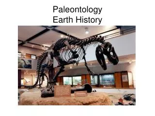
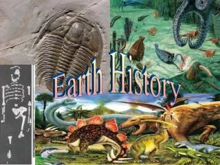
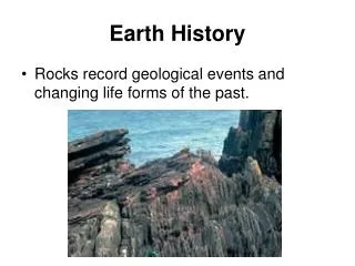
Chapter 14 Mesozoic Earth history
Nevadan Orogeny and Gold • Approximately 150 to 210 million years after • the emplacement of massive plutons created the Sierra Nevada • in the Nevadan orogeny • gold was discovered at Sutter's Mill • on the South Fork of the American River at Coloma, California • On January 24, 1848, James Marshall, • a carpenter building a sawmill for John Sutter, • found bits of the glittering metal in the mill's tailrace
Gold Rush • Soon, settlements throughout the state • were completely abandoned as word • of the chance for instant riches • spread throughout California • Within a year after • the news of the gold discovery reached the East Coast, • the Sutter's Mill area was swarming with more than 80,000 prospectors, • all hoping to make their fortune
Gold Mining • By 1852, • mining operations were well underway • on the American River near Sacramento
Prospecting Was Very Hard Work • In all, at least 250,000 gold seekers • prospected the Sutter's Mill area, • and though most were Americans, • they came from all over the world, • even as far away as China • Most of them thought • the gold was simply waiting to be taken, • and didn't realize that prospecting • was very hard work
Shopowners Made More Money • Of course, no one gave any thought • to the consequences of so many people converging on the Sutter's Mill area, • all intent on making easy money • In fact, life in the mining camps • was extremely hard and expensive • Frequently, the shopowners and traders • made more money than the prospectors
Abandoning Their Dream • In reality, only a small percentage of prospectors • ever hit it big • or were even moderately successful • The rest barely eked out a living • until they eventually abandoned their dream and went home
Placer Gold • The gold these prospectors sought was mostly in the form of placer deposits • Placer deposits form • when gold-bearing igneous rocks weather • Stream transport mechanically separates minerals • by density • Although many prospectors searched for the mother lode, • all of the gold recovered during the gold rush came from placers
Gold Panning • Panning is a common method of mining placer deposits • In this method, • a shallow pan is dipped into a streambed, • the material is swirled around • and the lighter material is poured off • Gold, being about six times heavier • than most sand grains and rock chips, • concentrates on the bottom of the pan • and can then be picked out
$200 million in gold • Although some prospectors • dug $30,000 worth of gold dust a week • out of a single claim • and gold was found practically on the surface • most of this easy gold was recovered • very early during the gold rush • Most prospectors made only a living wage working their claims • Nevertheless, during the five years • from 1848 to 1853 • that constituted the gold rush proper, • miners extracted more than $200 million in gold
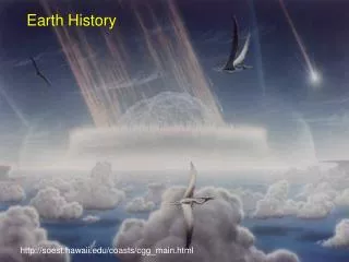
Mesozoic Era • The Mesozoic Era • 245 to 66 million years ago • was an important time in Earth history • The major geologic event • was the breakup of Pangaea, • which affected oceanic and climatic circulation patterns • and influenced the evolution of the terrestrial and marine biotas
Other Mesozoic Events • Other important Mesozoic geologic events • resulting from plate movement • include • the origin of the Atlantic Ocean basin • and the Rocky Mountains • accumulation of vast salt deposits • that eventually formed salt domes • adjacent to which oil and natural gas were trapped • and the emplacement of huge batholiths • accounting for the origin of various mineral resources
The Breakup of Pangaea • Just as the formation of Pangaea • influenced geologic and biologic events • during the Paleozoic, • the breakup of this supercontinent • profoundly affected geologic and biologic events • during the Mesozoic • The movement of continents • affected the global climatic and oceanic regimes • as well as the climates of the individual continents
Effect of the Breakup • Populations became isolated • or were brought into contact • with other populations, • leading to evolutionary changes in the biota • So great was the effect of this breakup • on the world, • that it forms the central theme of this chapter
Progress of the Breakup • The breakup of Pangaea • began with rifting • between Laurasia and Gondwana during the Triassic • By the end of the Triassic, • the expanding Atlantic Ocean • separated North America from Africa • This change was followed • by the rifting of North America from South America • sometime during the Late Triassic and Early Jurassic
Paleogeography of the World • During the Triassic Period
Paleogeography of the World • During the Jurassic Period
Paleogeography of the World • During the Late Cretaceous Period
Oceans Responded to Continental Separation • Separation of the continents • allowed water from the Tethys Sea • to flow into the expanding central Atlantic Ocean, • while Pacific Ocean waters • flowed into the newly formed Gulf of Mexico, • which at that time was little more than a restricted bay • Evaporites formed in these areas
Early Mesozoic Evaporites • Evaporites accumulated in shallow basins • as Pangaea broke apart during the Early Mesozoic • Water from the Tethys Sea flowed into the Central Atlantic Ocean
Early Mesozoic Evaporites • Water from the Pacific Ocean flowed into the the newly formed Gulf of Mexico • Marine water from the south flowed into the area that would eventually become the southern Atlantic Ocean
Evaporite Deposits • During that time, these areas were located • in the low tropical latitudes • where high temperatures • and high rates of evaporation • were ideal for the formation • of thick evaporite deposits
Further Breakup • During the Late Triassic and Jurassic periods, • Antarctica and Australia, • which remained sutured together, • began separating from South America and Africa Also during this time, • India began rifting from the Gondwana continent • During the Jurassic, • South America and Africa began separating
Paleogeography of the World • During the Jurassic Period
Thick Evaporites from the Southern Ocean • The subsequent separation of South America and Africa • formed a narrow basin • where thick evaporite deposits • accumulated from the evaporation • of southern ocean waters
Thick Southern Ocean Evaporites • Marine water flowed into the southern Atlantic Ocean from the south
Tethys Sea • During this time, the western end of the Tethys Sea • began closing toward the east • as a result of the clockwise rotation • of Laurasia and the northward movement of Africa • This narrow Late Jurassic and Cretaceous seaway • between Africa and Europe • was the forerunner • of the present Mediterranean Sea
End of the Cretaceous • By the end of the Cretaceous, • Australia and Antarctica had separated, • India was nearly to the equator, • South America and Africa were widely separated, • and Greenland was essentially an independent landmass
Paleogeography of the World • During the Late Cretaceous Period
Higher Heat Flow Caused Sea Level Rise • A global rise in sea level • during the Cretaceous • resulted in worldwide transgressions • onto the continents • These transgressions were caused • by higher heat flow along the oceanic ridges • due to increased rifting • and the consequent expansion of oceanic crust
Middle Cretaceous Sea Level Was High • By the Middle Cretaceous, • sea level was probably as high • as at any time since the Ordovician, • and approximately one-third of the present land area • was inundated by epeiric seas
Paleogeography of the World • During the Late Cretaceous Period
Final Stage in Pangaea's Breakup • The final stage in Pangaea's breakup • occurred during the Cenozoic • During this time, • Australia continued moving northward, • and Greenland completely separated • from Europe and North America • and formed a separate landmass
The Effects on Global Climates and Ocean Circulation Patterns • By the end of the Permian Period, • Pangaea extended from pole to pole, • covered about one-fourth of Earth's surface, • and was surrounded by Panthalassa, • a global ocean that encompassed about 300 degrees of longitude • Such a configuration exerted tremendous influence • on the world's climate • and resulted in generally arid conditions • over large parts of Pangaea's interior
Paleogeography of the World • For the Late Permian Period
Ocean Currents and Continents • The world's climates result from the complex interaction between • wind and ocean currents • and the location and topography of the continents • In general, dry climates occur • on large landmasses • in areas remote from sources of moisture • and where barriers to moist air exist, • such as mountain ranges • Wet climates occur • near large bodies of water • or where winds can carry moist air over land
Climate-Sensitive Deposits • Past climatic conditions can be inferred from • the distribution of climate-sensitive deposits • Evaporites are deposited • where evaporation exceeds precipitation • While dunes and red beds • may form locally in humid regions, • they are characteristic of arid regions • Coal forms in both warm and cool humid climates • Vegetation that is eventually converted into coal • requires at least a good seasonal water supply • Thus, coal deposits are indicative of humid conditions
Evaporites, Red Beds, Dunes, Coal • Widespread Triassic evaporites, red beds, and desert dunes • in the low and middle latitudes • of North and South America, Europe, and Africa • indicate dry climates in those regions, • while coal deposits • are found mainly in the high latitudes, • indicating humid conditions • These high-latitude coals are analogous to • today's Scottish peat bogs • or Canadian muskeg
Bordering the Tethys Sea • The lands bordering the Tethys Sea • were probably dominated by seasonal monsoon rains • resulting from the warm moist winds • and warm oceanic currents • impinging against the east-facing coast of Pangaea
Global Temperature Gradient • The breakup of Pangaea • during the Late Triassic • caused the global temperature gradient to increase • because the Northern Hemisphere continents • moved farther northward, • displacing higher-latitude ocean waters • Decrease in temperature in the high latitudes • and the changing positions of the continents, • caused the steeper global temperature gradient • Thus, oceanic and atmospheric circulation patterns • greatly accelerated during the Mesozoic
Oceanic Circulation Evolved • From a simple pattern in a single ocean (Panthalassa) with a single continent (Pangaea)
Oceanic Circulation Evolved • to a more complex pattern in the newly formed oceans of the Cretaceous Period
Faster Circulation • The temperature gradient • between the tropics and the poles • also affects oceanic and atmospheric circulation • The greater the temperature difference • between the tropics and the poles, • the steeper the temperature gradient • and the faster the circulation of the oceans and atmosphere
Areas Dominated by Seas Are Warmer • Oceans absorb about 90% of the solar radiation they receive, • while continents absorb only about 50%, • even less if they are snow covered • The rest of the solar radiation is reflected back into space • Therefore, areas dominated by seas are warmer • than those dominated by continents
Oceans Still Quite Warm • By knowing the distribution of continents and ocean basins, • geologists can generally estimate • the average annual temperature • for any region on Earth, • as well as determining a temperature gradient • Though the temperature gradient and seasonality on land • were increasing during the Jurassic and Cretaceous, • the middle- and higher-latitude oceans • were still quite warm
Equable Worldwide Climate • Higher-latitude oceans remained warm • because warm waters from the Tethys Sea • were circulating to the higher latitudes • The result was a relatively equable worldwide climate • through the end of the Cretaceous
The Mesozoic History of North America • In North America, the beginning of the Mesozoic Era • was essentially the same in terms of tectonism and sedimentation • as the preceding Permian Period • Terrestrial sedimentation continued over much of the craton, • while block faulting and igneous activity • began in the Appalachian region • as North America and Africa began separating
Permian Period • Paleogeography of North America during the Permian Period
Triassic Period • Paleogeography of North America during the Triassic Period
Gulf of Mexico • The newly forming Gulf of Mexico • experienced extensive evaporite deposition • during the Late Triassic and Jurassic • as North America separated from South America