The Barbados Cloud Observatory: a first outlook
140 likes | 383 Vues
The Barbados Cloud Observatory: a first outlook. Max-Planck-Institut für Meteorologie Hamburg. Louise Nuijens. Bjorn Stevens, Lutz Hirsch, Friedhelm Jansen, Ilya Serikov, Holger Linne, Bjorn Bruegman and Clara Herer. The Barbados Cloud Observatory. Goal :

The Barbados Cloud Observatory: a first outlook
E N D
Presentation Transcript
The Barbados Cloud Observatory: a first outlook Max-Planck-Institut für MeteorologieHamburg Louise Nuijens Bjorn Stevens, Lutz Hirsch, Friedhelm Jansen, Ilya Serikov, Holger Linne, Bjorn Bruegman and Clara Herer
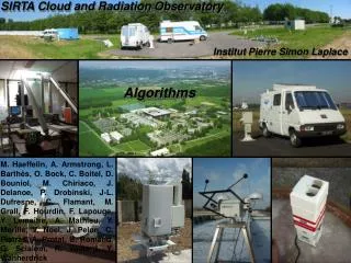
The Barbados Cloud Observatory Goal: to measure statistical properties of clouds, precipitation, aerosol and meteorology within the trades, to help improve our understanding of the behavior of shallow cumulus clouds and their link to our changing climate. Initiative: a joint project of the Max-Planck Institute for Meteorology (MPI-M) and the Caribbean Institute for Meteorology and Hydrology (CIMH) Partners: • Institute for Meteorology and Climate Research, Karlsruhe Institute for Technology • Leibniz Institute for Tropospheric Physics, Dr. Holger Siebert • Remote sensing group of Prof. Susanne Crewell (Univ. of Cologne) • Aerosol group of Prof. Joseph Prospero (Univ. of Miami, Rosenstiel School)
Outline • Location of the site • Measurement strategy and questions • Instrumentation and data products • A first look at data • Outlook and links Location • Strategy and questions • Instrumentation • Data • Outlook and links
Location of the site Ragged Point Deebles Point Location • Strategy and questions • Instrumentation • Data • Outlook and links
Measurement strategy and questions Starting April 2010, the Barbados Cloud Observatory measures 24/7 and will be in operation for two years (at least) with: • Scanning cloud radar: that scans (horizontally) an area upstream of the island at least once each 10 minutes, alternated with periods of vertical profiling. • Vertically pointing lidar, ceilometer, microrain radar: that help characterize the vertical structure of clouds, rain, the aerosol and the atmosphere. Major questions: • What (meteorological) conditions favor certain types of cloudiness? • For days that are meteorologically the same, what is the impact of the aerosol? • At what depth do clouds start to rain? • How does cloudiness change with organization (in the presence of precipitation)? Location • Strategy and questions • Instrumentation • Data • Outlook and links
Instrumentation Ceilometer Ka-band cloud radar (KIT) Location • Strategy and questions • Instrumentation • Data • Outlook and links
Instrumentation Rain gauge, aircraft safety radar Raman lidar All-sky imager cloud camera Micro rain radar Location • Strategy and questions • Instrumentation • Data • Outlook and links
Location • Strategy and questions • Instrumentation • Data • Outlook and links
What do we get (data products)? • Ceilometer (1064 nm, Dr = 15 m): • Height of cloud ‘bases’, aerosol layers (?) • KIT Ka-band cloud radar (37 GHz – 8 mm, Dr = 15 m, rmax = 7.5 km): • Cloud (horizontal/vertical extent, areal coverage) • Vertical profiles of reflectivity, LWC and fall speed (radial velocity), drizzle • Micro rain radar (10 GHz – 3 cm, Dr = 100 m): • Vertical profile of rain (reflectivity) and LWC • Raman “monster” lidar (1064, 532, 255 nm, Dr = 60 m): • Vertical profiles of aerosol and cloud backscatter, extinction • Vertical profiles of water vapor and temperature during night • All-sky imager and camera (Ragged Point) Location • Strategy and questions • Instrumentation • Data • Outlook and links
A first look at data May 9 August 12 Location • Strategy and questions • Instrumentation • Data • Outlook and links
A first look at data August 12 May 9 Location • Strategy and questions • Instrumentation • Data • Outlook and links
What is coming? A quick outlook Instrumentation & data (end of this year *wishful thinking*): • DIAL (differential absorption) water vapor lidar • Ka-band cloud radar with greater scanning abilities, to replace the KIT radar that is on loan • Scanning microwave radiometer (HATPRO - SUNHAT from Univ. Of Cologne) • S-Band precipitation data from CIMH Wish-list: • A wind lidar: vertical profile of wind speed • A pyrheliometer and pyrgeometer: down-welling SW and LW radiation Location • Strategy and questions • Instrumentation • Data • Outlook and links
What is coming? A quick outlook Intensive campaigns and collaborations: • August: collecting dust on Ragged Point (Joe Prospero - Univ. of Miami) • November and Spring: measuring turbulence, aerosol and cloud droplet number concentrations using ACTOS (Holger Siebert – IfT) • Start 2011: involve students at CIMH with the data analysis • … Location • Strategy and questions • Instrumentation • Data • Outlook and links
Links Websites: • MPI – Atmosphaere im Erdsystem – Barbados Initiative: www.mpimet.mpg.de • The Barbados Worldpress Site – a first ‘Wiki’ on instrument and data status with links to images and quicklooks: http://barbadossite.wordpress.com/ Location • Strategy and questions • Instrumentation • Data • Outlook and links