Download
1 / 23
230 likes | 406 Vues
CONSERVATION MANAGEMENT USING INTEGRATED MIST-GIS IN CAMBODIA PROTECTED AREAS. By Sorn Pheakdey, MIST-GIS Database and Training Officer WCS Cambodia Program. ESRI User Conference San Diego, California, USA June 2007. pheakdey.sorn@gmail.com. Presentation Outline.

E N D
CONSERVATION MANAGEMENTUSING INTEGRATED MIST-GIS IN CAMBODIA PROTECTED AREAS By Sorn Pheakdey, MIST-GIS Database and Training Officer WCS Cambodia Program ESRI User Conference San Diego, California, USA June 2007 pheakdey.sorn@gmail.com
Presentation Outline • Protected Area in Cambodia • Protected Area Management in Cambodia • What is MIST-GIS? • How can MIST help in Protected Area Management? • MIST Advantages and Disadvantages! • Conclusion
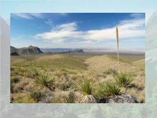
Protected Area in Cambodia *** Covers 47,845Km2or about 26.3% of Cambodia’s land territory
The Species Richness of Wildlife in Cambodia
Protected Area Management in Cambodia Successful Protected Area Management in Cambodia requires: • Research • Law enforcement patrols • Working with local communities • Cooperating Managers need good information about the site and what is happening to inform decisions !!! MIST-GIS
What is MIST-GIS? • A spatial Management Information System (Computer Software link between Database and GIS) • Undergoing development by Ecological Software Solutions since 1997 initially for UWA as part of a GTZ project (http://www.ecostats.com/software/mist) • Designed to: • Provide a simple data entry facility • Store this data • Provide simple, easy to understand reports and maps to help decision-making for protected areas management
Historical use of MIST in Cambodia • Originally adapted for Cambodia by Ministry of Environment – Biodiversity and Protected Areas Management Project since 2003. • Ministry of Environment has recently adopted the use of Ranger-Based Data Collection (and MIST-GIS as a tool to analyses the data). • Now used in 8 protected areas in Cambodia
MIST-GIS Used by WCS Cambodia Program - Patrol data - Checkpoint Patrols data - Wildlife Research - Occasional Observations WCS have used MIST-GIS for:
MIST-GIS How do we implement MIST-GIS? Operation of MIST-GIS requires the following steps: • Create a MIST-GIS Database; • Establish Management teams; • Define the Conservation Management Sector; • Provide appropriate equipment; • MIST database training; and • Law Enforcement Staff training.
How can MIST help Protected Area management? MIST-GIS will not make the decisions for you! • However it will allow you to get quickly & easily access the essential up to date informationabout what happen in Protected Area, especially biodiversity and human activities trend in the area; and • Help manager to make the right decision, plan protection measure, plan the future conservation effort to sustain the conservation project to reach the conservation Goal and Vision.
MIST-GIS GPS Reports MIST-GIS DATA FORM Maps Converting Data into Information DATA INFORMATION
Standard Output Produced By MIST-GIS • Patrol coverage (areas patrolled shown in 1 km² grid cells) • Distribution and number of illegal activities • Distribution and numbers of key wildlife species • Information on patrols (performance indicators) • Illegal activities (indices and numbers) • Key wildlife species (indices, numbers) Maps Reports
Conservation Ranger Report General information on Patrols Information for each staff participating in patrols
MIST Advantages and Disadvantages! Advantages ! Disadvantages ! • Fast and accurate data entry • data download (from GPS) • use of look-up lists and tick boxes for observations • avoid “type-in” mistakes • User-friendly, easily accessible and easy to maintain and up-date database • Easy to use, flexible and powerful tool to improve the effectiveness of management through access to up-to-date information • Currently only available in English language • Data storage and reports can lack detail required by managers, e.g. description of events at particular sites • Doesn’t include sources of information not collected during patrols or surveys e.g. interview reports
Conclusion! MIST-GIS will not make the decisions for you! However it will allow you to get quickly & easily access the essential information you need to make the right decisions. Examples: • Regular up-to-date data on what is happening in the PA • Identify areas requiring a management interventions • Identify core wildlife areas • Plan next months activities • How efficient your patrol teams are • Long-term trends in management activity and wildlife
Acknowledgments • Wildlife Conservation Society, Cambodia Program • Environmental System Research Institute (ESRI), and • Special thanks to SCGIS for granting me the great chance to be here.
Thank you very much indeed for your attention !