Download
1 / 59
590 likes | 765 Vues
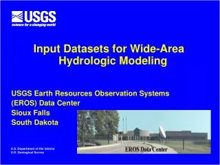
Input Datasets for Wide-Area Hydrologic Modeling USGS Earth Resources Observation Systems (EROS) Data Center Sioux Falls South Dakota. U.S. Department of the Interior U.S. Geological Survey. Famine Early Warning System Network (FEWS NET). U.S. Agency for International Development.

E N D
Input Datasets for Wide-Area Hydrologic Modeling USGS Earth Resources Observation Systems (EROS) Data Center Sioux Falls South Dakota U.S. Department of the Interior U.S. Geological Survey
Famine Early Warning System Network (FEWS NET) U.S. Agency for International Development Foreign Agricultural Service National Aeronautics and Space Administration National Oceanic and Atmospheric Administration U.S. Geological Survey USAID contractor (Chemonics)
FEWS NET Countries in Africa FEWS NET supports data collection and analysis in 17 African countries: Burkina Faso, Chad, Mali, Mauritania, Niger; Eritrea, Ethiopia, Kenya, Rwanda, Somalia, southern.Sudan, Tanzania, Uganda; Malawi, Mozambique, Zambia, and Zimbabwe. On-going USAID restructuring to make FEWS NET a global undertaking
Famine Early Warning System Network (FEWS NET) GLOBAL REGIONAL NEWU DMU MET NATIONAL CSO MoA NEWU Local Gov’t LOCAL MoA HOUSEHOLD INDIVIDUAL horizontal and vertical collaboration in Southern Africa LEVELS
Famine Early Warning System Network (FEWS NET) Monthly food security reports, produced jointly with local institutions
Decision Inputs: • ETA Model Weather Forecast AfricaWeatherHazardsAssessment • Vegetation Index • Rainfall Estimates • WRSI • Soil Water Index • Stream Flow Model • ITCZ Sioux Falls Washington Santa Barbara Participants: NOAA/CPC USGS/EDC NASA/GSFC FEWS NET/ Chemonics UCSB USDA/PECAD Niamey Nairobi Harare edcintl.cr.usgs.gov/adds Weekly Tele-conference www.cpc.ncep.noaa.gov/products/fews/briefing.html
Hydroclimatic update on Lower Juba • During the past week, heavy rains were seen in southern Somalia (lower Juba), increasing the risk of probable flooding along the coastal strip in lower Juba. • The week ending October 29 picked up above 200mm for some areas along the Kenya – Somalia border and specifically in the lower parts of Juba (Slide 2) • These rains will improve the moisture conditions and increase the risk of flooding due to the high runoff generated in the area (Slide 3) • High soil moisture is already generated in the area (Slide 4) • The weather forecast calls for high rainfall in the upper catchments of Juba for the coming week (slide 5)
Key Data Inputs • Daily Rainfall Estimates (RFE) • Quantitative Precipitation Forecasts (QPF) • Daily Potential Evapo-Transpiration (PET) • Digital Elevation Models (DEM) • Soil and Vegetation Digital Map Data
Satellite-based Rainfall Estimation • Began in the early 1990 to support crop monitoring • Initially, computed in 10 day accumulations • Since 1997, computation of daily rainfall estimates
What the Satellite Gives You • A Meteosat Infra-Red Image every 30 minutes • Received less than 5 minutes after it is acquired • Requires a PDUS System for direct reception
Infrared Images Temp. < 235K Cold Clouds How it is converted to a rainfall estimate • IR Digital Counts converted to Cloud Top Temperatures • Temperature Threshold used to classify cold and warm clouds • Cold Clouds accumulated daily to obtain grids of Cold Cloud Duration (CCD) which approximates equal to rainfall duration
Ground observations for Truthing • Daily rain gauge readings collected and distributed through the global telecommunications system (GTS) • 500-1000 stations per day report in Africa
Deriving the final rainfall estimate Daily Rainfall Estimate = Rainfall Intensity * Duration • TAMSAT: • seasonally variable threshold temperature • Seasonally variable rainfall intensity • NOAA RFE: • constant threshold temperatures • daily variations in intensity computed from gauge data
Accessing the data • Africa-wide satellite rainfall estimates computed daily • Archive includes 1998 to present (1995-98 coming soon) • Available for download on the Internet • For current rainfall (less than 14 days old) ftp://edcftp.cr.usgs.gov/pub/edcuser/fewsips/africa/ • For historical rainfall estimates http://www.cpc.ncep.noaa.gov/products/fews/data.html
NESDIS Hydro-Estimator • Began as Auto-Estimator over CONUS • Now global coverage (60S-60N) • Resolution • Temporal: Half-hourly Inst,1,3,6,24 hour • Spatial: 0.05 degree (4km) • Available: 1330-1430 GMT
IR Input Data • All available geostationary half-hourly IR • Pre-determined Z-R Temperature-Rain Rate regression • Uses 10.7 micrometer brightness cloud top temperature • Instantaneous rain rates found • Relative Humidity, Precipitable Water, and storm growth/decay used to scale rain rates
NASA / NASDAJ TRMM • Global coverage (36S-36N) • Resolution • Temporal: ½ to 2 per day daily • Spatial: 0.25 degree (20km) • Available: 0600 GMT
TRMM Details • MPA-RT algorithm Multi Satellite Precipitation Analysis – Real Time • Inputs: • TRMM PR, TMI • Polar orbiter microwave • Geostationary IR
TRMM Instruments • TRMM Microwave Imager • 85 GHz passive microwave radiometer • 760 km swath width • Horizontal resolution: 5 by 7 km • TRMM Precipitation Radar • 13.8 GHz reflectivities (sfc-20 km) • 215 km swatch width
NOAA/CPC CMORPH • Running for around a year • Global coverage from 60S-60N • Resolution • Spatial: 0.1 degree (8km) • Temporal: ½ hour Daily • Available @ 1700-1800 GMT
CMORPH Details • Inputs • SSM/I, AMSUB, IR • Uses half-hourly spatial domain to propagate ~1.5-hourly microwave intensity • Now ‘nearly’ operational
Meteosat Second Generation • Currently at the trial stage • Expected to become operational in Sept 2003 • 15 minute images (as opposed to 30 minutes) • Available at national meteorological services
Historical Rainfall Datasets • Collaborative Historical African Rainfall Model (CHARM) • 30 yr rainfall climatology produced by blending global climate model reanalysis with gauge readings and an orographic model • Daily rainfall grids generated for the period 1961-1996 • Used to generate historical time series of flows for establishing return period flows and for forecast interpretation • Dr Chris Funk, chris@geog.ucsb.edu
Evolving comparison with Satellite Estimates • Overlap between CHARM and RFE still too short for the computation of definitive statistics • CHARM are typically smoother in time and space than RFE
AFWA Quantitative Precipitation Forecasts • AFWA Mesocale Model, MM5 daily • Forecasts accumulated for 24, 48 and 72 hours • Africa-wide forecasts • Spatial Resolution: • Data Availability: ftp://edcftp.cr.usgs.gov/pub/edcuser/fewsips/africa/
ETA Quantitative Precipitation Forecasts • NOAA ETA model • Forecasts for 24, 48 and 72 hours • Limited spatial domain for East, West and South Africa • Spatial Resolution: 32 km grids • Data Availability: ftp://edcftp.cr.usgs.gov/pub/edcuser/fewsips/africa/
Summary of Forecasts • Quantitative Precipitation Forecasting is still an evolving field • Fine resolution models at the continental scale may require over 24 hrs to complete a daily forecast run • Existing continental scale models may fail to capture important events or adequately represent local conditions • Research continues on ways to create hydrologic forecast from qualitative forecasts
Potential Evapo-Transpiration (PET) • Computed daily from Global Data Assimulation System (GDAS) data (generated every 6hrs) • Penman Monteith Equation solved to obtain PET values • Spatial domain: Global • Spatial Resolution: 100 km grids (1o) • Data Availability: ftp://edcftp.cr.usgs.gov/pub/edcuser/fewsips/africa/ • Contact: Ronald Lietzow, lietzow@usgs.gov
Remotely sensed parameters allow basin-wide coverage USGS Global HYDRO1K Datasets
Flow Direction Flow Accumulation Flow Length Hill Length Slope Subbasins and Rivers Subbasin Connectivity Derivatives of USGS 1 km DEM Derived by GIS-based Terrain Analysis
1:5 000 000 1:5 000 000 FAO Digital Soil Map of the World (http://www.fao.org/ag/AGL/agll/dsmw.stm) Data not available for download. CDROM must be purchased from FAO • Water Holding Capacity • Soil Depth • Hydraulic Conductivity • Soil Texture