Download
1 / 25
250 likes | 464 Vues
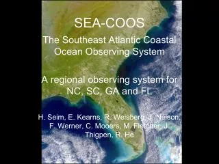
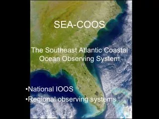
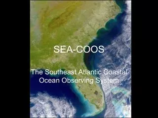
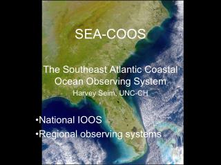
SEA-COOS. The Southeast Atlantic Coastal Ocean Observing System Harvey Seim, UNC-CH National IOOS Regional observing systems. U .S Global Ocean Observing System Steering Committee , formed 1998 – responsible for design of IOOS.

E N D
SEA-COOS The Southeast Atlantic Coastal Ocean Observing System Harvey Seim, UNC-CH National IOOS Regional observing systems
U.S Global Ocean Observing System Steering Committee, formed 1998 – responsible for design of IOOS. • Ocean.US, formed 2000– a component of NOPP – responsible for implementation of IOOS. • A number of reports to Congress have identified the need for • sustained and integrated coastal observations. They will be used to: • detect and forecast climate variability • facilitate safe and efficient marine operations • ensure national security • manage resources for sustainable use • preserve healthy and restore degraded marine ecosystems • mitigate natural hazards, improve weather forecasting • ensure public health • enable sustained marine research
The Coastal Component of the Integrated Ocean Observing System should be: • An end-to-end (measurements and data management to analysis and applications), user-driven system based on sound science • Cost-effective through the incorporation of existing infrastructure and shared use of collected resources and expertise • Both sustained (in perpetuity) and integrated (multi-disciplinary, synoptic observations for a variety of purposes) • Responsive to the information needs of many user groups • Coordinated and linked to developing components of IOOS
The thematic scope of the system will increase with time. The system will initially consist of existing operational components and be capable of improving marine operations, weather forecasting and mitigating natural hazards. As new technologies become operational, more difficult issues can be addressed, such as national security, managing resources and sustaining ecosystem health.
Ocean.US workshop, March 2002 (my view) Engaged ocean community to determine what should be measured and some initial aspects of implementation. Made a significant effort to engage federal agencies in the process and identify their role in coastal GOOS. Did not do much to clarify role of regional systems. Core Variables: salinity, temperature, bathymetry, sea level, surface waves, vector currents water column contaminants, dissolved inorganic nutrients, dissolved oxygen, fish species and abundance, zooplankton species and abundance, optical properties, ocean color, etc… Near-Term Actions: create a federation of regional ocean observing systems (i. e. figure this out); implement US contribution to global component (largely figured out);
Implement data management system (working hard on this); • Establish the initial IOOS by incorporating existing elements: • Enhance and augment moorings (500), and tide gauge • network (1000) to measure more variables; • b) Conduct regular ship surveys of bathymetry and benthic • habitats, c) support infrastructure maintenance.
The IOOS model of overlapping regional systems that with the National (federal?) backbone form a national system
SE region has common forcing, is linked oceanographically, needs merged information to address scientific and societal issues Hurricane paths and locations since 1880
SEA-COOS Goals Developmental: Design, develop, deploy, evaluate, and improve a model-based, real-time, integrated, multi-purpose regional coastal ocean observing system for the Southeast in partnership with federal, state, and local agencies and regional users. Scientific: identify and understand the processes that control regional-scale cross-shelf and along-shelf exchange, cyclogenesis, physical/chemical/geological/biological response to wind forcing, response to climate variability, ecosystem health and variability, etc. Operational: implement a system that delivers information about the coastal ocean to users in a timely and useful manner in support of Ocean.US objectives (safe marine operations, mitigating natural hazards, improve national security, detect climate change, ensure public health, etc.
Supporting Objectives • Promote integration of the Southeast coastal ocean observing • system by (1) linking several subregional observing systems and • (2) supplementing and enhancing the de facto operational coastal • ocean observing system • Establish testbeds and observatories for fostering technology • development and introducing new technology through quantitative • assessments • Provide a testbed for conducting observing system experiments and • assessing various data assimilative coastal ocean models and • information products • Develop and demonstrate new data and information products via a • Web-based information management system, and in association with • a range of user communities
Create and operate a regional information system that will foster • understanding of coastal ocean processes and coastal ecosystems on • a regional scale.
Partners In-kind collaborators University of North Carolina Naval Surface Warfare Center/USN University of South Carolina CO-OPS/NOS/NOAA Skidaway Inst of Oceanography NAMOC/USN University of Miami National Data Buoy Center /NOAA University of South Florida NCEP/NWS/NOAA NCSU (Sea Grant) Florida Keys National Marine Sanctuary/NOS/NOAA South Carolina Sea Grant Atlantic Oceanographic and Meteorological Laboratory/NOAA University of Georgia (Sea Grant) NCDDC/NOAA University of Florida (Sea Grant) Jacksonville and Miami Regional NWS Offices/NOAA South Carolina Department of Natural Resources Field Research Facility/USACE NCSC/MCNC Southeast Fisheries Science Center/NMFS/NOAA SEA-COOS partners and in-kind collaborators
SEA-COOS includes the coasts of NC, SC, GA and FL, from the • EEZ to head of tide, and will consist of: • An observing subsystem (measures and transmits data) • A communications network and data management subsystem • (organizing and disseminating information) • A data analysis and applications subsystem (translating data into • products for users – computer modeling) • Outreach and education subsystem – to assess users needs and • Identify needed products • SEA-COOS will contribute to the national system but be • designed to address regional and local needs and concerns
HF Radar major effort in first year – includes installations at Duck, NC, Miami, FL and Tampa, FL Univ. Miami (Shay) will lead effort, has considerable prior experience but with systems with smaller aerial extent
Circulation Modeling: first year effort – to blend existing programs to provide region-wide coverage.
Regional models will provide information products in a variety of formats and will interface to larger-scale modeling efforts. Also are a mechanism to synthesize observations using assimilative techniques.
Data management: essential linkage between regional contributors and with external users.
Outreach/education/collaboration: Non-science users (by Sea Grant) – justification of system existence Federal agencies (by PIs) – to coordinate resource allocation Management agencies (by Sea Grant and PIs) – to impact policy decisions Broader science community (by PIs) – to increase scope of issues addressed by the system
Year 1 Goals • More sites reporting real-time observations • Critically evaluate key technologies in field deployments • Use and refine data assimilative modeling techniques • Produce nowcasts and forecasts from circulation models • Implement a regional data management system • Develop mechanisms of information exchange between SEA-COOS and non-research users • Engage the SE research and management community to plan for further development of the system • Develop a working partnership with federal operational and research entities to link to national infrastructure. • Establish a flexible Governance system