Download
1 / 51
510 likes | 618 Vues
This system offers a comprehensive solution for monitoring and alerting about natural disasters using sensors, designed to save lives and property. It provides services such as data collection and analysis, risk modeling, and alert management, based on an open-source computational system architecture. The platform allows for the integration of various meteorological and hydrological data sources to generate accurate risk assessments and alerts for extreme events like floods, landslides, and forest fires. Users can configure the system through a user-friendly interface, adding servers, risk maps, and user permissions. The system also supports the programming of custom risk analyses through Lua scripting. With automated alerts and detailed spatial analysis capabilities, this system aims to enhance disaster preparedness and response efforts.

E N D
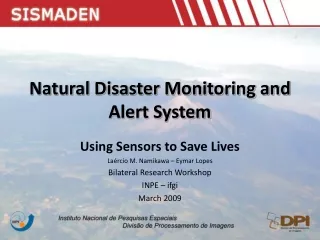
Natural Disaster Monitoring and Alert System Using Sensors to Save Lives Laércio M. Namikawa – Eymar Lopes Bilateral Research Workshop INPE – ifgi March 2009
Natural Disaster Monitoring and Alert System SIStema de Monitoramento e Alerta de DEsastres Naturais www.dpi.inpe.br/sismaden Version 1.0 Version 2.0 Released July/11/2008 July/2009
Natural Disasters in Brazil Forest fires Flooding Droughts Landslides Forest fires Flooding Flooding Landslides Flooding High winds Hail storms 12 Oil refineries 4 Petrochemical Complexes reference: Adapted from GEO BRASIL 2002 - Perspectivas do Meio Ambiente no Brasil – Edições Ibama, 2002.
Natural Disasters in Brazil Extreme temperature High winds Droughts Floods Epidemic Landslides Source (adpated): Vulnerabilidade Ambiental / Rozely Ferreira dos Santos, organizadora. – Brasilia: MMA, 2007. 192 p. : il. color. ; 29 cm.
Center for Weather Forecast and Climate Studies www.cptec.inpe.br
CPTECAlerts Civil Defense is notified when forecast indicates that intense or long lasting rain has potential to trigger natural disastres National Secretariat for Civil Defense Emergency Actions For Preparation and Mitigation in States and Municipalities State Coordination for Civil Defense- SP CPTEC Regional and Municipalities Civil Defenses
Technological Support Geographical database and spatial operation by TerraLib: www.terralib.org
Automatically Generated Alerts Natural Disasters Risks Hidrology and Meteorology Observations and Forecasts Risk Areas Spatial Analysis Extreme Event Alerts Additional Information
SIStema de Monitoramento e Alerta de DEsastres NaturaisNatural Disaster Monitoring and Alert System Open Source Computational System based on service oriented architecture Provides technological infrastructure to develop operational systems to manage alerts of environmental risks Services: Data gathering and formatting Analysis by comparison with risk layers or by executing models Risk model edition for alerts Alert handling and management
Configuration Interface Register data servers and sources Register risk maps and base maps Program analysis Register users and permissions
Configuration Interface Main Menu Climate data Risk Maps Base Maps Analyses Users Add Server
Configuration Interface Data from CPTEC CPTEC Server DCP Satellite/Radar Models ETA 40, 20, 5 Km Ensemble 40 Km Total rain 72h 72 files ASCII grid file Rain total Fixed time and irregular – alert Point data One file per DCP Grid 4km Total rain 1h Total rain 24h Current (mm/h) Binary file
Configuration Interface Hidrometeorological Servers ftp://150.163.133.245/ c:\data\grids FTP File Rain/bingrd
Configuration Interface Hydrometeorological Data Series • Grids • Hydroestimator • Lightning • Radar • Forecast Models • Points • DCPs (data collection platforms)
Configuration Interface Hydrometeorological Grid Data Series Forecasted Total Others ASCII-GRID PCD TIFF GrADS Radar.%a%M%d.%h%m.tif
Configuration Interface Hydrometeorological Grid Data SeriesNew Version Extreme event threshold Save storage and analysis Area clipping Storage strategy Delete unnecessary data New formats Cumulative data. Ex: File with rain for every hour during forecast period (72 hours)
Configuration Interface Point Data Series - DCPs DCP Pre calculation of data series DCPs Location
DCPs Point Data Series Configuration Interface Collect Rules by Luawww.lua.org Pre calculation of new value to be used in the analysis
Configuration Interface Register risk maps and base maps Risk layers Areas (polygons) + attributes describing the risk Base map layers - Vector or grid layers supporting visualization in alert situations Included in database through www.dpi.inpe.br/terralib
Configuration Interface Risk Maps Polygons with attributes that specify risk levels
Configuration Interface Programming the Analysis User analysis and risk model programming by Luawww.lua.org
Configuration Interface Risk Analyses Analysis
Configuration Interface Analysis Types Using risk maps Executes analyses by areas in risk maps overlaid on hidrometeorological creating alerts in these areas. Model based Ex: SINMAP (Stability INdex MAPping) c – Coesion; β- Slope angle; φ- Soil internal friction; R/T- Reload/transmissivity ratio; a- Watershed area
Configuration Interface Analysis Based on Risk Maps Risk Layers Climate Data
Configuration Interface Analysis Based on Risk Maps • LUA programming language • LUA operators: arithmetic: + - * / ^ relational: == ~= < > <= >= logical: and or notmathematical: math.abs math.acos math.asin math.atan …. • TerraLib operators: • zonals: maximo minimo media conta_amostras • historical: operador_historico • grid: amostra
Configuration Interface Example - Risk Model Using Hydrometeorological Data in a Grid local ca = maximo(‘total rain')if ca < limiar_cathenreturn 0 -- Okelseif ca < limiar_ca * 1.2 thenreturn 2 – Attention levelelsereturn 4 – Maximum Alert levelend
Configuration Interface Example - Risk Model Using Point Data (DCPs) local rain = media(‘dcp_data’,'pluvio')if rain == nil then rain = media('rain_grid')end if rain < threshold thenreturn 0 -- Okelseif rain < threshold * 1.2 thenreturn 2 – Attention levelelsereturn 4 – Maximum alert levelend
Configuration Interface Model Based Analysis Output Grid Climate Data
Configuration Interface Model Based Analysis local slope = amostra('slope_grid')local rain = amostra(‘rain_grid') local c= 0.37, B= 34, T=0.00034 return FS = (c*cos^2.slope(1-(rain*a)/T *sin.slope)r )tan.B)/ sin.slope amostra – value at evaluation location on grid
Configuration Interface Risk AnalysesNew Version Use grids in addition to polygons to define risk areas Define influence areas of DCPs Classify analyses as active, inactive, and conditional (activated by another analysis)
Configuration Interface Risk AnalysesStretched Version Functions to validate DCPs data External simulation activated by a risk analysis TerraME program, FORTRAN program, Hidrological modeling Integration with TerraME, TerraHidro TerraHidro – Process Models on generalized flows
Configuration Interface Alert and Base Map Overlay
Configuration Interface Register Users and Analysis Based Permissions
Configuration Interface Register Users for Each Analysis Analysis based Permissions
Presentation Interface Users access alerts on internet through login (password required) Visualize current analysis Visualize risk polygons attributes Visualize a polygon risk history
Presentation Interface WEB Main Interface - TerraPHP
Presentation Interface Alert Information
Presentation Interface Alert Events per Region
Conclusions Processes extremes captured by risk analyses Vulnerabilities Processes values captured by images and DCPs Easy programming (non-experts) of input processing and risk analysis Data availability, censorship
Future Developments Capturing processes relevant changes Validation of DCPs data for a given process Finding and filling gaps in data Using randomly available data Collaborative data: Mobile phone (GPS, images, videos), web cam Use of OGC Sensor Observation Service standard