Download
1 / 29
290 likes | 454 Vues
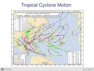
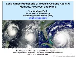
Typhoon Saomai & Tropical Storm Bopha, Western North Pacific, 08Aug06. Hurricane Bonnie, Western North Atlantic, 24Aug98. Long Range Predictions of Tropical Cyclone Activity: Methods, Progress, and Plans Tom Murphree, Ph.D. Department of Meteorology Naval Postgraduate School (NPS)

E N D
Typhoon Saomai & Tropical Storm Bopha, Western North Pacific, 08Aug06 Hurricane Bonnie, Western North Atlantic, 24Aug98 Long Range Predictions of Tropical Cyclone Activity: Methods, Progress, and Plans Tom Murphree, Ph.D. Department of Meteorology Naval Postgraduate School (NPS) murphree@nps.edu Brief Prepared for Presentation to 14th Weather Squadron and Other Organizations Involved in Long Range Environmental Prediction Draft V10, 22 September 2008 1 LRPs of TC Activity, murphree@nps.edu, Sep08
Long Range Predictions of TC Activity • Co-Authors • Tom Murphree (NPS Dept. of Meteorology) • David Meyer (NPS Depts. of Operations Research and Meteorology) • Capt Bryan Mundhenk, USAF (NPS masters of science student) • Capt Chad Raynak, USAF (NPS masters of science student) • Bruce Ford (Clear Science, Inc.) • Collaboration / Coordination • 14th Weather Squadron (14WS) • Climate Prediction Center (CPC/NCEP) • Environmental Modeling Center (EMC/NCEP) • Potential Collaboration / Coordination • National Hurricane Center (NHC) • Joint Typhoon Warning Center (JTWC) • Fleet Numerical Meteorology and Oceanography Center (FNMOC) • UK Meteorological Office (UKMO) • European Centre for Medium-range Weather Forecasting (ECMWF) • Bureau of Meteorology (BOM) • State University of New York Albany (SUNYA) 2 LRPs of TC Activity, murphree@nps.edu, Sep08
Long Range Predictions of TC Activity • Acronyms • 14WS: 14th Weather Squadron, US Air Force operational climatology support center • ACE: accumulated cyclone energy • BMRC: Bureau of Meteorology Research Centre • BOM: Bureau of Meteorology • CDPW: Climate Diagnostics and Prediction Workshop • CFS: Climate Forecast System • CPC: Climate Prediction Center, the climate branch of NCEP • ECMWF: European Centre for Medium-range Weather Forecasting • EMC: Environmental Modeling Center, a primary modeling organization within NCEP • FNMOC: Fleet Numerical Meteorology and Oceanography Center • FNMOD: Fleet Numerical Meteorology and Oceanography Detachment • JTWC: Joint Typhoon Warning Center • LRFs: long range forecasts • LRPs: long range predictions • LSEFs: large scale environmental factors • NA: North Atlantic • NAVO: Naval Oceanographic Office • NCEP: National Centers for Environmental Prediction • NHC: National Hurricane Center • NMFC: Naval Maritime Forecast Center • PACAF: Pacific Air Forces • PACOM: Pacific Command • POD: probability of detection • R&D: research and development • SUNYA: State University of New York Albany • TCs: tropical cyclones • UKMO: UK Meteorological Office • WNP: western North Pacific 3 LRPs of TC Activity, murphree@nps.edu, Sep08
Long Range Predictions of TC Activity • Definitions for This Brief • Hindcast: a retrospective forecast in which past events are predicted using a forecast system that is forced only by conditions that existed prior to the forecast launch time • Large scale environmental factors (LSEFs): environmental factors that are associated with and help determine TC activity (e.g., sea surface temperature, vertical wind shear, low level relative vorticity, low level atmospheric moisture) • Long range predictions: predictions with a lead time ofgreater than one month • Medium range predictions: predictions with a lead time of one week to one month • Statistical-dynamical prediction method: a prediction system based on using both statistical and dynamical analyses and forecasting models (e.g., a regression model and a dynamical numerical prediction model) • Tropical cyclone (TC) activity: the major aspects of tropical cyclones (e.g., TC formation, intensity, track, location, timing, frequency) 4 LRPs of TC Activity, murphree@nps.edu, Sep08
Long Range Predictions of TC Activity • Summary of NPS Approach – Part 1 • Operational planners would benefit from predictions of tropical cyclone (TC) activity (e.g., formations, tracks, intensities) at medium and long lead times (one week to several seasons). • To be of greatest value in operational planning, these predictions need to: • have high spatial and temporal resolution • provide confidence / uncertainty information • probabilistic forecasts • Naval Postgraduate School (NPS) has developed a statistical-dynamical prediction method for producing such predictions of TC formations in the western North Pacific (WNP). • NPS method is based on a logistic regression model that relates analyses of TC formations to analyses of the large scale environmental factors (LSEFs) that are associated with TC formations. • Analyses used for WNP: • JTWC best track analyses (for TC activity) • NCEP atmospheric reanalyses (for atmospheric LSEFs) • Hadley Centre SST analyses (for SST LSEF) 5 LRPs of TC Activity, murphree@nps.edu, Sep08
Long Range Predictions of TC Activity • Summary of NPS Approach – Part 2 • Main inputs to this statistical model are medium and long range predictions of the LSEFs provided by Climate Prediction Center (CPC) or other operational climate centers. Initial LSEF predictions from Climate Forecast System (CFS). • Main output from the model are maps of the probabilities of TC formation at weekly and 5x5 degree resolutions. • Initial hindcasts indicate NPS method has a high potential for improving on existing operational methods (e.g., use of long term mean probabilities). • Method readily adaptable for other basins (e.g., North Atlantic) • Method shows potential for improved long range predictions of TC intensities and tracks, and of deep tropical convection. • On-going work: • Continuing R&D • Identifying requirements and developing operational partnerships • Pursuing funding to: • extend R&D • collaborate with operational centers on testing and operational implementation 6 LRPs of TC Activity, murphree@nps.edu, Sep08
TC Formation Probabilities for 25 Jun - 01Jul 2006 10% 25% 40% 55% 70% Verifying observations of TC formation sites during 25 Jun - 01 Jul 2006 Results shown are from NPS zero lead hindcast. Experimental forecasts in development at NPS. Long Range Predictions of TC Activity NPS Prediction of TC Formation Probabilities Example of a hindcast of TC formation probabilities for an individual week at 5x5 degree resolution, using NPS statistical-dynamical method. See hindcasting and verification slides for more information. Note: Verifying formation positions shown by large red dots are based on first report in JTWC best track data. Updates to statistical model based on LSEF bounding will eliminate formation probabilities over land. 7 LRPs of TC Activity, murphree@nps.edu, Sep08
TC Formation Probabilities for 01 – 07 Oct 2006 10% 25% 40% 55% 70% Verifying observations of TC formation sites during 01 - 07 Oct 2006 Results shown are from NPS zero lead hindcast. Experimental forecasts in development at NPS. Long Range Predictions of TC Activity NPS Prediction of TC Formation Probabilities Example of a hindcast of TC formation probabilities for an individual week at 5x5 degree resolution, using NPS statistical-dynamical method. See hindcasting and verification slides for more information. Note: Verifying formation positions shown by large red dots are based on first report in JTWC best track data. 8 LRPs of TC Activity, murphree@nps.edu, Sep08
TC Formation Probabilities for 19 – 25 Nov 2006 10% 25% 40% 55% 70% Verifying observations of TC formation sites during 19 - 25 Nov 2006 Results shown are from NPS zero lead hindcast. Experimental forecasts in development at NPS. Long Range Predictions of TC Activity NPS Prediction of TC Formation Probabilities Example of a hindcast of TC formation probabilities for an individual week at 5x5 degree resolution, using NPS statistical-dynamical method. See hindcasting and verification slides for more information. Note: Verifying formation positions shown by large red dots are based on first report in JTWC best track data. 9 LRPs of TC Activity, murphree@nps.edu, Sep08
2. Statistical-Dynamical Predictions Predictands Ensemble based, probabilistic, long range predictions of TC formations Predictors Ensemble based, long range predictions of LSEFs from CFS or comparable system Statistical Model Regression model relating LSEFs to TC formations Long Range Predictions of TC Activity NPS Method for Producing TC Formation Predictions: Short Version 1. Statistical Model Development Statistical Model Regression model relating LSEFs to TC formations Observations Multi-decadal analyses of TC formations and LSEFs • Analyses of LSEFs and TCs used to build model. • Predictions of LSEFs used to force model that then predicts TC activity. 10 LRPs of TC Activity, murphree@nps.edu, Sep08
~30 years of TC data from JTWC best track dataset 1. Regression used to construct statistical model 4. Model calculates formation probabilities based on predicted LSEFs Statistical model relating LSEFs to TC formations ~30 years of LSEF data from NCEP reanalysis dataset 3. Predicted LSEFs used to force statistical model Ensemble based, probabilistic, long range predictions of TC formations Ensemble based, long range predictions of LSEFs from CFS or comparable systems 2. Statistical and dynamical modeling used to predict LSEFs Data on present state of climate system Key Analysis Element Prediction Element Long Range Predictions of TC Activity NPS Method for Producing TC Formation Predictions: Long Version 11 LRPs of TC Activity, murphree@nps.edu, Sep08
~30 years of TC data from JTWC best track dataset 1. Regression used to construct statistical model 4. Model calculates formation probabilities based on predicted LSEFs Statistical model relating LSEFs to TC formations ~30 years of LSEF data from NCEP reanalysis dataset 3. Predicted LSEFs used to force statistical model Ensemble based, probabilistic, long range predictions of TC formations Ensemble based, long range predictions of LSEFs from CFS or comparable systems 2. Statistical and dynamical modeling used to predict LSEFs Data on present state of climate system Key Analysis Element Prediction Element Long Range Predictions of TC Activity NPS Method for Producing TC Formation Predictions: Long Version • Key Steps: • TC and LSEF data used to build statistical model. • Forecasts of LSEFs then used to force statistical model. • Statistical model then generates TC predictions. 12 LRPs of TC Activity, murphree@nps.edu, Sep08
Long Range Predictions of TC Activity • Large Scale Environmental Factors (LSEFs) • Main LSEFs presently used in the NPS method for predicting TC activity: • sea surface temperature (SST) • vertical wind shear (from u / v components of 850 & 200 hPa wind) • absolute vorticity at 850 hPa • vertical velocity at 500 hPa • relative humidity at 850 hPa • Long Lead Predictions of LSEFs • LSEF predictions generated by NCEP Climate Forecast System (CFS). • CFS is an ensemble-based, coupled atmosphere-ocean, numerical forecast system developed and operated by NOAA (EMC and CPC) that produces medium and long range forecasts of atmosphere and ocean. • Hindcasts available from CFS for 1981-2006. • LSEF predictions from other operational centers (ECMWF, UKMO, BOM) will be evaluated for use in forcing statistical model. 13 LRPs of TC Activity, murphree@nps.edu, Sep08
Long Range Predictions of TC Activity Hindcasting • NPS statistical model was built using reanalysis LSEF data and best track TC data for a 26-year period, 1980-2005. • Model and its output have been tested by running model in zero lead time hindcast mode ( LSEFs well known), with forcing from LSEF data for years outside the 26-year period. • Example: LSEF data from 2006 used as inputs to produce weekly hindcasts of TC formation probabilities throughout the 2006 TC season (see examples in prior figures). • Hindcast results indicate model has potential to provide skillful medium and long range forecasts. Example: For 2006 season, hindcasts had a probability of detection (POD) of 75%. That is, 75% of all TCs that formed during mid-May 2006 through Dec 2006 did so at a time and location for which a formation probability of 10% or greater was predicted. • We are presently developing systems for generating hindcasts at longer lead times, and experimental forecasts at leads of one to 12 weeks. • Hindcast results obtained so far suggest actual forecasts will have higher skill than available from presently available methods based on long term mean TC formations (see next slide). 14 LRPs of TC Activity, murphree@nps.edu, Sep08
Probability of TC formation by 5x5 Degree Blocks Based on 15 May – 31 December 1970-2006 JTWC Best Track Data 30N 15N • Percentage • Probabilities • 0 • 0.5 • 1.0 • 1.5 • 2.0 • 2.5 • 3.0 • 3.5 • 4.0 120E 150E 180E Long Range Predictions of TC Activity TC Formation Probabilities Based on Long Term Mean TC Data • TC formation probabilities based on long term mean (LTM) TC formations are low (4% or less for TC season as a whole, 8% or less for individual weeks within TC season), with highest probabilities confined to LTM monsoon trough (MT). • Probabilities from NPS method are frequently much higher (20-70%), show high week-to-week variability, and often occur well outside the LTM MT. • These results, plus preliminary hindcast results, indicate NPS method has high potential to improve on LTM based methods for predicting TC formations. 15 LRPs of TC Activity, murphree@nps.edu, Sep08
Long Range Predictions of TC Activity Verification • Verification system for both LSEF and TC predictions presently being developed. • Several benchmarks will be used, including: • zero lead hindcast probabilities • long term mean probabilities • System will be based on multi-year hindcasts that will be used to: • Develop overall skill scores • Identify more and less predictable climate scenarios • Determine how to weight TC predictions by scenario, time of year, and location • Calculate confidence and uncertainty associated with predictions • Verification challenging due to: • Probabilistic nature of the predictions • Differences in the large areas represented by the probabilities and the much smaller areas represented by the actual formations. • Major constraint on TC prediction skill expected to be skill of LSEF predictions set TC related targets for CFS and similar systems 16 LRPs of TC Activity, murphree@nps.edu, Sep08
Long Range Predictions of TC Activity • Main Components of Operational Climate Support • State-of-the-science: • Data sets • Data access & visualization tools • Statistical & dynamical analysis • Climate modeling • Climate monitoring • Climate prediction • Climate scale decision analysis tools for risk assessment, • mitigation, and exploitation All of these components are part of NPS method for long range predictions of TCs. 17 LRPs of TC Activity, murphree@nps.edu, Sep08
Main Steps in Operational Climate Prediction 1. Data Selection 2. Climate System Analysis 3. Forecast Method Development 4. Forecast 5. Hindcast 7. Weighting/Selection 6. Verification/Evaluation 8. Decision Support Product Generation 9. Mission Impact Evaluation Long Range Predictions of TC Activity • NPS method for long range predictions of TCs has so far focused on steps 1-6. • In next 3-9 months, we will focus on enhancing results from steps 4-6, plus step 7. • Target date for operational beta testing of method: March 2009. 18 LRPs of TC Activity, murphree@nps.edu, Sep08
Main Steps in Operational Climate Prediction 1. Data Selection 2. Climate System Analysis 3. Forecast Method Development 4. Forecast 5. Hindcast 7. Weighting/Selection 6. Verification/Evaluation 8. Decision Support Product Generation 9. Mission Impact Evaluation Long Range Predictions of TC Activity • Need multi-year hindcasts to: • Assess overall skill • Identify high and low skill situations • Develop weighting scheme for forecasts • Develop quantitative confidence and uncertainty estimates 19 LRPs of TC Activity, murphree@nps.edu, Sep08
~30 years of TC data from JTWC best track dataset 1. Regression used to construct statistical model 4. Model calculates intensity probabilities based on predicted LSEFs Statistical model relating LSEFs to TC intensities ~30 years of LSEF data from NCEP reanalysis dataset 3. Predicted LSEFs used to force statistical model Ensemble based, probabilistic, long range predictions of TC intensities Ensemble based, long range predictions of LSEFs from CFS or comparable systems 2. Statistical and dynamical modeling used to predict LSEFs Data on present state of climate system Key Analysis Element Prediction Element Long Range Predictions of TC Activity NPS Method for Producing TC Formation Intensities • NPS method has been applied to develop initial system for long range predictions of TC intensities. • Method also applicable to development of long range predictions of TC tracks and deep tropical convection. 20 LRPs of TC Activity, murphree@nps.edu, Sep08
TC Formation Probabilities for 25 Jun - 01Jul 2006 10% 25% 40% 55% 70% Verifying observations of TC formation sites during 25 Jun - 01 Jul 2006 Results shown are from NPS hindcast. Experimental forecasts in development at NPS. Long Range Predictions of TC Activity Deep Tropical Convection and TC Formation Probabilities Hindcast of TC formation probabilities for an individual week at 5x5 degree resolution. Note correspondence between higher TC formation probabilities and deep convective regions indicated by purple region in inset figure of outgoing longwave radiation (OLR) for the same week. Note: Verifying formation positions shown by large red dots are based on first report in JTWC best track data. Updates to statistical model based on LSEF bounding will eliminate formation probabilities over land. 21 LRPs of TC Activity, murphree@nps.edu, Sep08
Zero lead hindcast of TC formation probabilities for 25Jun-01Jul06, and site of Ewiniar formation on 29Jun06 Long Range Predictions of TC Activity Typhoon Enwiniar, 29June - 11July 06 Taiwan Ewiniar track, 29Jun-11Jul06 Ewiniar on 07Jul06 Note: Verifying formation positions shown by large red dots are based on first report in JTWC best track data. Updates to statistical model based on LSEF bounding will eliminate formation probabilities over land. Luzon 22 LRPs of TC Activity, murphree@nps.edu, Sep08
Long Range Predictions of TC Activity • Operational Applications of Long Range TC Predictions • Improved environmental situational awareness for METOC analysts and forecasters • Improved long range deployment of METOC sensors (e.g., UAVs, gliders) • Improved assessments of short and medium range METOC forecasts (e.g., weighting of ensemble forecasts) • Improved assessments of environmental variability, predictability, and uncertainty • Improved METOC recommendations regarding times / places with increased potential for operational problems and opportunities • Improved planning and execution of customer operations -- examples: • Scheduling and routing (e.g., aircraft, ships, subs, rocket launches, etc.) • Pre-positioning assets (e.g., ISR & ASW platforms, materiel, etc.) • Scheduling exercises and training events • Planning evacuation, humanitarian, and other emergency management operations • Gaming, simulation, and training (e.g., war games, fleet synthetic training) LRPs of TC Activity, murphree@nps.edu, Sep08
Long Range Predictions of TC Activity • Additional Topics for Future Briefs • Details on NPS method: • Regression modeling (e.g., methods, equations, etc.) • Resolution and lead times for LSEF inputs to statistical model • Hindcasting (e.g., methods, uses of hindcasts) • Verification (e.g., methods, skill scores, automation) • Quantification of confidence and uncertainty in predictions • Sensitivity of TC activity to variations in LSEFs • On-going refinements to regression modeling (e.g., eliminating non-zero probabilities over land; use of upper and lower bounds for each LSEF beyond which TC formations do not occur) • Adaptation of NPS method for North Atlantic and other basins • Adaptation of NPS method to prediction of TC intensities and tracks, and of deep tropical convection • Development of decision support products based on TC predictions • Applications of products in operational planning • Operational implementation at 14WS and/or other centers • Cost estimates for: • Additional applied research (e.g., for adaptation of method to North Atlantic, to TC track predictions, etc.) • Operational implementation 24 Information available on these and related topics. LRPs of TC Activity, murphree@nps.edu, Sep08
Long Range Predictions of TC Activity • Support Requested • Critical assessment of NPS method and results • Identification of operational requirements and potential end users of long range predictions of TCs • Development of collaborations / coordination with DoD operational METOC centers • Development of sponsorship / funding for continued R&D, and operational testing and implementation LRPs of TC Activity, murphree@nps.edu, Sep08
Long Range Predictions of TC Activity R&D on long range predictions of TC activity is one aspect of the NPS Smart Climatology Program. Reports from this program are available for downloading at: http://wx.met.nps.navy.mil/smart-climo/reports.php LRPs of TC Activity, murphree@nps.edu, Sep08
Long Range Predictions of TC Activity • Related Readings – Part 1 • Camargo, S. J., A. G. Barnston, and S. E. Zebiak, 2005. A statistical assessment of tropical cyclone activity in atmospheric general circulation models. Tellus, 57A, 589-604. • Chan, Johnny C. L., 2006. Comment on “Changes in tropical cyclone number, duration, and intensity in a warming environment. Science,311. • Chan, J. C. L., Liu, K. S., 2004. Global warming and western North Pacific typhoon activity from an observational perspective. J. Climate, 17, 4590-4602. • Chan, J. C. L., J. Shi, C. Lam, 1998. Seasonal forecasting of tropical cyclone activity over the western North Pacific and the South China Sea. Wea. Forecasting,13, 997-1004. • Epstein, E. S., 1988. Long-range weather prediction: limits of predictability and beyond. Wea. Forecasting, 3, 69–75. • Ford, B., 2000. El Nino and La Nina Events, and Tropical Cyclones: Impacts and Mechanisms. Thesis, Naval Postgraduate School, 120 pp. • Frank, W. M., 1987. Tropical Cyclone Formation. In: A Global View of Tropical Cyclones. R. L. Elsberry, Ed., Office of Naval Research, 53-90. • Gray, W. M., 1975. Tropical Cyclone Genesis in the Western North Pacific. Naval Air Systems Command, Washington, D. C., 20361. • Hildebrand, P., 2001. El Nino and La Nina Events and North Atlantic Tropical Cyclones. Thesis, Naval Postgraduate School, 95 pp. • Kalnay, E., and Co-authors, 1996. The NCEP/NCAR 40-Year Reanalysis Project. Bull. Amer. Meteor. Soc., 77, 437-471. • Kistler, R., and Co-authors, 2001. The NCEP-NCAR 50-Year Reanalysis: Monthly means CD-ROM and documentation. Bull. Amer. Meteor. Soc., 82, 247-267. • Jury, M. R., B. Pathack, B. Parker, 1999. Climatic determinants and statistical prediction of tropical cyclone days in the Southwest Indian Ocean. J. Climate, 12, 1738-1746. 27 LRPs of TC Activity, murphree@nps.edu, Sep08
Long Range Predictions of TC Activity • Related Readings – Part 2 • Klotzbach, P. J., and W. M. Gray, 2006, 2006. Extended Range Forecast of Atlantic Seasonal Hurricane activity and U.S. Landfall Strike Probability for 2006. Department of Atmospheric Science, Colorado State University, Fort Collins, CO, 80523. • Leroy, A., and M. C. Wheeler, 2008. Statistical prediction of weekly tropical cyclone activity in the Southern Hemisphere. Mon. Wea. Rev. In press. • McBride, J. L., 1995. Large scale conditions associated with tropical cyclone formation. In: Global Perspectives on Tropical Cyclones. World Meteorological Organization TCP-38, Ch. 3, Secretariat of the World Meteorological Organization, Geneva, Switzerland. • Meyer, D. W., 2007. Relationships between Global Warming and Tropical Cyclone Activity in the Western North Pacific. Thesis, Dept. of Operations Research, Naval Postgraduate School, 163 pp. • Saha, S., and Co-authors, 2006. The NCEP Climate Forecast System. J. Climate, 19, 3483–3517. • Saunders, M. A., and A. S. Lea, 2005. Seasonal prediction of hurricane activity reaching the coast of the United States. Nature, 434, 1005-1008. • Tournay, R., 2007. Long-Range Statistical Forecasting of Korean Summer Precipitation. Thesis, Naval Postgraduate School, 121 pp. • van den Dool, H., 2007. Empirical Methods in Short-Term Climate Prediction. Oxford University Press, 215 pp. • Vitart, F., and Co-authors, 2007. Dynamically-based seasonal forecasts of Atlantic tropical storm activity issued in June by EUROSIP. Geophysical Research Letters, 34, L16815. • Webster, P. J., Holland, G. J., Curry, J. C., Chang, H.-R., 2005. Changes in tropical cyclone number, duration, and intensity in a warming environment. Science,309, 1844. • Webster, P. J., Holland, G. J., Curry, J. C., Chang, H.-R., 2006. Response to comment on Changes in tropical cyclone number, duration, and intensity in a warming environment. Science,311, 1713. • Wilks, D. S., 2006. Statistical Methods in the Atmospheric Sciences. 2nd ed., Academic Press, 627 pp. • Yang, S., Z. Zhang, V.E. Kousky, R.W. Higgins, S.H. Yoo, J. Liang, and Y. Fan, 2008. Simulations and seasonal prediction of the Asian summer monsoon in the NCEP Climate Forecast System. J. Climate, 21, 3755–3775. 28 LRPs of TC Activity, murphree@nps.edu, Sep08
Long Range Predictions of TC Activity • Contact Information • Tom Murphree, Ph.D. • Department of Meteorology • Naval Postgraduate School • 254 Root Hall • 589 Dyer Road • Monterey, CA 93943-5114 • 831-656-2723 commercial • 312-756-2723 DSN • 831-402-9603 cell • 831-656-3061 fax • murphree@nps.edu • murphrjt@nps.navy.smil.mil • Smart Climatology: http://wx.met.nps.navy.mil/smart-climo/reports.php • METOC Metrics: http://wx.met.nps.navy.mil/metrics/metrics_reports.html 29 LRPs of TC Activity, murphree@nps.edu, Sep08