Download
1 / 12
120 likes | 254 Vues
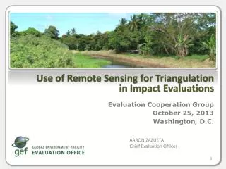
Use of Remote S ensing for Triangulation in Impact Evaluations . Evaluation Cooperation Group October 25, 2013 Washington, D.C. AARON ZAZUETA Chief Evaluation Officer. The objective was to assess GEF contributions to environmental change in specific sites in the South China Sea.

E N D
Use of Remote Sensing for Triangulation in Impact Evaluations Evaluation Cooperation Group October 25, 2013 Washington, D.C. AARON ZAZUETA Chief Evaluation Officer
The objective was to assess GEF contributions to environmental change in specific sites in the South China Sea This analysis was part of a larger regional evaluation. Task at the site level was to determine: • what environmental changes have occurred, and • to what extent GEF has contributed to these changes. 27 sample sites, of which GEF supported 18 through coastal habitat management. Of these, 6 sites included mangroves
3 Steps to Assess GEF Impact on Mangrove Protection • Determine what the mangrove conditions were before and after GEF intervention. • Establish causality. • Discount rival hypothesis (counterfactual analysis).
Remote Sensing is One of Many Tools • Faced data gaps and data reliability issues. • GEF EO triangulated evidence using various methodsto measure change: • Site visits and interviews • Documents and historical review • National and regional databases • Remote Sensing Analysis • Images found for 4 out of the 6 sites
Did GEF help improve mangrove cover in Trat, Thailand? 1990 – 28.35 ha 2000 – 38.25 ha 2006 – 59.22 ha Remote Sensing shows increasing mangrove cover before GEF support.
Mangroves improved, but did GEF help? Remote sensing: Mangrove cover increasing over time, even before GEF support. Document and historical reviews: Policy changes across the region were slowing down the decline. National and regional databases:Mangrove cover declined throughout the region, although at a decreasing rate. Site visits and interviews: Local engagement and national economic conditions drove successful activities 10 years before GEF intervention. GEF support enabled cooperation between communities in conflict to achieve protection of a greater area of mangroves. CONCLUSION: GEF support did not result in increasing mangrove cover per se, but sustained and increasedthe momentum of community and government support for mangrove protection that otherwise might have eroded.
Did GEF help improve mangrove cover in Fangchengghang, China? 1990 – 1046.3 ha 1999 – 1435.2 ha 2009 – 1525.1 ha Increase in mangrove cover according to remote sensing was lower than that reported through interviews.
Mangroves improved, but did GEF help? Remote sensing: Mangrove cover increasing during GEF support. Document and historical reviews: Long trend of degradation due to conversion of mangroves to shrimp ponds; collection of marine benthos within the mangrove forests; grazing of buffaloes on mangrove seedlings; and erosion. National and regional databases:Mangrove cover declined throughout the region, although at a decreasing rate. Site visits and interviews: The GEF approach focused on buildinglocal partipation in protection, eco-friendly utilization, and cross-sectoral planning and management.70% of mangrove cover increase was due to natural regeneration from better protection, 30% due to plantings. CONCLUSION: GEF support strengthened management capacity.
Did GEF help improve mangrove cover in PeamKrasop, Cambodia? 1990 – 11524 ha 2006 – 11230 ha 2009 – 10086 ha There is progressive decrease in mangrove cover, even during GEF intervention.
Mangroves worsened, what was GEF’s role? Remote sensing: There is progressive decrease in mangrove cover even during GEF intervention. Document and historical reviews: Cessation of political conflict in the early 1990’s to have caused population growth and exploitation of mangrove resources in Cambodia. National and regional databases:Mangrove cover has declined in the country, at anincreasingrate. Site visits and interviews: Mangrove areas have been cleared for charcoal production, and converted to agricultural purposes, but law enforcement starting to improve. CONCLUSION:GEF-supported activities were not sufficiently effective in reducing the larger pressures on this resource base.
Conclusion Remote sensing: • Filled in data gaps on before/after • Verified reports by projects Used in combination with other sources of information An important limitation: cloud cover.
Thank you ops5@thegef.org www.gefeo.org