

SlideServe
Menu
Préférences
© SlideServe · v2026

Epochs

navid avatar
16 diapositives · 325 Views · Sep 05, 2014

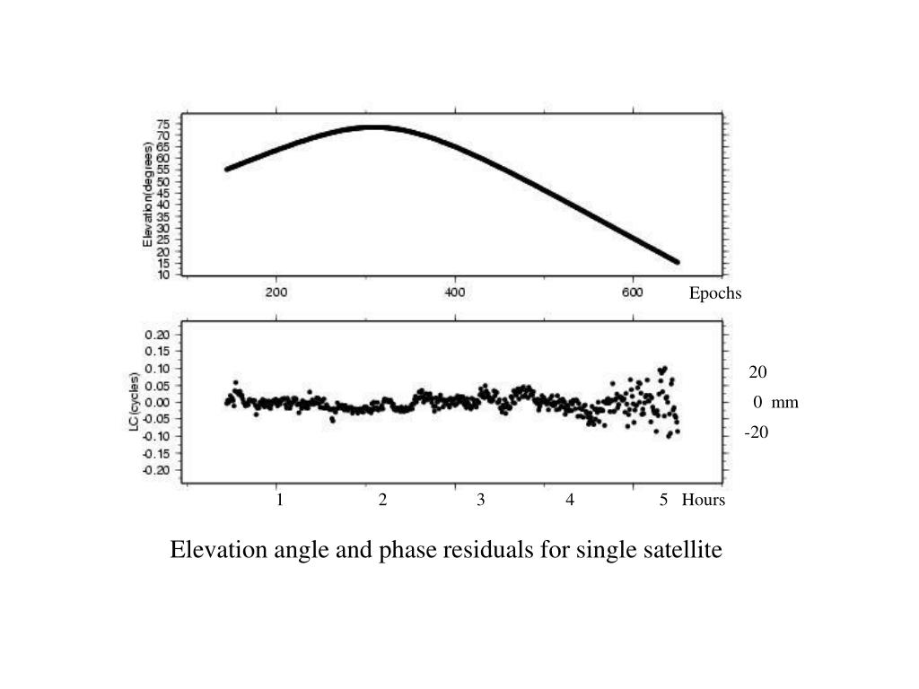
Epochs. 20 0 mm -20. 1 2 3 4 5 Hours. Elevation angle and phase residuals for single satellite. Simple geometry for incidence of a direct and reflected signal.
Epochs - slide 1
01 / 16Epochs
1 / 17

Télécharger la présentation

Epochs
Une image / un lien ci-dessous est fourni (tel quel) pour télécharger la présentation

Politique de téléchargement : le contenu du site vous est fourni TEL QUEL pour votre information et votre usage personnel ; il ne peut être vendu, concédé sous licence ni partagé sur d’autres sites sans l’accord de son auteur.Le contenu vous est fourni TEL QUEL, pour votre information et votre usage personnel uniquement. Téléchargez la présentation en cliquant sur ce lien. Lors du téléchargement, si vous ne parvenez pas à télécharger une présentation, l’éditeur a peut-être supprimé le fichier de son serveur.Pendant le téléchargement, si vous ne parvenez pas à obtenir une présentation, le fichier a peut-être été supprimé par l’éditeur.

F I N

Plus de contenu associé

Transcription de la présentation
  1. Epochs 20 0 mm -20 1 2 3 4 5 Hours Elevation angle and phase residuals for single satellite

  2. Simple geometry for incidence of a direct and reflected signal Multipath contributions to observed phase for an antenna at heights (a) 0.15 m, (b) 0.6 m, and (c ) 1 m. [From Elosegui et al, 1995]

  3. Antenna Phase Patterns

  4. Top: PBO station near Lind, Washington. Bottom: BARD station CMBB at Columbia College, California

  5. Left: Phase residuals versus elevation for Westford pillar, without (top) and with (bottom) microwave absorber. Right: Change in height estimate as a function of minimum elevation angle of observations; solid line is with the unmodified pillar, dashed with microwave absorber added [From Elosequi et al.,1995]

  6. Correlation between estimates of height and zenith delay as function of minimum elevation angle observed (VLBI, from Davis [1986])

  7. Uncertainty in estimated height as function of minimum elevation angle observed (VLBI, from Davis [1986]; dotted line with no zenith delay estimated)

  8. GPS adjustments to atmospheric zenith delay for 29 June, 2003; southern Vancouver Island (ALBH) and northern coastal California (ALEN). Estimates at 2-hr intervals.