Download
1 / 31
310 likes | 472 Vues
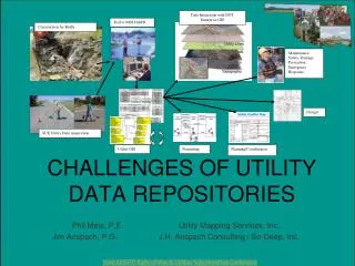
Data Integration with DOT Enterprise GIS. Tied to NGS HARN. Construction As-Builts. Maintenance, Safety, Damage Prevention, Emergency Response. CHALLENGES OF UTILITY DATA REPOSITORIES. Design. SUE Utility Data Acquisition. Utility GIS. Permitting. Planning/Coordination.

E N D
Data Integration with DOT Enterprise GIS Tied to NGS HARN Construction As-Builts Maintenance, Safety, Damage Prevention, Emergency Response CHALLENGES OF UTILITY DATA REPOSITORIES Design SUE Utility Data Acquisition Utility GIS Permitting Planning/Coordination Phil Meis, P.E. Utility Mapping Services, Inc. Jim Anspach, P.G. J.H. Anspach Consulting / So-Deep, Inc.
Utility Data Repositories are Changing • 1980s and before • Used to be collection of paper maps maintained and controlled by individual utility owners • 1990s • Digital CADD files and paper maps • Now • All of the above, plus GIS • Who is in control of data? • Who keeps data current?
CADD & GIS are Merging • CADD is Graphical • GIS is Database + Graphics • GIS has much more available data, and data can be organized and searched • Both CADD & GIS are going 3-D • GIS will serve many more masters than CAD, and therein lies the challenge
How Close is GIS to Taking over the Utility Engineering Field? • FAA already requiring all airports to do their layout plans for design in GIS rather than CAD • SHRPII R-01A Research project is about developing standards and protocols for GPS/GIS to build Utility Data Repositories for state DOTs
Utility Management System Architecture A Geographic Information System (GIS) assembles information from several sources, including ground surveys, existing maps, aerial photos, and satellite imagery. In a GIS, specific information about a place, such as the locations of utility lines, roads, streams, and buildings, is layered over a set of geodetic data. Because a GIS stores data digitally, information can be quickly and economically updated, easily reproduced, and made widely available. In fact, because of its power and speed, GIS technology is doing most of the cartographic (mapmaking) work that, in the past, was laboriously done by hand on paper charts and maps.
Geographic Information Systems • Challenges • system architecture for creating robust legacy data inventory and data integration • GIS, Geodesy, National Standards, State Statutes • management buy-in and funding • initial data collection • data maintenance
Everybody needs to understand lingo and basics. Good idea to run everyone through basics.
Need multi-discipline team to manage initiative – don’t just turn it over to GIS nerds. Leader needs to have multi-discipline background to understand and guide effort. GIS, PLS, and engineering communities have in general not yet fully meshed. Throw on top of that, all of them lack an understanding of utilities.
Managing three data types: • attribute (what it is) • coordinate (where it is) • metadata (data about the data) Need to be able to access, update, query, and retrieve data readily, and push it back into variety of CADD platforms, tied and projected to desired project coordinate system.
What defines robust, legacy data? Need essential attribute data fields e.g., size, capacity, material, ownership, conduit, quality levels, coordinates Need essential meta-data e.g., data source, acquisition campaign, survey control and projection, engineer-of-record Need coordinate data tied to national datum Comply with Federal and international data standards (FGDC and ISO)
Positional accuracy is paramount for utilities. Ensure system development includes individuals who understand the science of geodesy. Otherwise data usage will be limited to inventory type applications.
Geodesy - the science of measuring and monitoring the size and shape of the Earth and the location of points on its surface. NOAA's National Geodetic Survey (NGS) is responsible for the development and maintenance of a national geodetic data system that is used for navigation, communication systems, and mapping and charting.
Positional data and accuracy is the foundation for a GIS based utility data management system. National Spatial Reference System Datum to securely support other spatial information
NSRS Horizontal Datum In 1927 the U.S. Coast and Geodetic Survey, the predecessor of the National Geodetic Survey, "connected" all of the existing horizontal monuments together and created the North American Datum of 1927 (NAD 27). This datum was used extensively during the next 60 years as the primary reference for horizontal positioning. In 1983, NAD 27 was adjusted to remove inaccuracies and to correct distortions. The new datum, called NAD 83, is the most commonly used horizontal positioning datum today in the United States.
NSRS Vertical Datum In 1929, the National Geodetic Survey (NGS) compiled all of the existing vertical benchmarks and created the National Geodetic Vertical Datum of 1929 (NGVD 29). Since then, movements of the Earth's crust have changed the elevations of many benchmarks. In 1988, NGVD 29 was adjusted to remove inaccuracies and to correct distortions. The new datum, called the North American Vertical Datum of 1988 (NAVD 88), is the most commonly used vertical datum in the United States today.
Positional data and accuracy is the foundation for a GIS based utility data management system.
Taking it to Next Level - CORS and GIS The Continuously Operating Reference Stations (CORS) system is a network that continually corrects GPS signals, and provides these corrections to GPS users over the Internet. Relatively simple to tie all observations to the NSRS
National Committees and Centers • Federal Geographic Data Committee - representatives from • Dept.’s of Ag, Commerce, Defense, Energy, Housing and • Urban Development, Interior, State, Transportation, EPA, • FEMA, Library of Congress, NASA, National Archives, and • Tennessee Valley Authority. • CADD/GIS Technology Center for Facilities, Infrastructure, • and Environment, located at the U.S. Army Engineer • Research and Development Center’s Information • Technology Laboratory in Vicksburg, MS - a consortium • for joint development of CADD and GIS standards by the • Army Corps of Engineers, Army, Air Force, Navy, Marines, • and other federal, state, local government agencies.
National GIS Data Standards • Spatial Data Standard for Facilities, Infrastructures, and Environment (SDSFIE) • CADD/GIS Technology Center, Information Technology Laboratory (ITL), U.S. Army Engineer Waterways Experiment Station (WES) Vicksburg, MS, a complex of five laboratories of the U. S. Army Engineer Research and Development Center (ERDC). The CADD/GIS Technology Center was chartered in 1992 to promote the use of CADD and GIS technologies for life-cycle facilities management within the Army, U.S. Army Corps of Engineers, Navy, and Air Force. ESRI ArcGIS Survey Analyst (Oct ‘02) developed under contract with US Army Corps of Engineers as a result.
Need business process Capture data from permitting, construction, and SUE activities Need digital data standards, special provisions, and templates for data submittals Need repository
Be mindful of state statutes regulating publication of mapped fixed features of engineering.“Model Law” for management of survey data in a GIS
Utility Management System Buy-In • Need management to support need. • Need cost / benefit analysis and business process. • Need funding. • Consider banding with regional metropolitan entities, cities, counties, transit authorities, and other state agencies with identical needs - support a single system with pooled permit fees. • Need to educate continuously on why this is not a trivial exercise. • May need legislative changes and utility lobby support.
Utility Management System Buy-In Immediate GIS Database Benefits for Big Projects Flag Utility Conflicts Rapid Query of Database for Conflicts Cost Sensitivity Analysis Value Engineering (mitigate conflict cost) Recommend Resolutions Exacting Summary Reports for Utility Coordinator Track Conflict Resolutions Monitor Critical Path
Utility Management System Buy-In Port to handheld PC for Field Staff Extended Advantages of a Utility GIS Inventory • Retain Investment of SUE Investigations • ROW Management Tool • Facilitate Permitting • Shift SUE Data Burden to Utilities • Easement Commodity • Maintenance Use • Planning • Safety • Move SUE Effort Up to Planning or EA / EIS Stage • GASB 34 Compliance • FHWA Office of Asset Management Data Integration
FHWA Office of Asset Management - 1999 Utility Management System Buy-In Data Bridges Pavements Materials Roadway Hardware Vehicles ROW Utilities
Asset Management Goal Utility Management System Buy-In Data Bridges Pavements Materials Roadway Hardware Vehicles Utilities ROW Data Integration
Utility Management System – NOW! Don’t Miss the Boat! • Utilize Existing/New GeoSpatial Data Standards • Generate Legacy Data Sets • Share O&M Costs with Other Agencies • Utilize & Share Data with National/State/Local Sources • Harness the Digital World and Enable Planners, Designers, and Maintenance to Perform Fantastic GeoSpatial Data Analyses and Use Emerging Technologies (e.g., BIM, 3D Modeling, etc.)
The New Utility Management System “Captain, sensors indicate an oil pipeline ofprobable Romulan origin is in conflict with our new storm drainage system. However, I’ve instructed the computer to develop a new optimal alignment that allows the pipeline to remain without threat.”
Your time is very much appreciated. Utility Mapping Services Phil Meis, P.E. Office: 406.933.5300 Cell: 801.209.2032 email: pjmeis@umsi.us