Nevado del Ruiz!
120 likes | 441 Vues
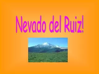
Nevado del Ruiz!. Facts about Nevado del Ruiz! Nevado del Ruiz is a volcano located in the Andes mountains of South America. This is a map to show where the Nevado del Ruiz is found.

Nevado del Ruiz!
E N D
Presentation Transcript
Facts about Nevado del Ruiz!Nevado del Ruiz is a volcano located in the Andes mountains of South America. • This is a map to show where the Nevado del Ruiz is found
It is the Northernmost and highest Colombian volcano, with a elevation of 5,389m or 17,784ft. • Even though it is only 500km away from the earth’s equator, the volcano is covered with 25 km2 of snow and ice! • When the Nevado del Ruiz erupts, instead of having lots of lava it creates mud slides made of materials like ash and water (Stratovolcano). These mud slides can cause just as much damage as a lava eruption. • The Nevado del Ruiz has had 3 eruptions in the 20th century, one of which I am going to tell you more about……….
The 1985 eruption! On the 13th November, 1985, after day of arguments whether or not Amero should be evacuated the people were told to stay where they were and that the ash had stopped falling from Nevado del Ruiz. Later on in the evening at 9:08pm the Nevado del Ruiz sent off a series of major steam explosions and flows. As time went on these explosions quickly eroded and melted the snow and ice that surrounds the crater of Nevado del Ruiz. This then got mixed with the ash from previous eruptions which created a mud-like substance. This substance quickly rolled down the steep sides of Nevado del Ruiz into the rivers (e.g. Lagnillas river) which goes through different towns like Amero. Amero was approximately 45km away from Nevado del Ruiz, but that didn’t save this town. About 2 hours after the eruption began huge mudslides hit Amero, washing away ¾ of the town. By the morning a layer of mud up to 8m thick covered Amero and the surrounding areas.
The damage and figures! • More than 23,000 people were killed by the eruption, including most of the 27,000 people that lived in Amero! This was the 2nd most dangerous eruption of the century! • The mudflow also went through the river Cauca and burst through the village Chinchina, killing 1,927 people! • 15,000 animals were killed by the disaster! • There was also 4,500 people who were injured and 8,000 people who were made homeless! • The estimated cost of the disaster is $1,000,000,000! • 5092 homes and 210,000 hectares of land were also destroyed.
The End! By Kerri McAuley 10AA
Mr Manson says . . • A good mixture of presentation and information Kerri – you don’t overpack the slides with information. • A2