Download
1 / 13
130 likes | 340 Vues
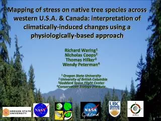
I R S S. Mapping of stress on native tree species across western U.S.A. & Canada: interpretation of climatically-induced changes using a physiologically-based approach. Richard Waring 1 Nicholas Coops 2 Amanda Mathys 2 Thomas Hilker 1 Wendy Peterman 3 1 Oregon State University

E N D
I R S S Mapping of stress on native tree species across western U.S.A. & Canada: interpretation of climatically-induced changes using a physiologically-based approach Richard Waring1 Nicholas Coops2 Amanda Mathys2 Thomas Hilker1 Wendy Peterman3 1 Oregon State University 2 University of British Columbia 3Conservation Biology Institute
Major Points • importance of mapping soil H20 storage • Spatially linked max leaf area to productivity • value of sharing data with the public
Base map of modeled estimates of available soil waterstorage capacity (mm) Coops, Waring, & Hilker (2012) Predicting soil properties using a process-based forest growth model to derive estimates of leaf area index. Remote Sensing of Env. 126:160-173. http://databasin.org/maps/new#datasets=9c19fc0df04c43aea41983fcfce358c0
Base map of modeled estimates of soil fertility at 1 km resolution (0 = poorest; 1.0 = best) Coops, Waring, & Hilker (2012) Predicting soil properties using a process-based forest growth model to derive estimates of leaf area index. Remote Sensing of Env. 126:160-173. http://databasin.org/maps/new#datasets=9c19fc0df04c43aea41983fcfce358c0
Relation between modeled max LAI & site productivity (3,356 field plots) Simulated max LAI (2000-2009 climate) Waring, Coops, Mathys, Hilker & Latta (2014) Process-based modeling to assess the effects of recent climatic variation on site productivity and forest function across western North America. Forests 5:518-534.
Simulated change in maximum leaf area index 2000-2009 in reference to 1950-1975 climate Waring, Coops, Mathys, Hilker & Latta (2014) Process-based modeling to assess the effects of recent climatic variation on site productivity and forest function across western North America. Forests5:518-534.
Effect on max LAI when soil H20 storage = 200 mm Effect on predicted range when soil H20 storage changed ± 50% • Mathys, A., N.C. Coops & R.H. Waring. 2014. Soil water availability effects on the • distribution of 20 tree species in western North America. For. Eco. & Mgmt.313:144-152.
Project shares all data via Conservation Biology Institute’s website: databasin.org • remote sensing products • model code in C++ • soils mapping units • species present at 44,000 field sites • simulated shifts in range of 20 species • publications
Lodgepole pine: Predicted potential shift in range since 2000 Tree species plots • http://databasin.org/maps/b2905dd782374dfd81d51fae6b16fcd4
Relative change in summer soil water constraints (± 20%) contrasting climate conditions since 2000 with 1950-75 period http://databasin.org/maps/dcd8043a7ed44581adae3555fe0f6db8/active
80 sites where twenty tree species are predicted to have the potential to contract (red) or expand (green) their range since 2000
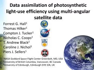
Project Publications 2011-2014 Waring, R.H., Coops, N.C., Mathys, A., Hilker, T. and Latta, G. 2014. Process-based modeling to assess the effects of recent climatic variation on site productivity and forest function across western North America. Forests 5:518-534.pdf Mathys, A., Coops, N.C., and Waring, R.H. 2014. Soil water availability effects on the distribution of 20 tree species in western North America. Forest Ecology and Management 313: 144-152. pdf. Smettem, K.R.J., R.H. Waring, N. Callow, M. Wilson, and Q. Mu. 2013. Satellite-derived estimates of forest leaf area index in South-west Western Australia are not tightly coupled to inter-annual variation in rainfall: implications for groundwater decline in a drying climate. Global Change Biology 19:2401-2412. (pdf). Coops, N.C., R.H. Waring, and T. Hilker. 2012. Prediction of soil properties using a process-based forest growth model to match satellite-derived estimates of leaf area index. Remote Sensing of Environment 126:160-173.pdf. Peterman, W., R.H. Waring, T. Seager, and W.L. Pollock. 2012. Soil properties affect pinyon pine-juniper response to drought. Ecohydrology 6:455-463.pdf. Coops, N.C., M.A. Wulden, and R.H. Waring. 2012. Modeling lodgepole and jack pine vulnerability to mountain pine beetle expansion into the Canadian boreal forest. Forest Ecology and Management 274:161-171. pdf. Waring, R.H., N.C. Coops and S.W. Running. 2011. Predicting satellite-derived patterns of large-scale disturbances in forests of the Pacific Northwest Region in response to recent climatic variation. Remote Sensing of Environment 115:3554-3566.pdf.
Contact Information Waring, Richard <richard.waring@oregonstate.edu> http://www.fsl.orst.edu/~waring Coops, Nicholas <nicholas.coops@ubc.ca> Project website: http://www.pnwspecieschange.info/