Download
1 / 18
180 likes | 468 Vues
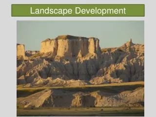
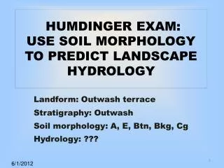
HUMDINGER EXAM: USE SOIL MORPHOLOGY TO PREDICT LANDSCAPE HYDROLOGY. Landform: Outwash terrace Stratigraphy: Outwash Soil morphology: A, E, Btn, Bkg, Cg Hydrology: ??? . 6/1/2012. INTERPRETING SOIL AND LANDSCAPE HYDROLOGY from SOIL MORPHOLOGY. Rationale

E N D
HUMDINGER EXAM: USE SOIL MORPHOLOGY TO PREDICT LANDSCAPE HYDROLOGY Landform: Outwash terrace Stratigraphy: Outwash Soil morphology: A, E, Btn, Bkg, Cg Hydrology: ??? 6/1/2012
INTERPRETING SOIL AND LANDSCAPE HYDROLOGY from SOIL MORPHOLOGY Rationale Soil morphology reflects soil processes and water history in a landscape. We can therefore use soil morphology to interpret landscape hydrology.
OBJECTIVES • Examine soil morphology. Infer soil forming processes, water flow directions, and seasonal water variation. • Evaluate presence of salts (evaporites) and soil mineral precipitates (Mn and Fe). Infer soil forming processes, water flow directions, and seasonal water variation. • Evaluate soil mineralogy. Infer soil forming processes, water flow directions, and seasonal water variation. • Use all of the above to interpret temporal and spatial soil water distribution (hydrology) for the soil landscape.
1. An increase in sediment load results in an increase in stream slope. 2. Slope determines the stream type. BRAIDED STREAM
Braided Stream Cristchina River Alaska A stream with discharge of 0.15 cfs has a threshold slope of 0.016 ft/ft. Above the threshold the channel is braided. Below the threshold the channel becomes meandering. Schumm and Kahn, GSA Bulletin, 1972; v. 83; no. 6; 1755-1770. 4 4
Platte River Missouri River 3. Braided Streams generally “Aggrade” the Flood Plain or Valley. 4.Braided streams occur in drier climates or glaciers. (high bed load) 5. Platte River 8 mi/hr; Missouri 3 mi/hr above confluence. (Lewis and Clark) 6. Humdinger Site is an Outwash Terrace. 5
LOUISIANA – Baton Rouge Area Soil had both iron and calcium accumulations above the regional norm. Soil had a poorly expressed Bt horizon (clay accumulation). The pH was neutral. JLR’s interpretation based on morphology and data was that this soil was a discharge area. Challenge: We were on a broad, level terrace miles from the Mississippi River or other water body. Additional data: The well 30 m away was an artesian well. It did not need a pump. HOW CAN THIS HAPPEN???
Bt Horizon (Soil Taxonomy, 1975) • 1. Distinct dry season. • 2. Takes time to form. • 3. Forms faster when Na+ is present; formation retarded by abundant Ca2+ or exchangeable Al3+ (helps to be leached and acid but not extremely so). • 4. Clay dispersion is important process • Multi-valentcations (Ca2+, Al3+ ) promote flocculation. • Dispersion occurs when clean water dilutes soil solution (reduces the solution cation concentration).
Bt Horizon (Soil Taxonomy, 1975) • 5. Dry soils when first wetted disperse most easily for this reason and because of trapped air action. • 6. In a “locally” saturated condition, dispersion yields unattached, suspended clay particles. • 7. Water with its suspended load (clay) moves downward in macropores by gravity and/or pressure. • 8. Ped interiors below a wetting front contain relatively dry micropores; matric flow draws water from larger pores into smaller pores. • 9. Clay is left on the ped surfaces as a film or skin.
Addition Loss Tranfer Transformation A E Btg Bt formation E formation 3 processes here: Redox; eluvial clay; gleyprocesses LANDSCAPE CONDITIONS NATURAL VEGETATION CROP LAND LATERAL FLOW Iron reduction ferric (Fe3+) to Ferrous (Fe2+) is a thermodynamically feasible process under the right conditions, but may require activation energy. Blount – fine, illitic, mesicAericEpiaqualfs
ARGILLIC HORIZON HYDROLOGY 1. Distinct dry season or Na present. 2. Clay dispersion on infiltration and wetting. Recharge – flow driven by Fg gravity potential 3. Downward flow in large pores. Flowthrough – flow driven by Fg 4. Interior ped pores pull water from larger pores. Discharge - flow driven by Fm matric potential MATRIC FLOW IS FROM COARSE TO FINE PORES.
TILL SOILS IN SUB-HUMID ND A E Bw Btn Bt SODIC PRAIRIE FOREST Deciduous RECHARGE WETLAND PRAIRIE POTHOLE SOIL Btg
MATERIAL SEGREGATION by WATER Mn nodules Fe nodules Dominant water movement direction
OUTWASH TERRACE; HIGH WATER TABLE EVERY SPRING; 94% SAND OR COARSER, HIGH SODIUM & pH; white Bk is Protodolomite; note the Btn horizon. A Btn pH 9.1 Bkg 50%clay 2Cg 94% sand PhotoJL Arndt THE PARTICIPANT WILL DESCRIBE AND EXPLAIN THE DEVELOPMENT OF THIS SOIL, ESPECIALLY FOCUS ON THE WATER DYNAMICS. STIRUM: COARSE-LOAMY, MIXED, SUPERACTIVE, FRIGID TYPICNATRAQUOLL
CONCEPTS TO USE IN YOUR ANSWER • Matric flow a) wet to dry; b) frost; • Saturated flow above and below water table; • Hydrology of Bt, Btn, and Bk formation; • Clay dispersion; • Translocation and reverse translocation; • Outwash terrace formed as braided stream; ; • Evaporite sequence – alkaline branch • Redoximorphic features